- National Register of Historic Places listings in Yell County, Arkansas
-
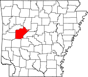
 Location of Yell County in Arkansas
This is a list of the National Register of Historic Places listings in Yell County, Arkansas.
This is intended to be a complete list of the properties and districts on the National Register of Historic Places in Yell County, Arkansas, United States. The locations of National Register properties and districts for which the latitude and longitude coordinates are included below, may be seen in a Google map.[1]
There are 22 properties and districts listed on the National Register in the county.
Contents: Counties in Arkansas Arkansas - Ashley - Baxter - Benton - Boone - Bradley - Calhoun - Carroll - Chicot - Clark - Clay - Cleburne - Cleveland - Columbia - Conway - Craighead - Crawford - Crittenden - Cross - Dallas - Desha - Drew - Faulkner - Franklin - Fulton - Garland - Grant - Greene - Hempstead - Hot Spring - Howard - Independence - Izard - Jackson - Jefferson - Johnson - Lafayette - Lawrence - Lee - Lincoln - Little River - Logan - Lonoke - Madison - Marion - Miller - Mississippi - Monroe - Montgomery - Nevada - Newton - Ouachita - Perry - Phillips - Pike - Poinsett - Polk - Pope - Prairie - Pulaski (Little Rock) - Randolph - St. Francis - Saline - Scott - Searcy - Sebastian - Sevier - Sharp - Stone - Union - Van Buren - Washington - White - Woodruff - Yell
-
- This National Park Service list is complete through NPS recent listings posted November 10, 2011.[2]
Current listings
[3] Landmark name [4] Image Date listed Location City or town Summary 1 Archeological Site 3YE958 November 8, 2006 Address Restricted Dardanelle 2 Brearley Cemetery Historic Section September 20, 2007 Highway 27 approximately ½ mile west of Highway 22
35°13′13″N 93°10′23″W / 35.220203°N 93.173108°WDardanelle 3 CCC Company 749 Powder Magazine March 30, 2007 North of Forest Service Road 4128 and south of Briggsville
34°51′19″N 93°29′57″W / 34.855278°N 93.499167°WBriggsville 4 Thomas James Cotton House May 10, 2001 405 S. 3rd St.
35°13′12″N 93°09′21″W / 35.22°N 93.155833°WDardanelle 5 Dardanelle Agriculture and Post Office August 14, 1998 103 N. Front St.
35°13′14″N 93°08′50″W / 35.220556°N 93.147222°WDardanelle 6 Dardanelle Commercial Historic District 
January 28, 2009 Roughly bounded by Front, Oak, 2nd, and Pine Sts.
35°13′11″N 93°09′13″W / 35.219625°N 93.153658°WDardanelle 7 Dardanelle Confederate Monument April 26, 1996 Southeastern corner of the courthouse lawn, near the junction of Union and Front Sts.
35°13′26″N 93°09′23″W / 35.223889°N 93.156389°WDardanelle 8 First Presbyterian Church July 9, 1987 2nd and Quay Sts.
35°13′15″N 93°09′17″W / 35.220833°N 93.154722°WDardanelle 9 First Presbyterian Church-Berry House June 3, 1998 203 Pecan St.
35°13′03″N 93°09′15″W / 35.2175°N 93.154167°WDardanelle 10 Kimball House June 23, 1982 713 N. Front St.
35°08′11″N 93°09′25″W / 35.136389°N 93.156944°WDardanelle 11 Methodist Episcopal Church, South November 7, 1996 Northeastern corner of the junction of Locust Dr. and 2nd St.
35°13′13″N 93°09′15″W / 35.220278°N 93.154167°WDardanelle 12 Mickles Bridge August 16, 2007 Spanning the Petit Jean River 0.25 miles north of Highway 10 and approximately 1 mile west of County Road 49
35°04′27″N 93°17′51″W / 35.074167°N 93.2975°WMickles 13 Mitchell House June 7, 1990 Highway 80 west of Watson Branch
34°59′04″N 93°36′58″W / 34.984444°N 93.616111°WWaltreak 14 Mountain View Farm November 7, 1996 County Road 218, approximately 0.75 miles south of Plainview
34°58′38″N 93°17′45″W / 34.977222°N 93.295833°WPlainview 15 Mt. Nebo State Park-Pavilion May 28, 1992 North of Highway 155 in Mount Nebo State Park
35°13′13″N 93°15′01″W / 35.220278°N 93.250278°WDardanelle 16 Old Arkansas 22-Dardanelle Segment January 24, 2008 County Road 906, ½ mile west of the junction of Highway 22 and County Road 51
35°14′49″N 93°11′48″W / 35.246867°N 93.196539°WDardanelle 17 Petit Jean River Bridge January 21, 2010 County Road 49 over the Petit Jean River
35°04′37″N 93°14′29″W / 35.076975°N 93.241406°WOla 18 Spring Lake Bridge 
June 21, 1990 Highway 307 over Bob Barnes Branch
35°09′04″N 93°25′54″W / 35.151111°N 93.431667°WBelleville 19 Spring Lake Recreation Area Historic District September 11, 1995 Forest Service Rd. 1602 in the Ozark-St. Francis National Forest
35°09′12″N 93°25′30″W / 35.153333°N 93.425°WStafford 20 Steamboat House June 5, 1975 601 N. Front St.
35°13′34″N 93°09′25″W / 35.226111°N 93.156944°WDardanelle 21 Ward's Crossing Bridge June 4, 2008 County Road 8
34°56′40″N 93°19′41″W / 34.944408°N 93.327972°WPlainview Camelback through truss 22 Yell County Courthouse September 8, 1992 209 Union St.
35°13′26″N 93°09′23″W / 35.223889°N 93.156389°WDardanelle See also
- List of National Historic Landmarks in Arkansas
- National Register of Historic Places listings in Arkansas
References
- ^ The latitude and longitude information provided in this table was derived originally from the National Register Information System, which has been found to be fairly accurate for about 99% of listings. For about 1% of NRIS original coordinates, experience has shown that one or both coordinates are typos or otherwise extremely far off; some corrections may have been made. A more subtle problem causes many locations to be off by up to 150 yards, depending on location in the country: most NRIS coordinates were derived from tracing out latitude and longitudes off of USGS topographical quadrant maps created under the North American Datum of 1927, which differs from the current, highly accurate WGS84 GPS system used by Google maps. Chicago is about right, but NRIS longitudes in Washington are higher by about 4.5 seconds, and are lower by about 2.0 seconds in Maine. Latitudes differ by about 1.0 second in Florida. Some locations in this table may have been corrected to current GPS standards.
- ^ "National Register of Historic Places: Weekly List Actions". National Park Service, United States Department of the Interior. Retrieved on November 10, 2011.
- ^ Numbers represent an ordering by significant words. Various colorings, defined here, differentiate National Historic Landmark sites and National Register of Historic Places Districts from other NRHP buildings, structures, sites or objects.
- ^ "National Register Information System". National Register of Historic Places. National Park Service. . http://nrhp.focus.nps.gov/natreg/docs/All_Data.html.
U.S. National Register of Historic Places Topics Lists by states Alabama • Alaska • Arizona • Arkansas • California • Colorado • Connecticut • Delaware • Florida • Georgia • Hawaii • Idaho • Illinois • Indiana • Iowa • Kansas • Kentucky • Louisiana • Maine • Maryland • Massachusetts • Michigan • Minnesota • Mississippi • Missouri • Montana • Nebraska • Nevada • New Hampshire • New Jersey • New Mexico • New York • North Carolina • North Dakota • Ohio • Oklahoma • Oregon • Pennsylvania • Rhode Island • South Carolina • South Dakota • Tennessee • Texas • Utah • Vermont • Virginia • Washington • West Virginia • Wisconsin • WyomingLists by territories Lists by associated states Other Municipalities and communities of Yell County, Arkansas Cities Belleville | Danville | Dardanelle | Havana | Ola | Plainview
Town Unincorporated
communitiesCategories:- Yell County, Arkansas
- National Register of Historic Places in Arkansas by county
-


Wikimedia Foundation. 2010.