- National Register of Historic Places listings in Wind Cave National Park
-
This is a list of the National Register of Historic Places listings in Wind Cave National Park.
This is intended to be a complete list of the properties and districts on the National Register of Historic Places in Wind Cave National Park, South Dakota, United States. The locations of National Register properties and districts for which the latitude and longitude coordinates are included below, may be seen in a Google map.[1]
There are ten properties and districts listed on the National Register in the park.
-
- This National Park Service list is complete through NPS recent listings posted November 10, 2011.[2]
Current listings
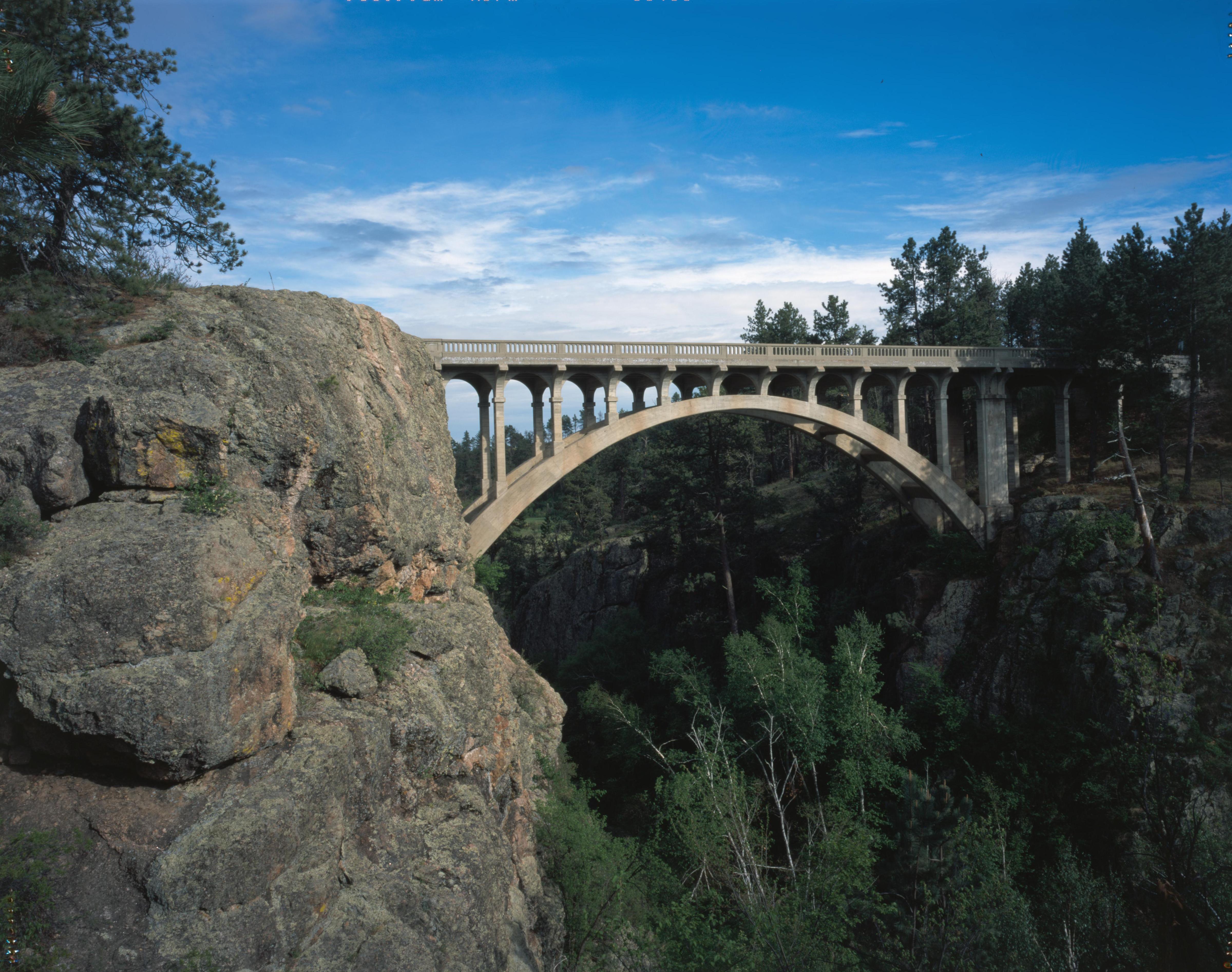
[3] Landmark name[4] Image Date listed Location City or Town Summary 7 Beaver Creek Bridge 
August 8, 1984 Wind Cave National Park, Highway 87, 0.5 miles north of U.S. Route 385
43°35′4″N 103°29′19″W / 43.58444°N 103.48861°WHot Springs 8 Beaver Creek Rockshelter October 25, 1993 Address Restricted Pringle 26 Pig Tail Bridge 
April 7, 1995 Highway 87 loop over Highway 87, north of Norbeck Lake at Wind Cave National Park
43°36′4″N 103°29′38″W / 43.60111°N 103.49389°WHot Springs 45 Wind Cave National Park Administrative and Utility Area Historic District 
July 11, 1984 East of Custer off U.S. Route 385
43°33′23″N 103°28′26″W / 43.55639°N 103.47389°WCuster See also
- National Register of Historic Places listings in Custer County, South Dakota
- National Register of Historic Places listings in South Dakota
References
- Karsmizki, Kenneth W.. National Register of Historic Places Multiple Property Documentation Form: Wind Cave National Park Multiple Property Submission. National Park Service 1993 [1]
- ^ The latitude and longitude information provided in this table was derived originally from the National Register Information System, which has been found to be fairly accurate for about 99% of listings. For about 1% of NRIS original coordinates, experience has shown that one or both coordinates are typos or otherwise extremely far off; some corrections may have been made. A more subtle problem causes many locations to be off by up to 150 yards, depending on location in the country: most NRIS coordinates were derived from tracing out latitude and longitudes off of USGS topographical quadrant maps created under North American Datum of 1927, which differs from the current, highly accurate GPS system used by Google maps. Chicago is about right, but NRIS longitudes in Washington are higher by about 4.5 seconds, and are lower by about 2.0 seconds in Maine. Latitudes differ by about 1.0 second in Florida. Some locations in this table may have been corrected to current GPS standards.
- ^ "National Register of Historic Places: Weekly List Actions". National Park Service, United States Department of the Interior. Retrieved on November 10, 2011.
- ^ Numbers represent an ordering by significant words. Various colorings, defined here, differentiate National Historic Landmark sites and National Register of Historic Places Districts from other NRHP buildings, structures, sites or objects.
- ^ "National Register Information System". National Register of Historic Places. National Park Service. 2008-04-24. http://nrhp.focus.nps.gov/natreg/docs/All_Data.html.
National Register of Historic Places in Wind Cave National Park Historic districts Wind Cave National Park Administrative and Utility Area Historic District
NRHP properties Beaver Creek Bridge | Beaver Creek Rockshelter | Pig Tail Bridge
See also: National Register of Historic Places listings in Wind Cave National Park U.S. National Register of Historic Places Topics Lists by states Alabama • Alaska • Arizona • Arkansas • California • Colorado • Connecticut • Delaware • Florida • Georgia • Hawaii • Idaho • Illinois • Indiana • Iowa • Kansas • Kentucky • Louisiana • Maine • Maryland • Massachusetts • Michigan • Minnesota • Mississippi • Missouri • Montana • Nebraska • Nevada • New Hampshire • New Jersey • New Mexico • New York • North Carolina • North Dakota • Ohio • Oklahoma • Oregon • Pennsylvania • Rhode Island • South Carolina • South Dakota • Tennessee • Texas • Utah • Vermont • Virginia • Washington • West Virginia • Wisconsin • WyomingLists by territories Lists by associated states Other  Category:National Register of Historic Places •
  Portal:National Register of Historic PlacesCategories:
- National Register of Historic Places lists in the National Park Service
- Wind Cave National Park
-


Wikimedia Foundation. 2010.