- National Register of Historic Places listings in Washington County, Minnesota
-
This is a list of properties on the National Register of Historic Places in Washington County, Minnesota. Many of the historic properties are associated with the timber industry, which began just after treaties with the Dakota and Ojibwe Indians were signed in 1837. The first sawmill in the state was established in Marine Mills (now Marine on St. Croix) in 1839. Other towns along the St. Croix River were associated with the lumber trade: Stillwater, Lakeland, and Point Douglas. Many of the houses in Stillwater are associated with wealthy lumbermen. Railroads and other industries also played a part in the development of the county.[1]
Several of these properties are listed in the "Washington County Multiple Resource Area".[1]
Current listings
[2] Landmark name Image Date listed Location City or town Summary 1 Moritz Bergstein Shoddy Mill and Warehouse 
March 5, 2008 6046 Stagecoach Rd.
45°02′11″N 92°47′34″W / 45.036389°N 92.792778°WOak Park Heights 2 Erastus Bolles House 
April 20, 1982 1741 Stagecoach Trail
44°55′23″N 92°48′03″W / 44.923056°N 92.800833°WAfton 3 Chicago, Milwaukee and St. Paul Freight House 
July 13, 1977 233-335 Water St.
45°03′18″N 92°48′15″W / 45.055°N 92.804167°WStillwater 4 John T. Chyphers House 
September 10, 1971 661 Quinnell Ave., N. Lakeland 5 John Copas House 
July 21, 1980 North of Marine on St. Croix on Minnesota Highway 95
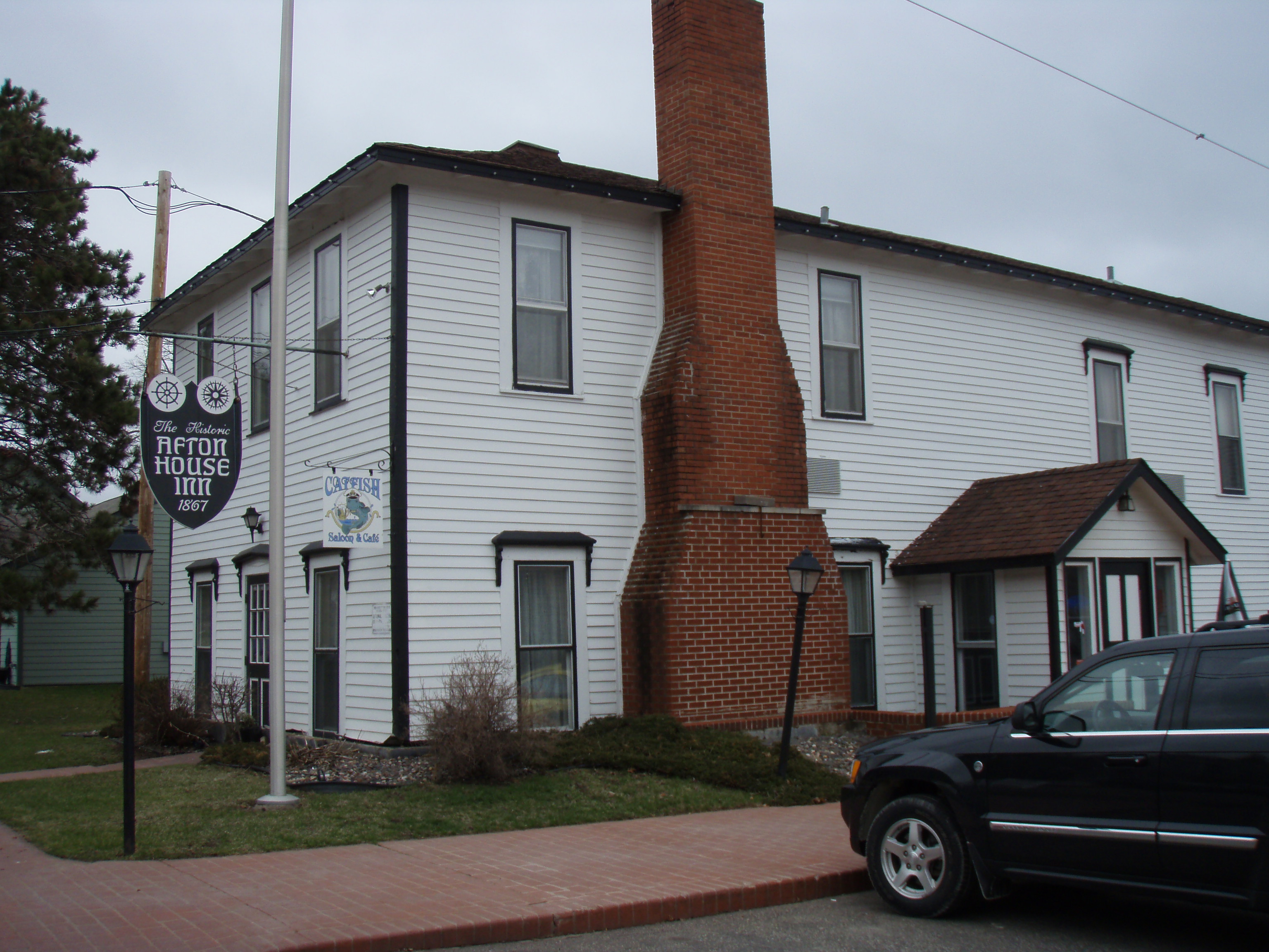
45°13′52″N 92°45′47″W / 45.231111°N 92.763056°WMarine on St. Croix 6 Cushing Hotel 
January 17, 1985 3291 St. Croix Trail Ave., S.
44°54′04″N 92°46′58″W / 44.901111°N 92.782778°WAfton 7 Johannes Erickson House 
June 17, 1976 County Highway 3
45°13′55″N 92°49′14″W / 45.231944°N 92.820556°WScandia 8 John P. Furber House 
April 20, 1982 7310 Lamar Ave.
44°50′37″N 92°52′54″W / 44.843611°N 92.881667°WCottage Grove 9 Newington Gilbert House 
April 20, 1982 1678 Stagecoach Trail
44°55′29″N 92°48′11″W / 44.924722°N 92.803056°WAfton 10 Grey Cloud Lime Kiln 
December 18, 1978 10398 Grey Cloud Island Trail
44°47′55″N 92°58′40″W / 44.798611°N 92.977778°WCottage Grove 11 Hay Lake School 
July 1, 1970 County Highway 3
45°13′56″N 92°49′10″W / 45.232222°N 92.819444°WMarine on St. Croix Profile 12 Roscoe Hersey House 
February 19, 1982 416 S. 4th St.
45°03′09″N 92°48′32″W / 45.0525°N 92.808889°WStillwater 13 Mitchell Jackson Farmhouse 
February 19, 1982 16376 7th St. Lane, S.
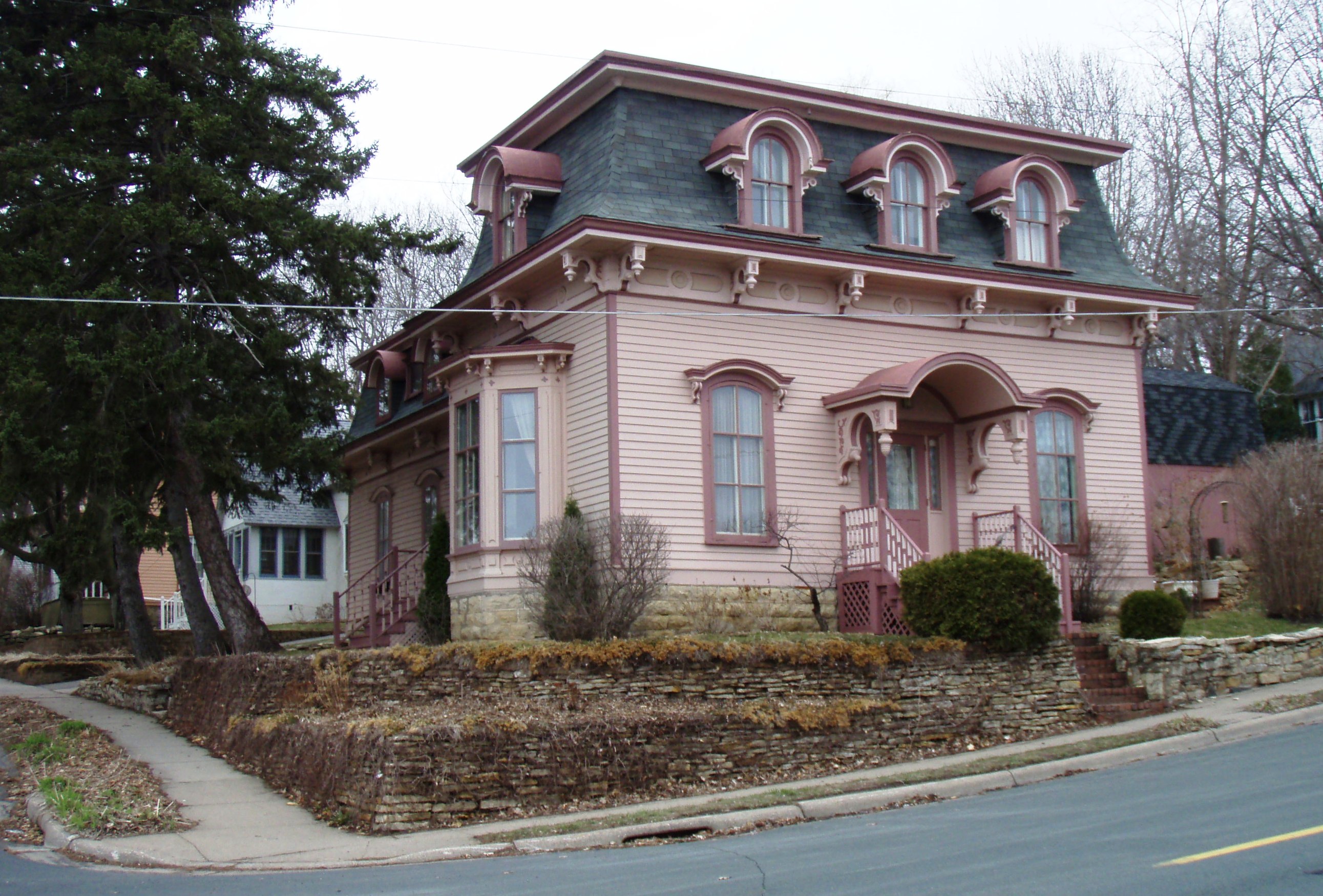
44°56′15″N 92°46′33″W / 44.9375°N 92.775833°WLakeland 14 Capt. Austin Jenks House 
April 20, 1982 504 S. 5th St.
45°03′05″N 92°48′35″W / 45.051389°N 92.809722°WStillwater 15 Albert Lammers House 
April 20, 1982 1306 S. 3rd St.
45°02′40″N 92°48′23″W / 45.044444°N 92.806389°WStillwater 16 Log Cabin Restaurant/Club Tara 
December 27, 2007 15021 60th St., N.
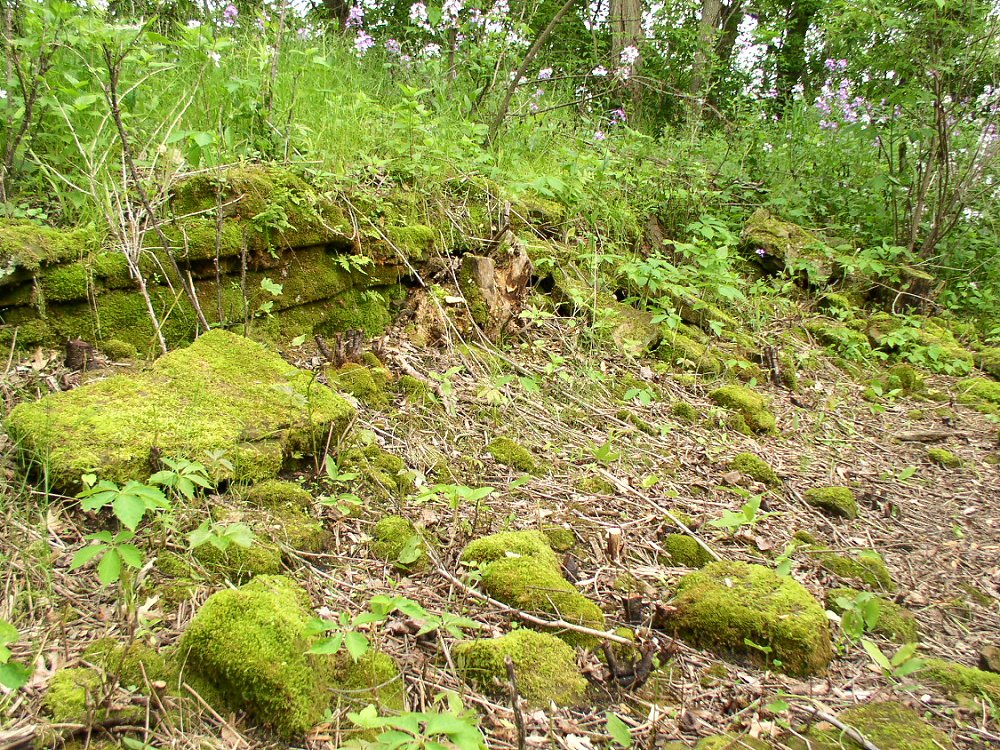
45°02′07″N 92°48′06″W / 45.035278°N 92.801667°WOak Park Heights 17 Marine Mill Site 
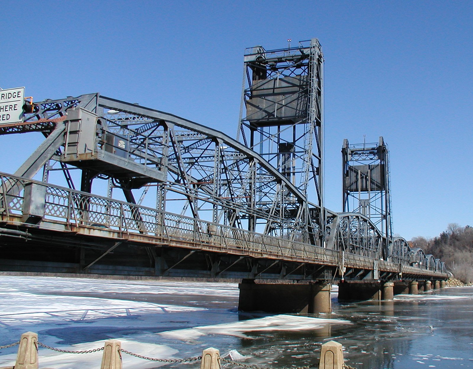
January 26, 1970 Mill Reservation, Block 47
45°11′51″N 92°46′05″W / 45.1975°N 92.768056°WMarine on St. Croix Profile 18 Marine on St. Croix Historic District 
June 28, 1974 Roughly bounded by the St. Croix River, railroad tracks, and Kennedy and Spruce Sts.
45°11′49″N 92°46′25″W / 45.196944°N 92.773611°WMarine on St. Croix 19 Ivory McKusick House 
April 20, 1982 504 N. 2nd St.
45°03′37″N 92°48′33″W / 45.060278°N 92.809167°WStillwater 20 Minnesota Territorial-State Prison Warden's House 
December 17, 1974 602 N. Main St.
45°03′42″N 92°48′26″W / 45.061667°N 92.807222°WStillwater 21 John and Martin Mower House and Arcola Mill Site 
June 17, 1980 Arcola Tr.
45°08′19″N 92°45′05″W / 45.138611°N 92.751389°WStillwater 22 Nelson School 
October 25, 1979 1018 S. 1st St
45°02′49″N 92°48′13″W / 45.046944°N 92.803611°WStillwater 23 Capt. John Oliver House 
December 16, 1977 1544 Rivercrest Rd.
44°58′16″N 92°46′19″W / 44.971111°N 92.771944°WLakeland 24 Pest House 
June 17, 1980 North of Stillwater at 9033 Fairy Falls Rd.
45°04′48″N 92°48′19″W / 45.08°N 92.805278°WStillwater 25 Point Douglas-St. Louis River Road Bridge 
February 24, 1975 Off County Highway 5
45°04′32″N 92°49′44″W / 45.075556°N 92.828889°WStillwater 26 St. Croix Boom Company House and Barn 
June 3, 1980 Northeast of Stillwater at 9666 N. St. Croix Trail
45°05′11″N 92°47′05″W / 45.086389°N 92.784722°WStillwater 27 St. Croix Boom Site 
November 13, 1966 3 miles north of Stillwater on the St. Croix River Stillwater 28 St. Croix Lumber Mills-Stillwater Manufacturing Company 
April 20, 1982 318 N. Main
45°03′35″N 92°48′26″W / 45.059722°N 92.807222°WStillwater 29 St. Croix River Access Site August 23, 1984 On Lower Grey Cloud Island[3] Stillwater 30 William Sauntry House and Recreation Hall 
April 20, 1982 626 N. 4th St. and 625 N. 5th St.
45°03′40″N 92°48′45″W / 45.061111°N 92.8125°WStillwater 31 Schilling Archeological District December 22, 1978 Address Restricted Cottage Grove 32 Cordenio Severance House 
June 3, 1976 6940 Keats Ave., S.
44°50′57″N 92°54′16″W / 44.849167°N 92.904444°WCottage Grove 33 Benjamin B. Sheffield House 
June 3, 1980 North of Stillwater at 4 Croixside Rd.
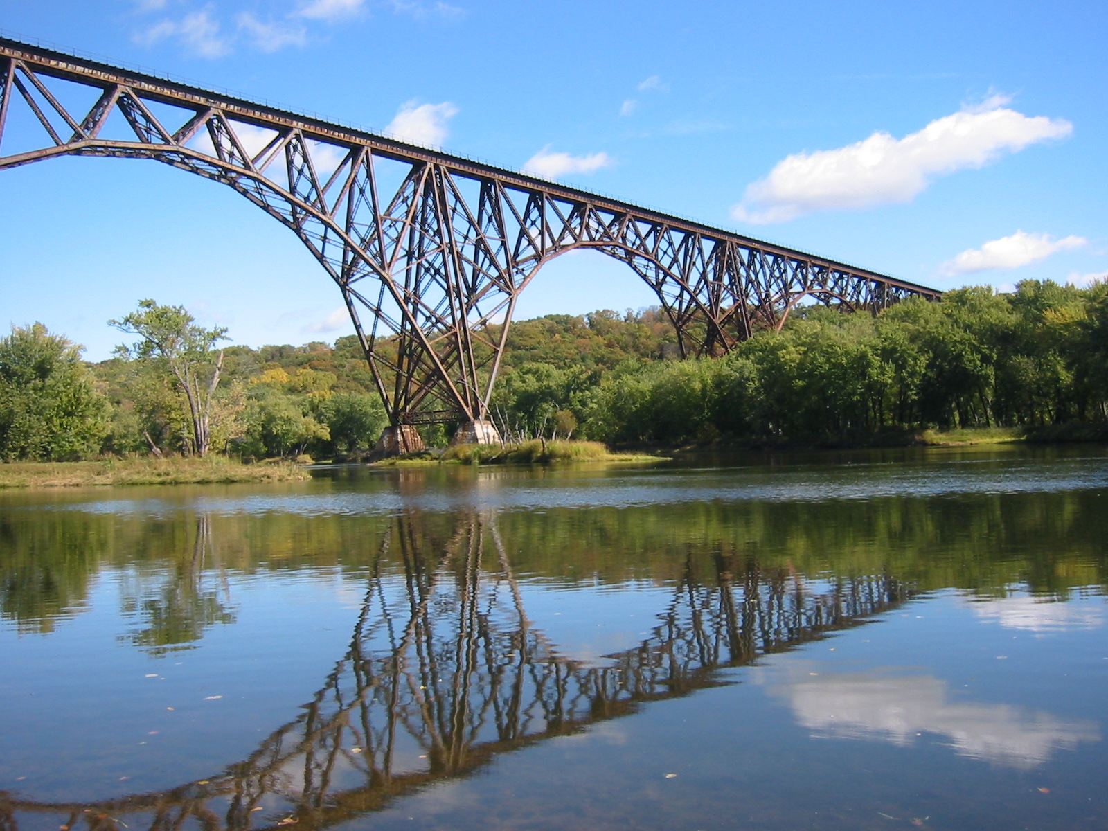
45°09′17″N 92°45′30″W / 45.154722°N 92.758333°WStillwater 34 Soo Line High Bridge 
August 22, 1977 Over the St. Croix River, 5 miles north of Stillwater
45°7′23″N 92°44′39″W / 45.12306°N 92.74417°W[4]Stillwater 35 Charles Spangenberg Farmstead 
December 5, 1978 Southeast of Woodbury at 9431 Dale Rd.
44°52′33″N 92°54′52″W / 44.875833°N 92.914444°WWoodbury 36 State Prison Historic District 
July 10, 1986 5500 Pickett Ave.
45°01′31″N 92°47′19″W / 45.025278°N 92.788611°WBayport 37 Stillwater Bridge 
May 25, 1989 Minnesota Highway 36/Wisconsin Highway 64 over the St. Croix River
45°03′23″N 92°48′12″W / 45.056389°N 92.803333°WStillwater 38 Stillwater Commercial Historic District 
March 26, 1992 Vicinity of Main, 2nd, and Chestnut Sts.
45°03′35″N 92°48′23″W / 45.059722°N 92.806389°WStillwater 39 Stillwater Overlook 
December 27, 2007 Lookout Trail near 63rd St. N.
45°02′26″N 92°47′44″W / 45.040556°N 92.795556°WOak Park Heights 40 Henry Stussi House 
April 20, 1982 9097 Mendel Rd.
45°04′50″N 92°50′44″W / 45.080556°N 92.845556°WStillwater 41 Washington County Courthouse 
August 26, 1971 W. Pine St. at S. 3rd St.
45°03′02″N 92°48′18″W / 45.050556°N 92.805°WStillwater Profile 42 Mortimer Webster House 
April 20, 1982 435 S. Broadway
45°03′11″N 92°48′15″W / 45.053056°N 92.804167°WStillwater References
- ^ a b "Washington County MRA". March 15, 1982. http://pdfhost.focus.nps.gov/docs/NRHP/Text/64000383.pdf. Retrieved October 17, 2009.
- ^ Numbers represent an ordering by significant words. Various colorings, defined here, differentiate National Historic Landmark sites and National Register of Historic Places Districts from other NRHP buildings, structures, sites or objects.
- ^ Location derived from this Cottage Grove city webpage; the NRIS lists the site as "Address Restricted"
- ^ Location derived from Gardner, Denis. Minnesota Treasures: Stories Behind the State's Historic Places. St. Paul: Minnesota Historical Society P, 2004, 68. Accessed 2009-10-05. The NRIS lists the site as "Address Restricted"
See also
Categories:- National Register of Historic Places in Minnesota by county
- Washington County, Minnesota
- Buildings and structures in Washington County, Minnesota


Wikimedia Foundation. 2010.