- National Register of Historic Places listings in Otero County, New Mexico
-
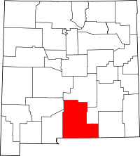 Location of Otero County in New Mexico
This is a list of the National Register of Historic Places listings in Otero County, New Mexico.
This is intended to be a complete list of the properties and districts on the National Register of Historic Places in Otero County, New Mexico, United States. Latitude and longitude coordinates are provided for many National Register properties and districts; these locations may be seen together in a Google map.[1]
There are 29 properties and districts listed on the National Register in the county.
-
- This National Park Service list is complete through NPS recent listings posted November 10, 2011.[2]
Contents: Counties in New Mexico Bernalillo – Catron – Chaves – Cibola – Colfax – Curry – De Baca – Doña Ana – Eddy – Grant – Guadalupe – Harding – Hidalgo – Lea – Lincoln – Los Alamos – Luna – McKinley – Mora – Otero – Quay – Rio Arriba – Roosevelt – San Juan – San Miguel – Sandoval – Santa Fe – Sierra – Socorro – Taos – Torrance – Union – Valencia Current listings
[3] Landmark name [4] Image Date listed Location City or town Summary 1 Administration Building 
May 16, 1989 1900 N. White Sands Boulevard, New Mexico School for the Blind and Visually Impaired
32°54′51″N 105°57′33″W / 32.914167°N 105.959167°WAlamogordo 2 Alamogordo Woman's Club 
August 4, 2003 Southeastern corner of the junction of 12th St. and Indiana Ave.
32°54′12″N 105°57′22″W / 32.903333°N 105.956111°WAlamogordo 3 Archeological Site No. AR-03-08-02-409 April 13, 1998 Address Restricted Timberon 4 Archeological Site No. AR-03-08-02-415 April 13, 1998 Address Restricted Timberon 5 Archeological Site No. AR-03-08-03-128 November 24, 1995 Address Restricted Queen 6 Auditorium and Recreation Building 
May 16, 1989 1900 N. White Sands Boulevard, New Mexico School for the Blind and Visually Impaired
32°54′49″N 105°57′30″W / 32.913611°N 105.958333°WAlamogordo 7 Bluewater Lookout Complex January 28, 1988 Lincoln National Forest
32°44′28″N 105°27′54″W / 32.741111°N 105.465°WWeed 8 Carrisa Lookout Complex January 28, 1988 Lincoln National Forest
32°40′34″N 105°37′09″W / 32.676111°N 105.619167°WLong Canyon 9 Central Receiving Building 
May 16, 1989 1900 N. White Sands Boulevard, New Mexico School for the Blind and Visually Impaired
32°54′51″N 105°57′29″W / 32.914167°N 105.958056°WAlamogordo 10 Circle Cross Ranch Headquarters November 17, 1980 Southwest of Sacramento
32°39′26″N 105°42′20″W / 32.657222°N 105.705556°WSacramento 11 Fresnal Shelter April 13, 1998 Address Restricted High Rolls 12 Juan Garcia House October 23, 1980 Tularosa St. La Luz 13 Hay Canyon Logging Camp January 2, 1992 Address Restricted Mayhill 14 Hubbell Canyon Log Chute December 31, 1991 Address Restricted Cloudcroft 15 Infirmary Building 
May 16, 1989 1900 N. White Sands Boulevard, New Mexico School for the Blind and Visually Impaired
32°55′19″N 105°57′30″W / 32.921944°N 105.958333°WAlamogordo 16 Jackson House 
January 28, 2004 1700 9th St.
32°53′56″N 105°56′23″W / 32.898889°N 105.939722°WAlamogordo 17 La Luz Historic District 
October 23, 1980 Off State Road 83
32°58′42″N 105°56′33″W / 32.978333°N 105.9425°WLa Luz 18 La Luz Pottery Factory 
May 29, 1979 2 miles (3.2 km) east of La Luz
32°58′45″N 105°54′08″W / 32.979167°N 105.902222°WLa Luz 19 Mayhill Administrative Site June 1, 1989 U.S. Route 82, 1.5 miles north of Mayhill
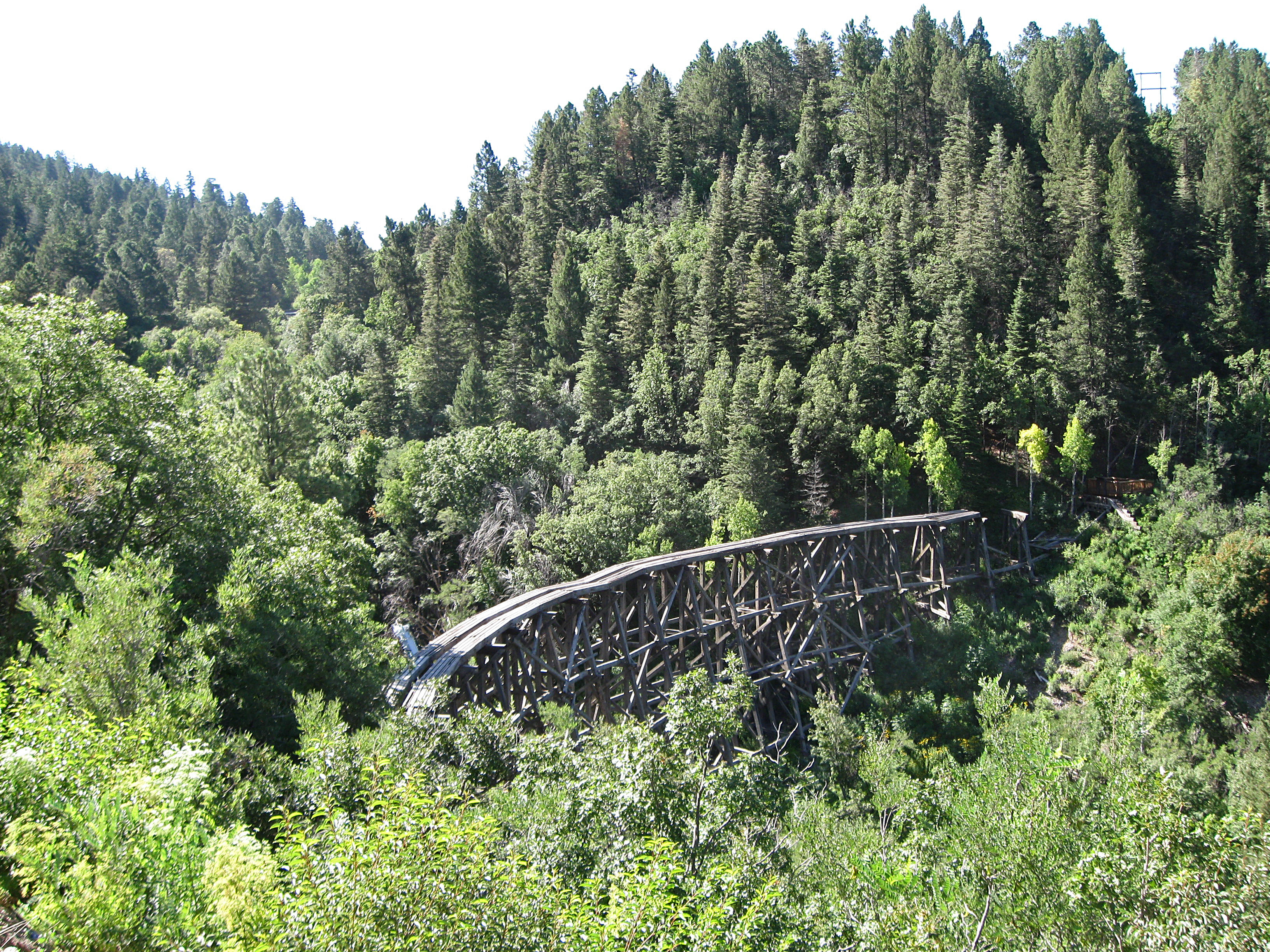
32°54′32″N 105°28′10″W / 32.908889°N 105.469444°WMayhill 20 Mexican Canyon Trestle 
May 7, 1979 Northwest of Cloudcroft off State Road 83
32°57′49″N 105°44′49″W / 32.963611°N 105.746944°WCloudcroft 21 Queen Anne House 
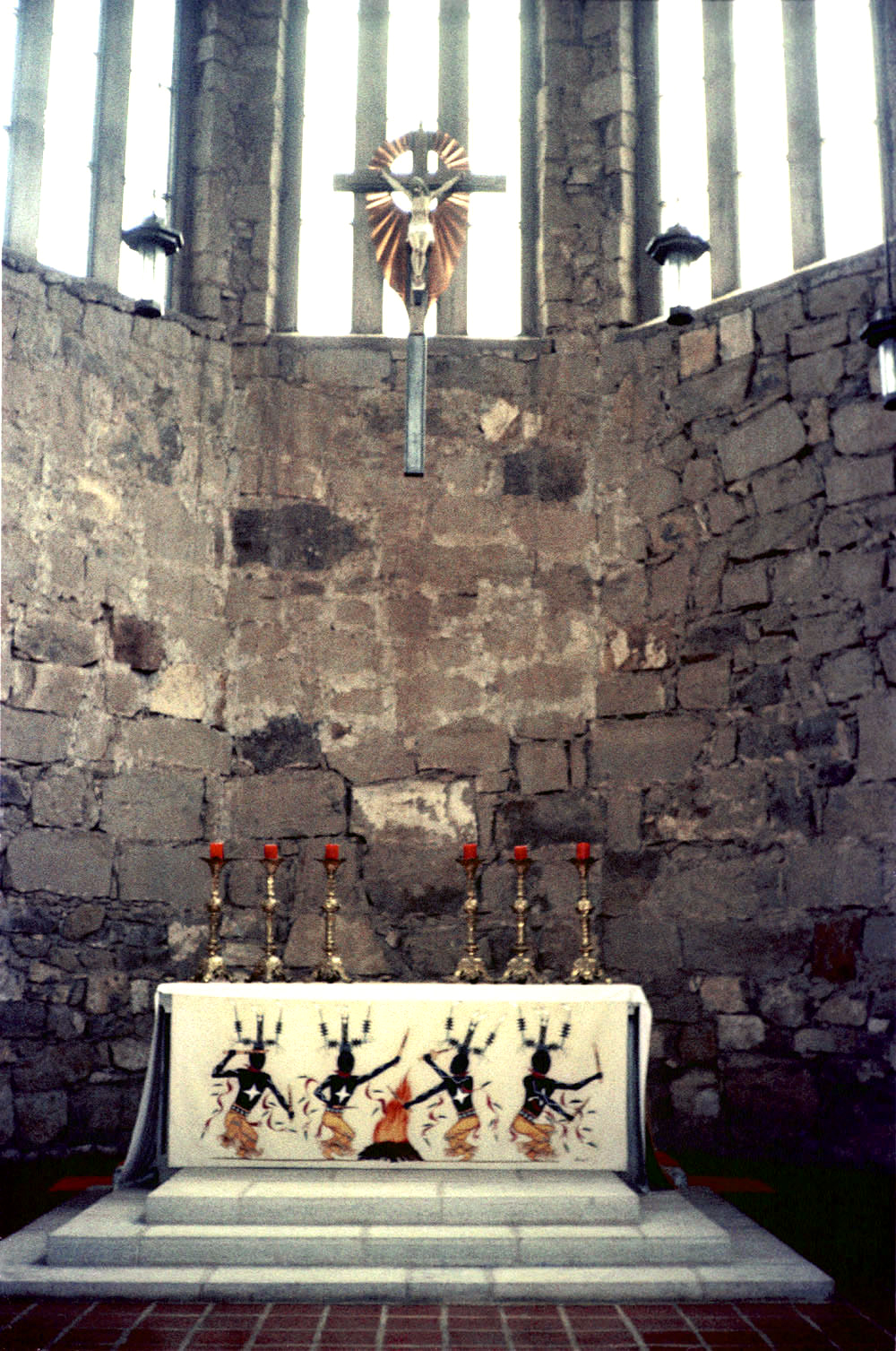
October 23, 1980 Kearney St. La Luz 22 St. Joseph Apache Mission Church 
February 1, 2005 626 Mission Trail
33°09′24″N 105°46′03″W / 33.156667°N 105.7675°WMescalero 23 D.H. Sutherland House 
October 23, 1980 Main St. La Luz 24 Tularosa Original Townsite District 
February 2, 1979 U.S. Routes 54/70
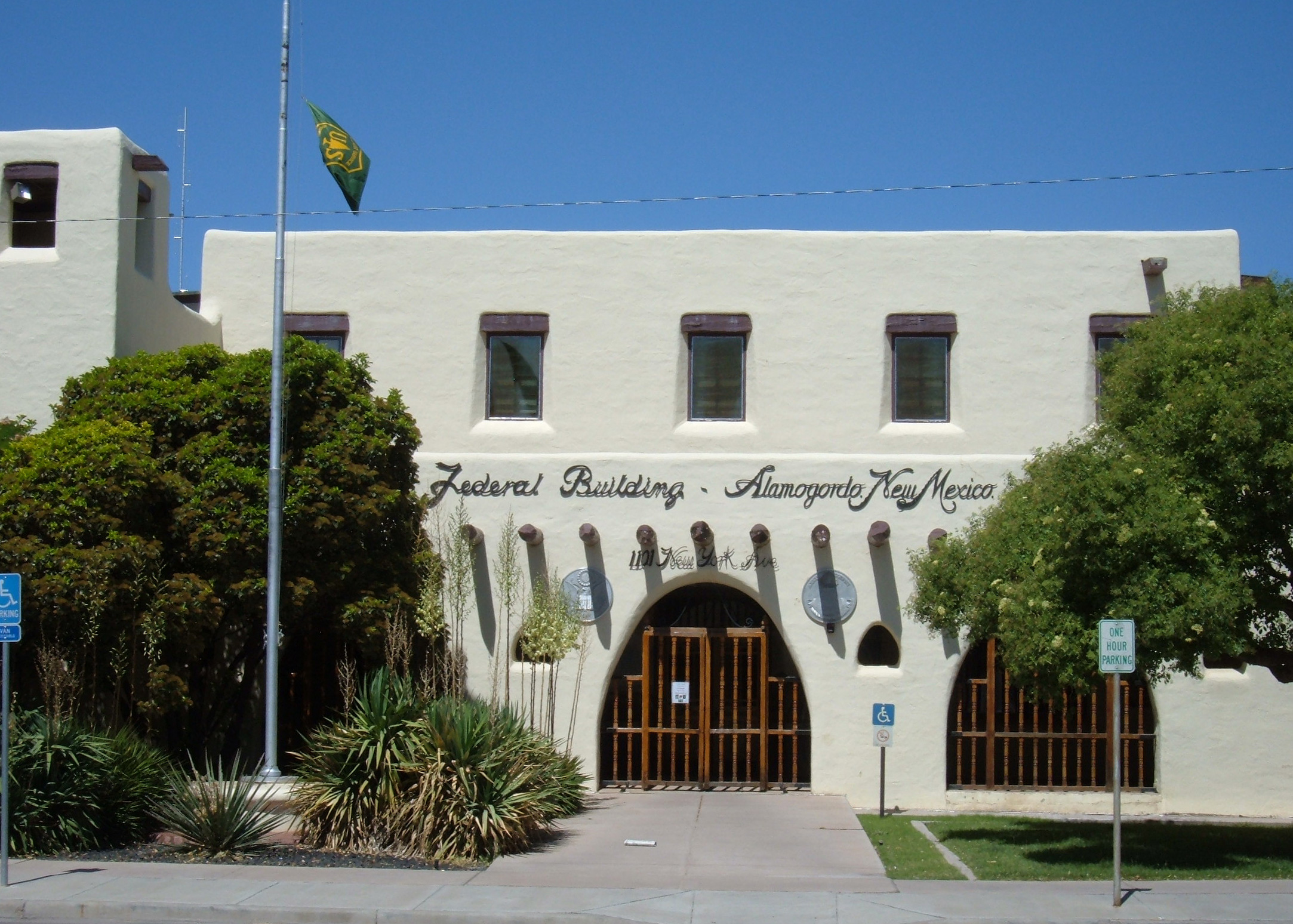
33°04′28″N 106°01′01″W / 33.074444°N 106.016944°WTularosa 25 US Post Office-Alamogordo 
May 18, 2000 1101 New York Ave.
32°54′03″N 105°57′32″W / 32.900833°N 105.958889°WAlamogordo 26 Weed Lookout Tower January 28, 1988 Lincoln National Forest
32°48′23″N 105°33′33″W / 32.806389°N 105.559167°WSacramento 27 White Sands National Monument Historic District 
June 23, 1988 U.S. Routes 70/82
32°46′47″N 106°10′18″W / 32.779722°N 106.171667°WAlamogordo 28 Wills Canyon Spur Trestle December 31, 1991 Address Restricted Cloudcroft 29 Wofford Lookout Complex January 28, 1988 Lincoln National Forest
32°05′40″N 105°42′12″W / 32.094444°N 105.703333°WCloudcroft See also
- List of National Historic Landmarks in New Mexico
- National Register of Historic Places listings in New Mexico
References
- ^ The latitude and longitude information provided in this table was derived originally from the National Register Information System, which has been found to be fairly accurate for about 99% of listings. For about 1% of NRIS original coordinates, experience has shown that one or both coordinates are typos or otherwise extremely far off; some corrections may have been made. A more subtle problem causes many locations to be off by up to 150 yards, depending on location in the country: most NRIS coordinates were derived from tracing out latitude and longitudes off of USGS topographical quadrant maps created under North American Datum of 1927, which differs from the current, highly accurate GPS system used by Google maps. Chicago is about right, but NRIS longitudes in Washington are higher by about 4.5 seconds, and are lower by about 2.0 seconds in Maine. Latitudes differ by about 1.0 second in Florida. Some locations in this table may have been corrected to current GPS standards.
- ^ "National Register of Historic Places: Weekly List Actions". National Park Service, United States Department of the Interior. Retrieved on November 10, 2011.
- ^ Numbers represent an ordering by significant words. Various colorings, defined here, differentiate National Historic Landmark sites and National Register of Historic Places Districts from other NRHP buildings, structures, sites or objects.
- ^ "National Register Information System". National Register of Historic Places. National Park Service. . http://nrhp.focus.nps.gov/natreg/docs/All_Data.html.
U.S. National Register of Historic Places Topics Lists by states Alabama • Alaska • Arizona • Arkansas • California • Colorado • Connecticut • Delaware • Florida • Georgia • Hawaii • Idaho • Illinois • Indiana • Iowa • Kansas • Kentucky • Louisiana • Maine • Maryland • Massachusetts • Michigan • Minnesota • Mississippi • Missouri • Montana • Nebraska • Nevada • New Hampshire • New Jersey • New Mexico • New York • North Carolina • North Dakota • Ohio • Oklahoma • Oregon • Pennsylvania • Rhode Island • South Carolina • South Dakota • Tennessee • Texas • Utah • Vermont • Virginia • Washington • West Virginia • Wisconsin • WyomingLists by territories Lists by associated states Other  Category:National Register of Historic Places •
  Portal:National Register of Historic Places
Municipalities and communities of Otero County, New Mexico County seat: Alamogordo City 
Villages CDPs Unincorporated
communitiesHigh Rolls | Mayhill | Mountain Park | Newman | Orogrande | Piñon | Sunspot | Weed | Three Rivers
Indian reservation Mescalero Apache Indian Reservation
Categories:- National Register of Historic Places in New Mexico by county
- Otero County, New Mexico
- History of Otero County, New Mexico
-


Wikimedia Foundation. 2010.