- National Register of Historic Places listings in McLennan County, Texas
-
List of Registered Historic Places in McLennan County, Texas
This is intended to be a complete list of properties and districts listed on the National Register of Historic Places in McLennan County, Texas. The locations of National Register properties and districts (at least for all showing latitude and longitude coordinates below) may be seen in a Google map by clicking on "Map of all coordinates".[1]
-
- This National Park Service list is complete through NPS recent listings posted November 10, 2011.[2]
[3] Landmark name [4] Image Date listed Location City or town Summary 1 Artesian Manufacturing and Bottling Company Building 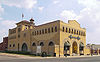
May 26, 1983 300 S. 5th St.
31°33′18″N 97°07′47″W / 31.555°N 97.129722°WWaco Currently houses the Dr Pepper Museum 2 Brown-Mann House October 22, 1987 725 W. Sixth St.
31°26′06″N 97°24′30″W / 31.435°N 97.408333°WMcGregor 3 Castle Heights Historic District November 17, 2009 Roughly bounded by Waco Dr. (US 84), Oriental Rd., Franklin Ave., and 39th St.
31°31′58″N 97°09′40″W / 31.532836°N 97.161147°WWaco 4 Madison Cooper House 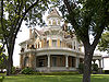
July 8, 1982 1801 Austin Ave.
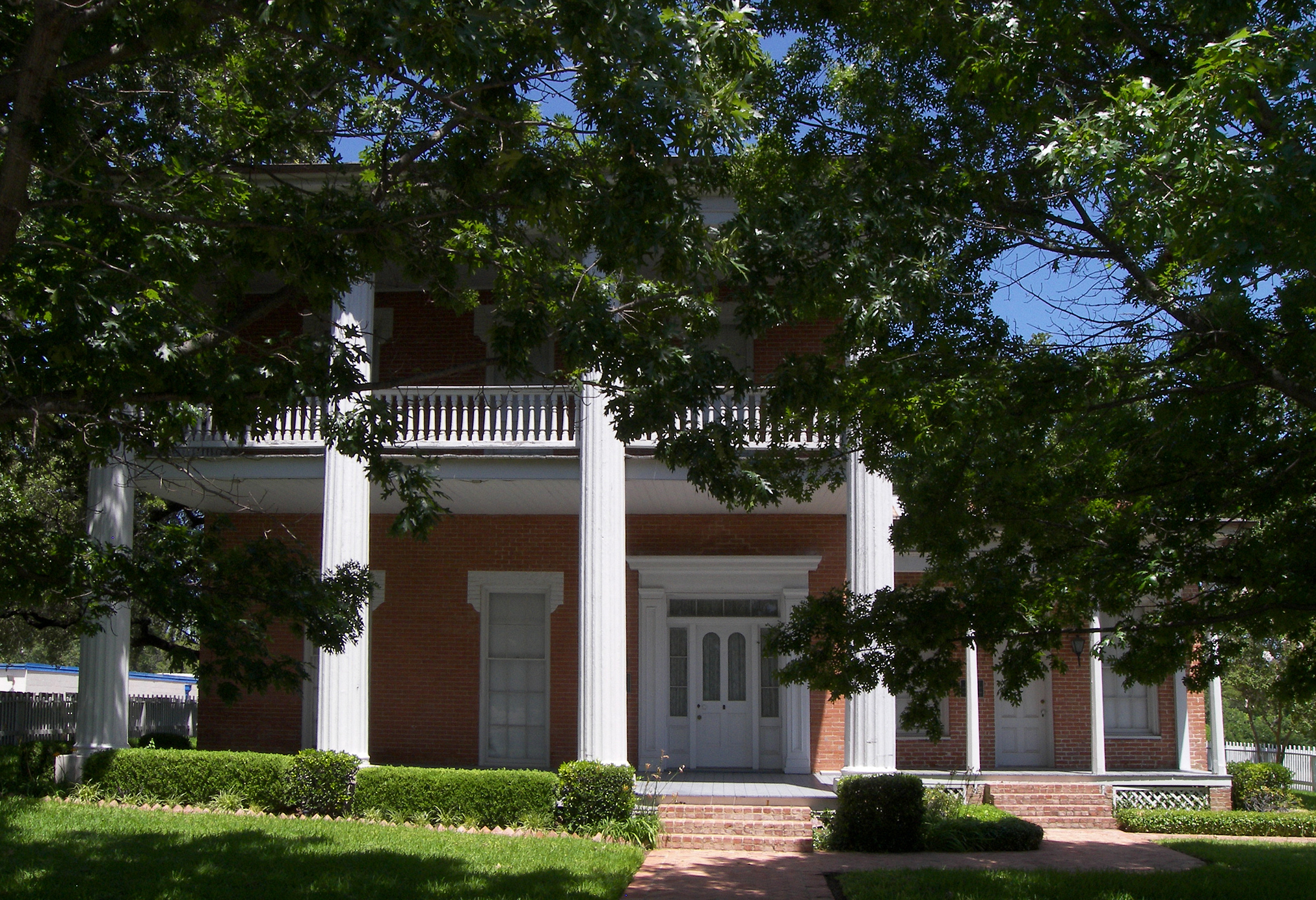
31°32′46″N 97°08′39″W / 31.546111°N 97.144167°WWaco 5 Earle-Napier-Kinnard House 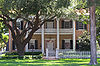
March 11, 1971 814 S. 4th St.
31°34′43″N 97°07′21″W / 31.578611°N 97.1225°WWaco 6 Forsgard Homestead November 13, 2003 1116-1122 N. 4th St.
31°33′51″N 97°08′24″W / 31.564167°N 97.14°WWaco 7 Fort House 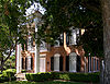
October 15, 1970 503 E. 4th St.
31°33′14″N 97°07′35″W / 31.553889°N 97.126389°WWaco 8 Hippodrome 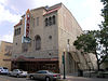
April 28, 1983 724 Austin Ave.
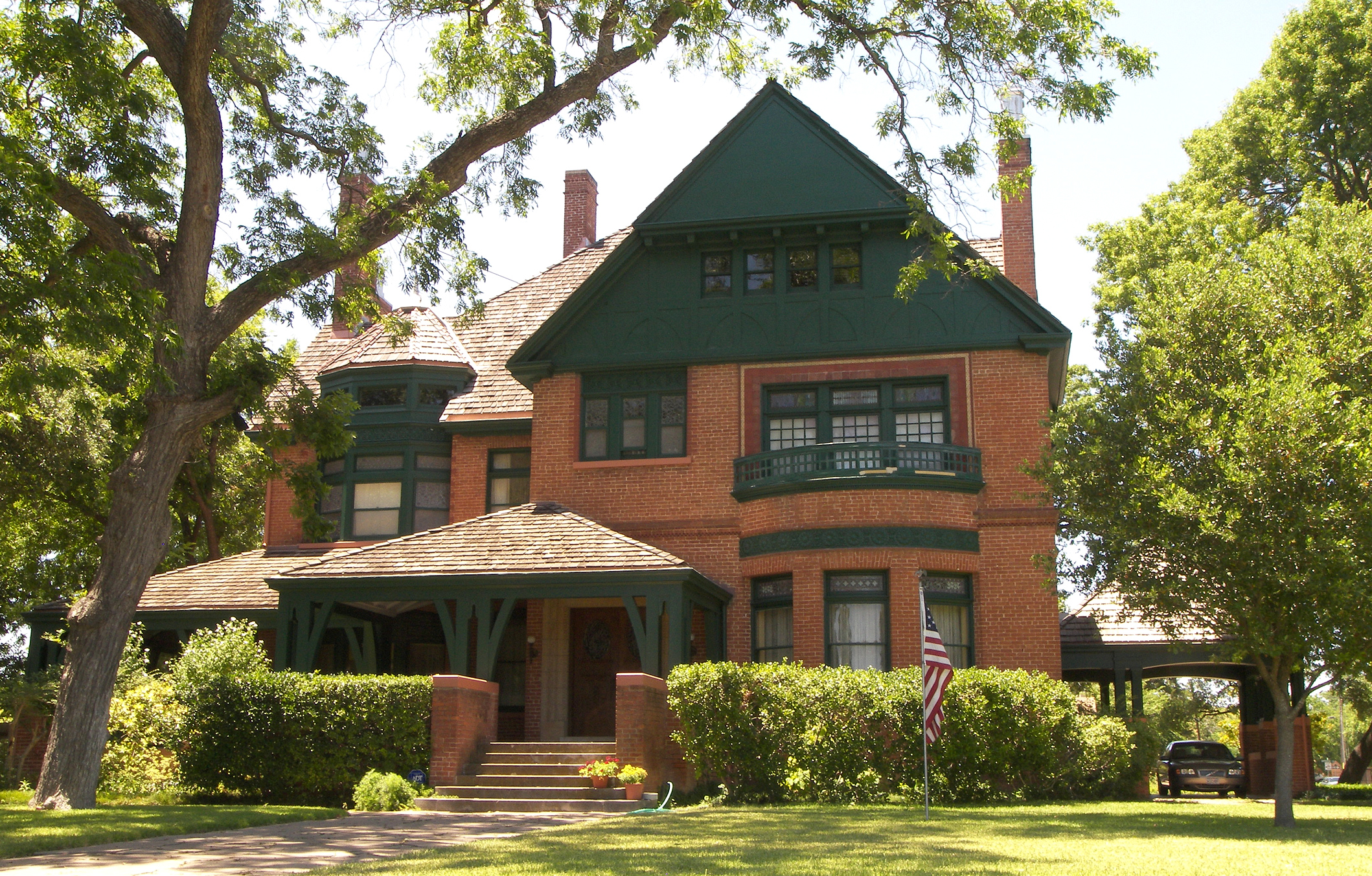
31°33′16″N 97°08′03″W / 31.554583°N 97.134167°WWaco 9 John Wesley Mann House 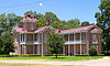
April 19, 1972 100 Mill St.
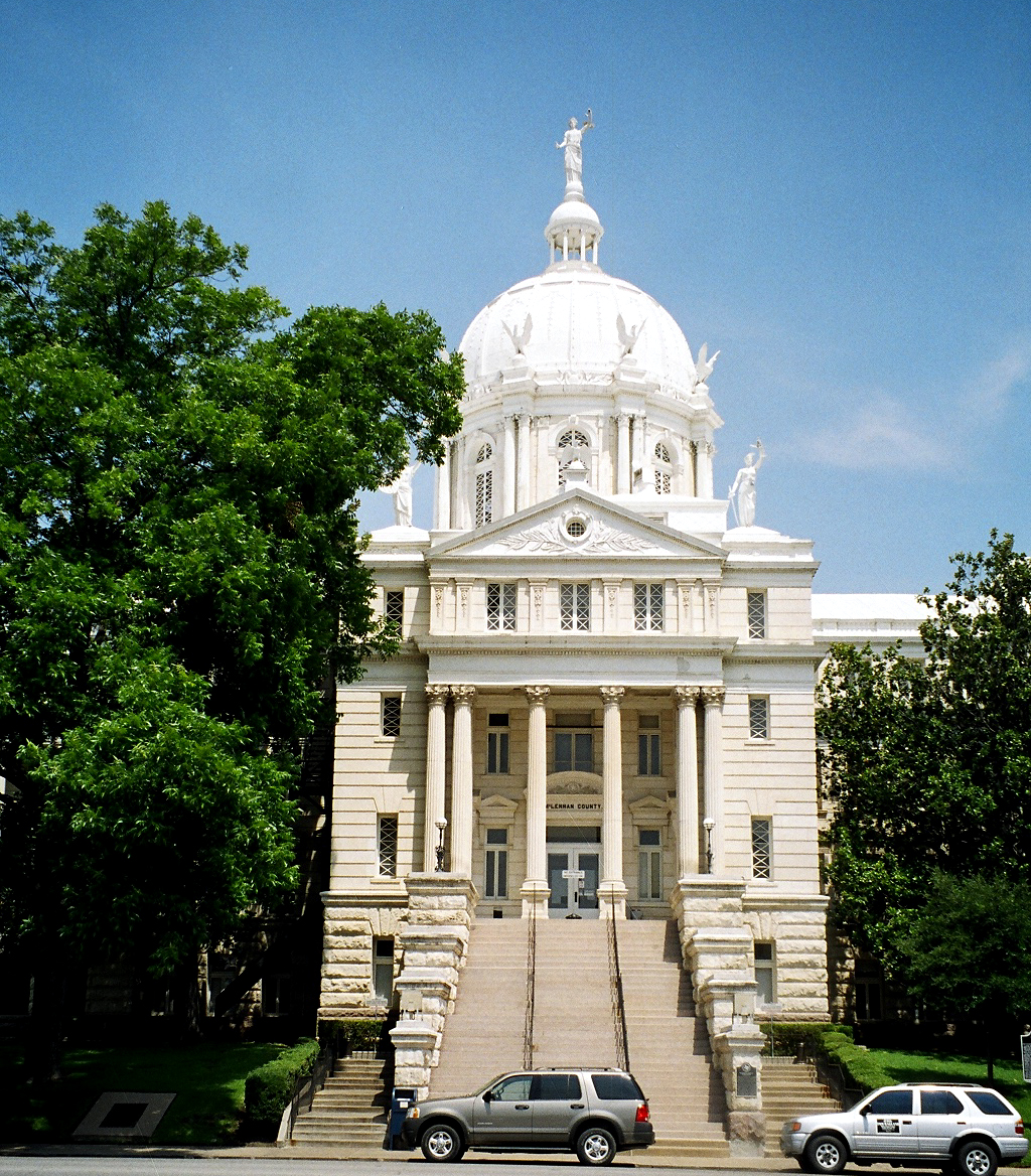
31°34′02″N 97°08′01″W / 31.567222°N 97.133611°WWaco 10 McClennan County Courthouse 
December 14, 1978 Public Sq.
31°33′26″N 97°08′01″W / 31.557222°N 97.133611°WWaco 11 McCulloch House 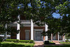
September 14, 1972 406 Columbus Ave.
31°33′32″N 97°07′58″W / 31.558889°N 97.132778°WWaco 12 McDermott Motors Building 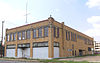
January 14, 2004 1125 Washington Ave.
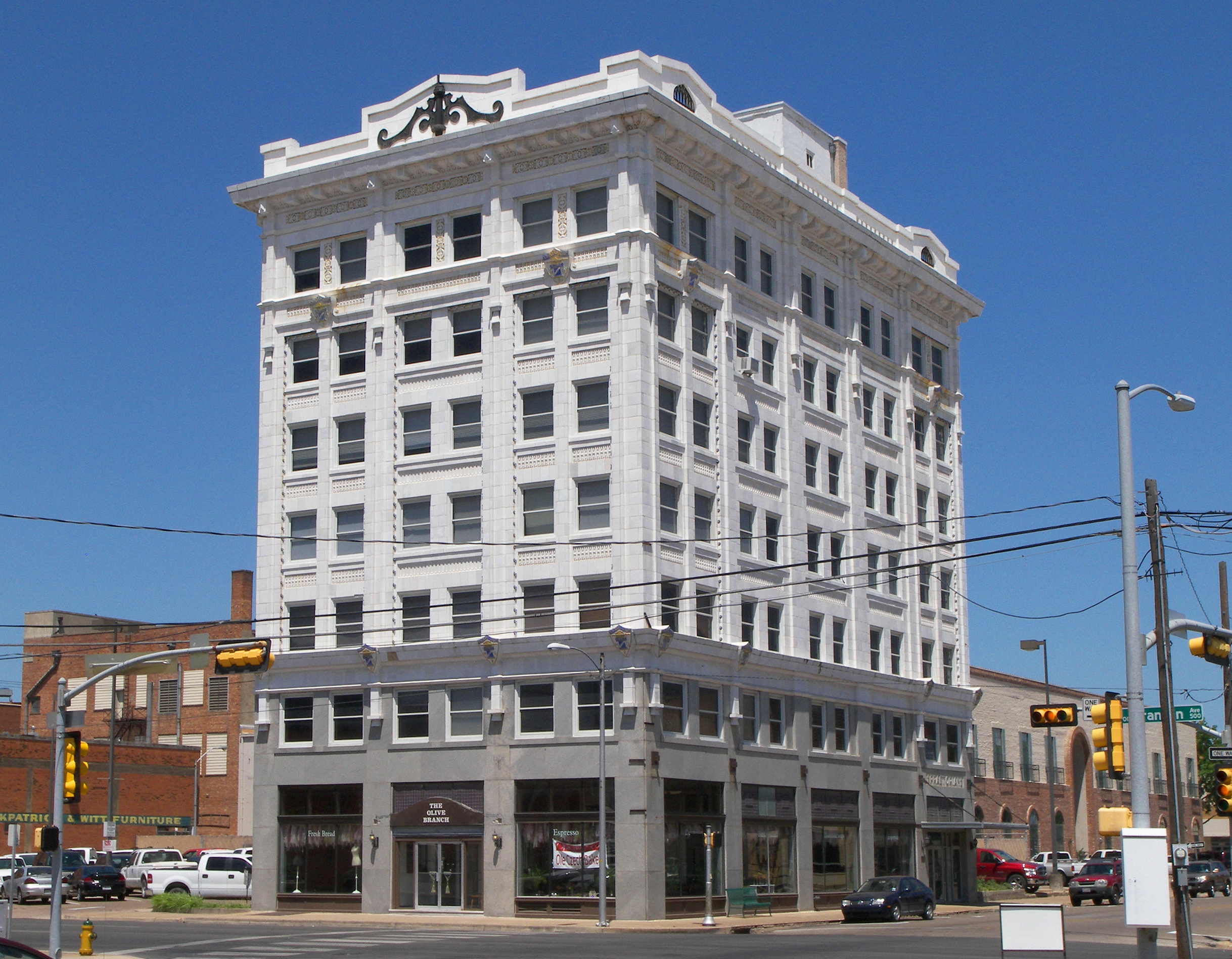
31°33′08″N 97°08′22″W / 31.552222°N 97.139444°WWaco 13 Praetorian Building 
July 26, 1984 601 Franklin Ave.
31°33′18″N 97°07′55″W / 31.555°N 97.131944°WWaco 14 Rotan-Dossett House 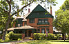
January 29, 1979 1503 Columbus Ave.
31°33′01″N 97°08′35″W / 31.550278°N 97.143056°WWaco 15 Texas Textile Mills-L.L. Sams Company Historic District December 13, 2004 2100 River St.
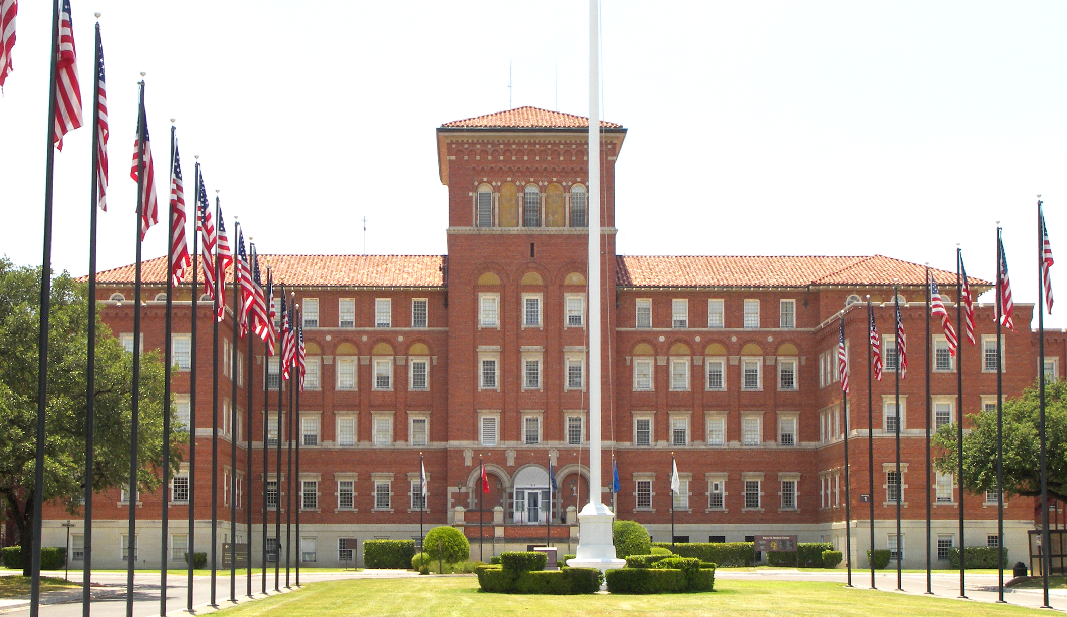
31°32′42″N 97°06′31″W / 31.545°N 97.108611°WWaco 16 Torrey's Trading House No. 2 Site June 5, 1975 Address Restricted Waco 17 Veterans Administration Hospital Historic District 
July 18, 1994 4800 Memorial Dr.
31°30′40″N 97°09′54″W / 31.511111°N 97.165°WWaco 18 Waco Drug Company 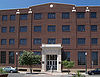
March 24, 2008 225 S. 5th St.
31°33′19″N 97°07′50″W / 31.555278°N 97.130556°WWaco 19 Waco High School March 17, 2009 815 Columbus
31°33′22″N 97°08′15″W / 31.556111°N 97.1375°WWaco 20 Waco Suspension Bridge 
June 22, 1970 At Bridge St., over the Brazos River
31°33′40″N 97°07′39″W / 31.561111°N 97.1275°WWaco 21 Washington Avenue Bridge 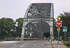
February 20, 1998 Washington and wlm Aves. across Brazos River
31°33′40″N 97°07′43″W / 31.561111°N 97.128611°WWaco See also
- Registered Historic Places in Texas, Counties K-S
References
- ^ The latitude and longitude information provided in this table was derived originally from the National Register Information System, which has been found to be fairly accurate for about 99% of listings. For about 1% of NRIS original coordinates, experience has shown that one or both coordinates are typos or otherwise extremely far off; some corrections may have been made. A more subtle problem causes many locations to be off by up to 150 yards, depending on location in the country: most NRIS coordinates were derived from tracing out latitude and longitudes off of USGS topographical quadrant maps created under North American Datum of 1927, which differs from the current, highly accurate GPS system used by Google maps. Chicago is about right, but NRIS longitudes in Washington are higher by about 4.5 seconds, and are lower by about 2.0 seconds in Maine. Latitudes differ by about 1.0 second in Florida. Some locations in this table may have been corrected to current GPS standards.
- ^ "National Register of Historic Places: Weekly List Actions". National Park Service, United States Department of the Interior. Retrieved on November 10, 2011.
- ^ Numbers represent an ordering by significant words. Various colorings, defined here, differentiate National Historic Landmark sites and National Register of Historic Places Districts from other NRHP buildings, structures, sites or objects.
- ^ "National Register Information System". National Register of Historic Places. National Park Service. . http://nrhp.focus.nps.gov/natreg/docs/All_Data.html.
U.S. National Register of Historic Places Topics Lists by states Alabama • Alaska • Arizona • Arkansas • California • Colorado • Connecticut • Delaware • Florida • Georgia • Hawaii • Idaho • Illinois • Indiana • Iowa • Kansas • Kentucky • Louisiana • Maine • Maryland • Massachusetts • Michigan • Minnesota • Mississippi • Missouri • Montana • Nebraska • Nevada • New Hampshire • New Jersey • New Mexico • New York • North Carolina • North Dakota • Ohio • Oklahoma • Oregon • Pennsylvania • Rhode Island • South Carolina • South Dakota • Tennessee • Texas • Utah • Vermont • Virginia • Washington • West Virginia • Wisconsin • WyomingLists by territories Lists by associated states Other  Category:National Register of Historic Places •
  Portal:National Register of Historic PlacesCategories:
- McLennan County, Texas
- National Register of Historic Places in Texas
- Buildings and structures in McLennan County, Texas
-


Wikimedia Foundation. 2010.