- National Register of Historic Places listings in Lassen County, California
-
This list includes properties and districts listed on the National Register of Historic Places in Lassen County, California. Click the "Map of all coordinates" link to the right to view a Google map of all properties and districts with latitude and longitude coordinates in the table below.[1]
-
- This National Park Service list is complete through NPS recent listings posted November 10, 2011.[2]
[3] Landmark name [4] Image Date listed Location City or town Summary 1 Bruff's Rock Petroglyph Site January 2, 2004 Address Restricted Susanville 2 Lassen County Court House January 23, 1998 Courthouse Square
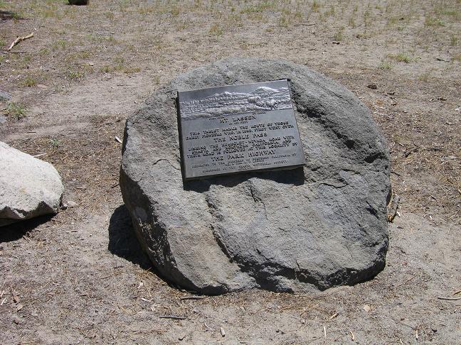
40°24′59″N 120°39′45″W / 40.416389°N 120.6625°WSusanville 3 Nobles Emigrant Trail 
October 3, 1975 E of Shingletown in Lassen Volcanic National Park
40°32′50″N 121°25′29″W / 40.547222°N 121.424722°WShingletown 4 Roop's Fort May 2, 1974 N. Weatherlow St.
40°25′08″N 120°39′20″W / 40.418889°N 120.655556°WSusanville 5 Standish Hall June 17, 2005 718-820 US 395 E
40°21′54″N 120°25′17″W / 40.365°N 120.421389°WStandish 6 Susanville Railroad Depot April 5, 2001 461 Richmond Rd.
40°24′42″N 120°39′31″W / 40.411667°N 120.658611°WSusanville 7 Willow Creek Rim Archeological District December 21, 1978 Address Restricted Litchfield See also
- List of Registered Historic Places in California
- List of National Historic Landmarks in California
References
- ^ The latitude and longitude information provided in this table was derived originally from the National Register Information System, which has been found to be fairly accurate for about 99% of listings. For about 1% of NRIS original coordinates, experience has shown that one or both coordinates are typos or otherwise extremely far off; some corrections may have been made. A more subtle problem causes many locations to be off by up to 150 yards, depending on location in the country: most NRIS coordinates were derived from tracing out latitude and longitudes off of USGS topographical quadrant maps created under the North American Datum of 1927, which differs from the current, highly accurate WGS84 GPS system used by Google maps. Chicago is about right, but NRIS longitudes in Washington are higher by about 4.5 seconds, and are lower by about 2.0 seconds in Maine. Latitudes differ by about 1.0 second in Florida. Some locations in this table may have been corrected to current GPS standards.
- ^ "National Register of Historic Places: Weekly List Actions". National Park Service, United States Department of the Interior. Retrieved on November 10, 2011.
- ^ Numbers represent an ordering by significant words. Various colorings, defined here, differentiate National Historic Landmark sites and National Register of Historic Places Districts from other NRHP buildings, structures, sites or objects.
- ^ "National Register Information System". National Register of Historic Places. National Park Service. . http://nrhp.focus.nps.gov/natreg/docs/All_Data.html.
U.S. National Register of Historic Places Topics Lists by states Alabama • Alaska • Arizona • Arkansas • California • Colorado • Connecticut • Delaware • Florida • Georgia • Hawaii • Idaho • Illinois • Indiana • Iowa • Kansas • Kentucky • Louisiana • Maine • Maryland • Massachusetts • Michigan • Minnesota • Mississippi • Missouri • Montana • Nebraska • Nevada • New Hampshire • New Jersey • New Mexico • New York • North Carolina • North Dakota • Ohio • Oklahoma • Oregon • Pennsylvania • Rhode Island • South Carolina • South Dakota • Tennessee • Texas • Utah • Vermont • Virginia • Washington • West Virginia • Wisconsin • WyomingLists by territories Lists by associated states Other Municipalities and communities of Lassen County, California City 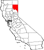
CDPs Bieber | Clear Creek | Doyle | Herlong | Janesville | Johnstonville | Litchfield | Milford | Nubieber | Patton Village | Spaulding | Westwood
Unincorporated
communitiesAvila Place | Belfast | Big Valley | Brockman | Buntingville | Calneva | Coppervale | Crest | Dan Ryan Place | Dixie | Evans Place | Hallelujah Junction | Halls Flat | Hayden Hill | Herlong Junction | Horse Lake | Hot Springs | Jellico | Karlo | Lasco | Leavitt | Leonard | Little Valley | Madeline | Moran | Norvell | Omira | Pine Town | Pinnio | Plumas | Pumpkin Center | Ravendale | Reno Junction | Robbers Creek | Sage Hen | Scotts | Scotty Place | Sheepshead | Shumway | Stacy | Standish | Stones Landing | Termo | The Crossing | Viewland | Wendel | Westwood Junction
Indian reservation Susanville Indian Rancheria
Ghost towns Addington | Antelope | Argusville | Ashton | Atola | Bunnel | Camero | Chats | Clinton | Conman | Constantia | Cromwell | Cuba | Datura | Dayton | Dewitt | Edgemont | Evan's Ranch | Fredonia | Gest | Glade | Goumaz | Hillside | Hausen | Junction House | Juniper | Lake Greeno | Lake Nokopen | Long Valley | Madeline | Mapes | Molitor | Moll Ranch | Murray | Plumas Junction | Prockmans | Purser | Rayl | Red Camp | Roscoe | Sellicks Springs | Secret Springs | Sheep Springs | Soldier's Bridge | Tiptons Springs | Waverly | Wheaton
Categories:- Lassen County, California
- National Register of Historic Places in California by county
- Lists of National Register of Historic Places in California
- Geography of Lassen County, California
-

Wikimedia Foundation. 2010.