- National Register of Historic Places listings in Idaho County, Idaho
-
 Location of Idaho County in Idaho
This is a list of the National Register of Historic Places listings in Idaho County, Idaho.
This is intended to be a complete list of the properties and districts on the National Register of Historic Places in Idaho County, Idaho, United States. Latitude and longitude coordinates are provided for many National Register properties and districts; these locations may be seen together in a Google map.[1]
There are 37 properties and districts listed on the National Register in the county. More may be added; properties and districts nationwide are added to the Register weekly.[2]
-
- This National Park Service list is complete through NPS recent listings posted November 10, 2011.[3]
Current listings
[4] Landmark name [5] Image Date listed Location City or town Summary 1 Ah Toy Garden June 27, 1990 Along China Creek near its confluence with the South Fork of the Salmon River in the Payette National Forest
45°12′57″N 115°33′21″W / 45.215833°N 115.555833°WWarren 2 Aitken Barn August 9, 1982 Southwest of Riggins on U.S. Route 95
45°24′29″N 116°19′44″W / 45.408056°N 116.328889°WRiggins 3 Arctic Point Fire Lookout August 29, 1994 North of Big Creek in the Frank Church-River of No Return Wilderness and the Payette National Forest
45°28′28″N 115°02′16″W / 45.474444°N 115.037778°WBig Creek 4 James V. and Sophia Baker House January 6, 2004 204 Broadway St.
46°02′51″N 116°21′01″W / 46.0475°N 116.350278°WCottonwood 5 Polly Bemis House March 4, 1988 Accessible on the Salmon River via boat
45°25′59″N 115°40′13″W / 45.433056°N 115.670278°WRiggins 6 Blue Fox Theatre November 30, 1999 116 W. Main St.
45°55′32″N 116°07′09″W / 45.925556°N 116.119167°WGrangeville 7 Burgdorf April 14, 1972 About 15 miles west of Warrens
45°16′38″N 115°54′46″W / 45.277222°N 115.912778°WBurgdorf 8 Campbell's Ferry February 8, 2007 Southeastern bank of the Salmon River at Mile 148 in the Frank Church-River of No Return Wilderness Riggins 9 Carey Dome Fire Lookout March 25, 1994 Nez Perce National Forest, 9 miles north of United States Forest Service Burgdorf Guard Station
45°24′10″N 115°54′12″W / 45.402778°N 115.903333°WBurgdorf 10 Celadon Slope Garden June 27, 1990 Along China Creek near its confluence with the South Fork of the Salmon River in the Payette National Forest
45°12′58″N 115°34′15″W / 45.216111°N 115.570833°WWarren 11 Chamberlain Ranger Station Historic District January 14, 2004 Frank Church-River of No Return Wilderness
45°22′32″N 115°12′02″W / 45.375556°N 115.200556°WPayette National Forest 12 Chi-Sandra Garden June 27, 1990 Along China Creek near its confluence with the South Fork of the Salmon River in the Payette National Forest
45°12′52″N 115°33′50″W / 45.214444°N 115.563889°WWarren 13 Chinese Cemetery March 29, 1994 Payette National Forest, 0.5 miles northwest of Warren Wagon Rd. at B
45°16′22″N 115°41′06″W / 45.272778°N 115.685°WWarren 14 Chinese Mining Camp Archeological Site September 4, 1994 Northwest of Warren in the Payette National Forest
45°16′14″N 115°41′34″W / 45.270556°N 115.692778°WWarren 15 Cold Meadows Guard Station August 19, 1994 Northeast of McCall in the Frank Church-River of No Return Wilderness and the Payette National Forest
45°17′10″N 114°56′28″W / 45.286111°N 114.941111°WMcCall 16 Jurden Henry Elfers Barn and Field June 7, 2007 John Day Creek Lucile 17 Elk City Wagon Road-Vicory Gulch-Smith Grade Segment May 21, 2001 Nez Perce National Forest
45°51′29″N 115°35′23″W / 45.858056°N 115.589722°WElk City 18 Fenn Ranger Station 
June 18, 1990 Selway Road 223 near Johnson Creek in the Nez Perce National Forest
46°06′06″N 115°32′41″W / 46.101667°N 115.544722°WKooskia 19 First Presbyterian Church May 13, 1976 Southeast of Kamiah on U.S. Route 12
46°12′16″N 116°00′20″W / 46.204444°N 116.005556°WKamiah 20 Dr. Wilson Foskett Home and Drugstore April 26, 2005 West side of River Rd.
45°45′44″N 116°18′01″W / 45.762222°N 116.300278°WWhite Bird 21 Blacky Foster House April 10, 1992 Along the Salmon River west of Shoup in the Bitterroot National Forest
45°29′10″N 114°58′29″W / 45.486111°N 114.974722°WShoup 22 Gold Point Mill July 14, 2000 United States Forest Service Road 222
45°46′56″N 115°23′33″W / 45.782222°N 115.3925°WElk City 23 Hells Canyon Archeological District August 10, 1984 Address Restricted[6] Riggins Extends into Adams and Nez Perce counties 24 Lochsa Historical Ranger Station June 9, 1978 Address Restricted[6] Kooskia 25 Lower Salmon River Archeological District September 4, 1986 Address Restricted[6] Cottonwood Extends into Lewis and Nez Perce counties 26 Sue McBeth Cabin June 3, 1976 Southeast of Kamiah on U.S. Route 12
46°12′18″N 116°00′22″W / 46.205°N 116.006111°WKamiah 27 Meinert Ranch Cabin September 23, 1987 1.8 miles southwest of Red River Hot Springs on Red River-Beargrass Road 234
45°46′19″N 115°13′22″W / 45.771944°N 115.222778°WElk City 28 Jim Moore Place March 29, 1978 Salmon River Canyon
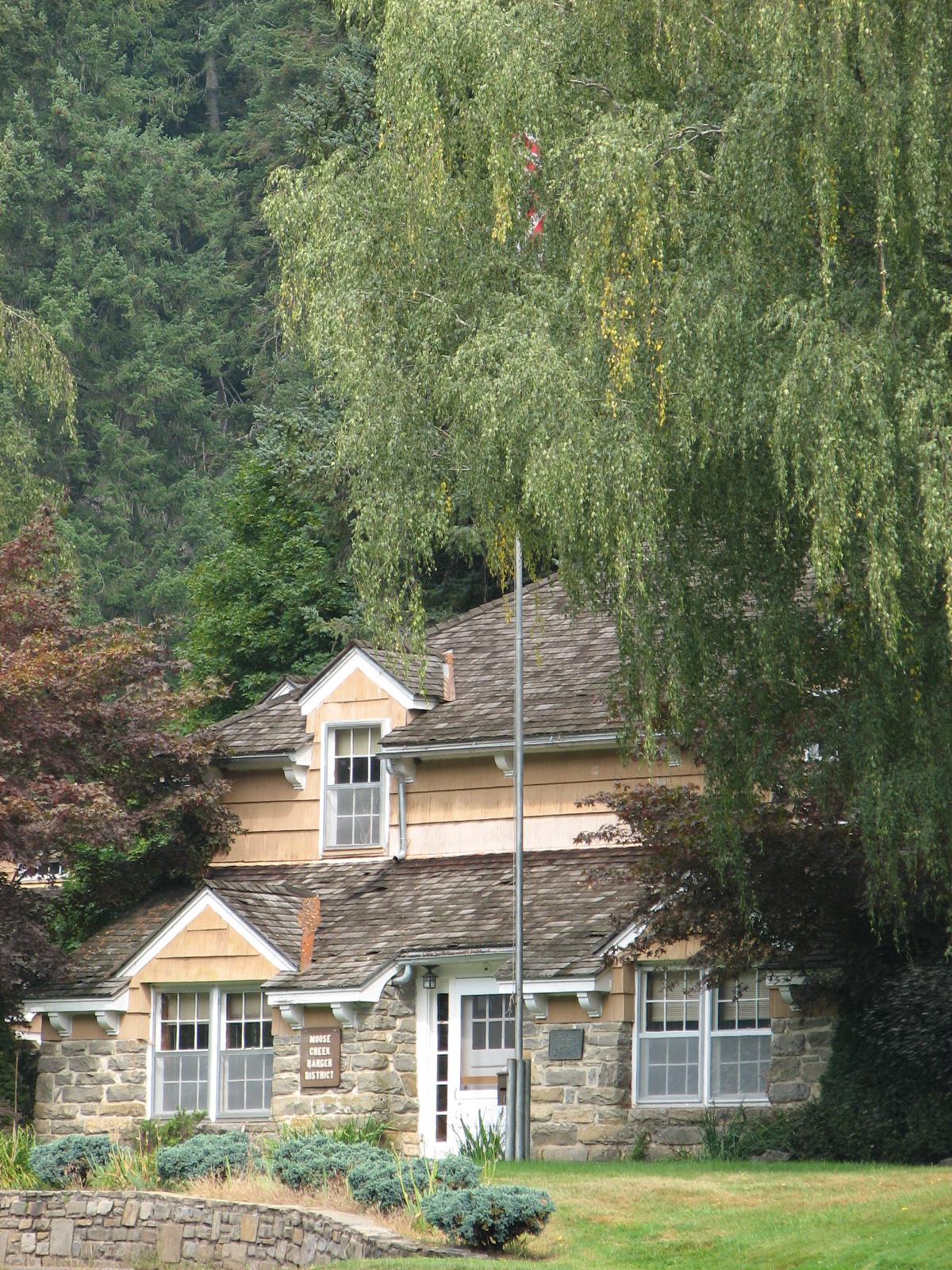
45°29′13″N 115°20′14″W / 45.486944°N 115.337222°WDixie 29 Moose Creek Administrative Site June 25, 1990 Eastern side of Moose Creek, south of Whistling Pig Creek, in the Nez Perce National Forest
46°06′40″N 114°55′15″W / 46.111111°N 114.920833°WGrangeville 30 Old China Trail June 27, 1990 Along China Creek near its confluence with the South Fork of the Salmon River in the Payette National Forest
45°13′00″N 115°33′48″W / 45.216667°N 115.563333°WWarren 31 Riggins Motel September 14, 2001 615 S. State Highway 95
45°25′05″N 116°19′02″W / 45.418056°N 116.317222°WRiggins 32 St. Gertrude's Convent and Chapel June 18, 1979 West of Cottonwood
46°02′01″N 116°23′25″W / 46.033611°N 116.390278°WCottonwood 33 State Bank of Kooskia May 22, 1978 1 S. Main St.
46°08′24″N 115°58′40″W / 46.14°N 115.977778°WKooskia 34 Tolo Lake February 7, 2011 Tolo Lake Rd., Nez Perce National Historical Park
45°54′54″N 116°14′10″W / 45.915°N 116.236111°WGrangeville vicinity Tolo Lake page on NPS website 35 Warren Guard Station, Building 1206 April 7, 1994 Southwestern side of Warren Wagon Rd., United States Forest Service Highway 21
45°16′02″N 115°40′16″W / 45.267222°N 115.671111°WWarren 36 White Bird Battlefield July 18, 1974 North of White Bird off U.S. Route 95
45°47′30″N 116°16′47″W / 45.791667°N 116.279722°WWhite Bird 37 White Bird Grade July 30, 1974 Northeast of White Bird
45°49′26″N 116°14′34″W / 45.823889°N 116.242778°WWhite Bird See also
References
- ^ The latitude and longitude information provided in this table was derived originally from the National Register Information System, which has been found to be fairly accurate for about 99% of listings. For about 1% of NRIS original coordinates, experience has shown that one or both coordinates are typos or otherwise extremely far off; some corrections may have been made. A more subtle problem causes many locations to be off by up to 150 yards, depending on location in the country: most NRIS coordinates were derived from tracing out latitude and longitudes off of USGS topographical quadrant maps created under North American Datum of 1927, which differs from the current, highly accurate GPS system used by Google maps. Chicago is about right, but NRIS longitudes in Washington are higher by about 4.5 seconds, and are lower by about 2.0 seconds in Maine. Latitudes differ by about 1.0 second in Florida. Some locations in this table may have been corrected to current GPS standards.
- ^ "National Register of Historic Places: Weekly List Actions". National Park Service. http://www.cr.nps.gov/nr/nrlist.htm. Retrieved March 29, 2009.
- ^ "National Register of Historic Places: Weekly List Actions". National Park Service, United States Department of the Interior. Retrieved on November 10, 2011.
- ^ Numbers represent an ordering by significant words. Various colorings, defined here, differentiate National Historic Landmark sites and National Register of Historic Places Districts from other NRHP buildings, structures, sites or objects.
- ^ "National Register Information System". National Register of Historic Places. National Park Service. . http://nrhp.focus.nps.gov/natreg/docs/All_Data.html.
- ^ a b c Some listings on the NRHP are highly sensitive sites and may be subject to looting or vandalism. The NRHP lists this site as "Address Restricted."
Properties on the National Register of Historic Places in Idaho  Ada • Adams • Bannock • Bear Lake • Benewah • Bingham • Blaine • Boise • Bonner • Bonneville • Boundary • Butte • Camas • Canyon • Caribou • Cassia • Clark • Clearwater • Custer • Elmore • Franklin • Fremont • Gem • Gooding • Idaho • Jefferson • Jerome • Kootenai • Latah • Lemhi • Lewis • Lincoln • Madison • Minidoka • Nez Perce • Oneida • Owyhee • Payette • Power • Shoshone • Teton • Twin Falls • Valley • Washington
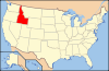
U.S. National Register of Historic Places Topics Lists by states Alabama • Alaska • Arizona • Arkansas • California • Colorado • Connecticut • Delaware • Florida • Georgia • Hawaii • Idaho • Illinois • Indiana • Iowa • Kansas • Kentucky • Louisiana • Maine • Maryland • Massachusetts • Michigan • Minnesota • Mississippi • Missouri • Montana • Nebraska • Nevada • New Hampshire • New Jersey • New Mexico • New York • North Carolina • North Dakota • Ohio • Oklahoma • Oregon • Pennsylvania • Rhode Island • South Carolina • South Dakota • Tennessee • Texas • Utah • Vermont • Virginia • Washington • West Virginia • Wisconsin • WyomingLists by territories Lists by associated states Other  Category:National Register of Historic Places •
  Portal:National Register of Historic Places
Municipalities and communities of Idaho County, Idaho County seat: Grangeville Cities Cottonwood | Ferdinand | Grangeville | Kamiah‡ | Kooskia | Riggins | Stites | White Bird

CDP Elk City
Unincorporated
communitiesBurgdorf | Clearwater | Dixie | Fenn | Golden | Greencreek | Harpster | Lucile | Mount Idaho | Pittsburg Landing | Pollock | Powell Junction | Warren
Ghost town Florence
Footnotes ‡This populated place also has portions in an adjacent county or counties
Categories:- National Register of Historic Places in Idaho by county
- Idaho County, Idaho
-


Wikimedia Foundation. 2010.