National Register of Historic Places listings in DeKalb County, Illinois
- National Register of Historic Places listings in DeKalb County, Illinois
-
See also: List of Registered Historic Places in Illinois
Contents: List of Registered Historic Places in DeKalb County, Illinois, USA:
-
- This National Park Service list is complete through NPS recent listings posted November 10, 2011.[1]
|
Landmark name |
Image |
Date listed |
Location |
City or Town |
Summary |
| 1 |
Ashelford Hall |
 |
01995-08-04 August 4, 1995 |
566 Eychaner Rd.
42°2′0″N 88°56′9″W / 42.033333°N 88.93583°W / 42.033333; -88.93583 (Ashelford Hall) |
Esmond |
|
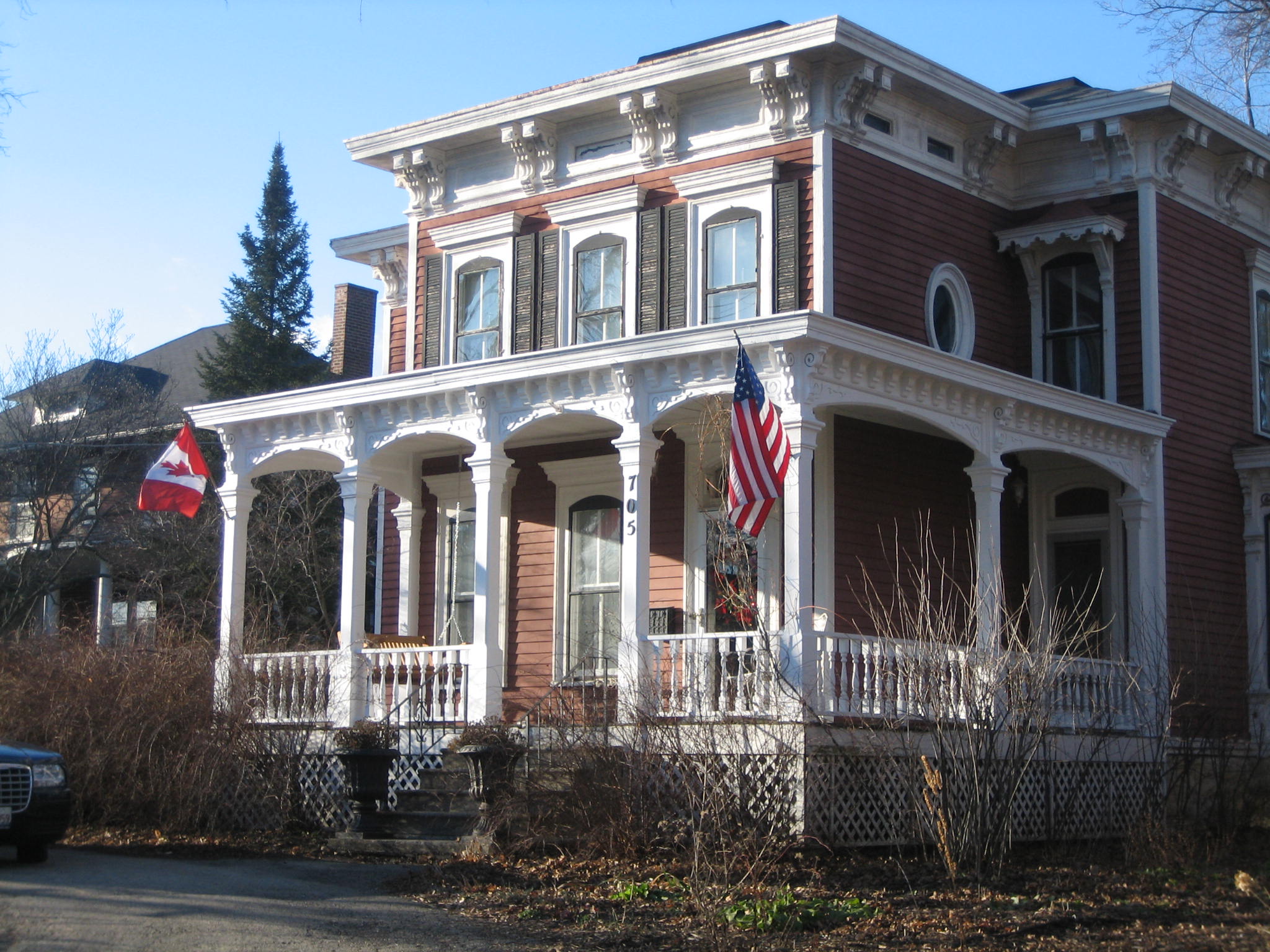
| 2 |
Adolphus W. Brower House |
 |
01979-02-14 February 14, 1979 |
705 DeKalb Ave.
41°59′11″N 88°41′38″W / 41.98639°N 88.69389°W / 41.98639; -88.69389 (Brower, Adolphus W., House) |
Sycamore |
|
| 3 |
Chicago and Northwestern Depot |
 |
01978-12-08 December 8, 1978 |
Sacramento and DeKalb Sts.
41°59′16″N 88°41′24″W / 41.98778°N 88.69°W / 41.98778; -88.69 (Chicago and Northwestern Depot) |
Sycamore |
|
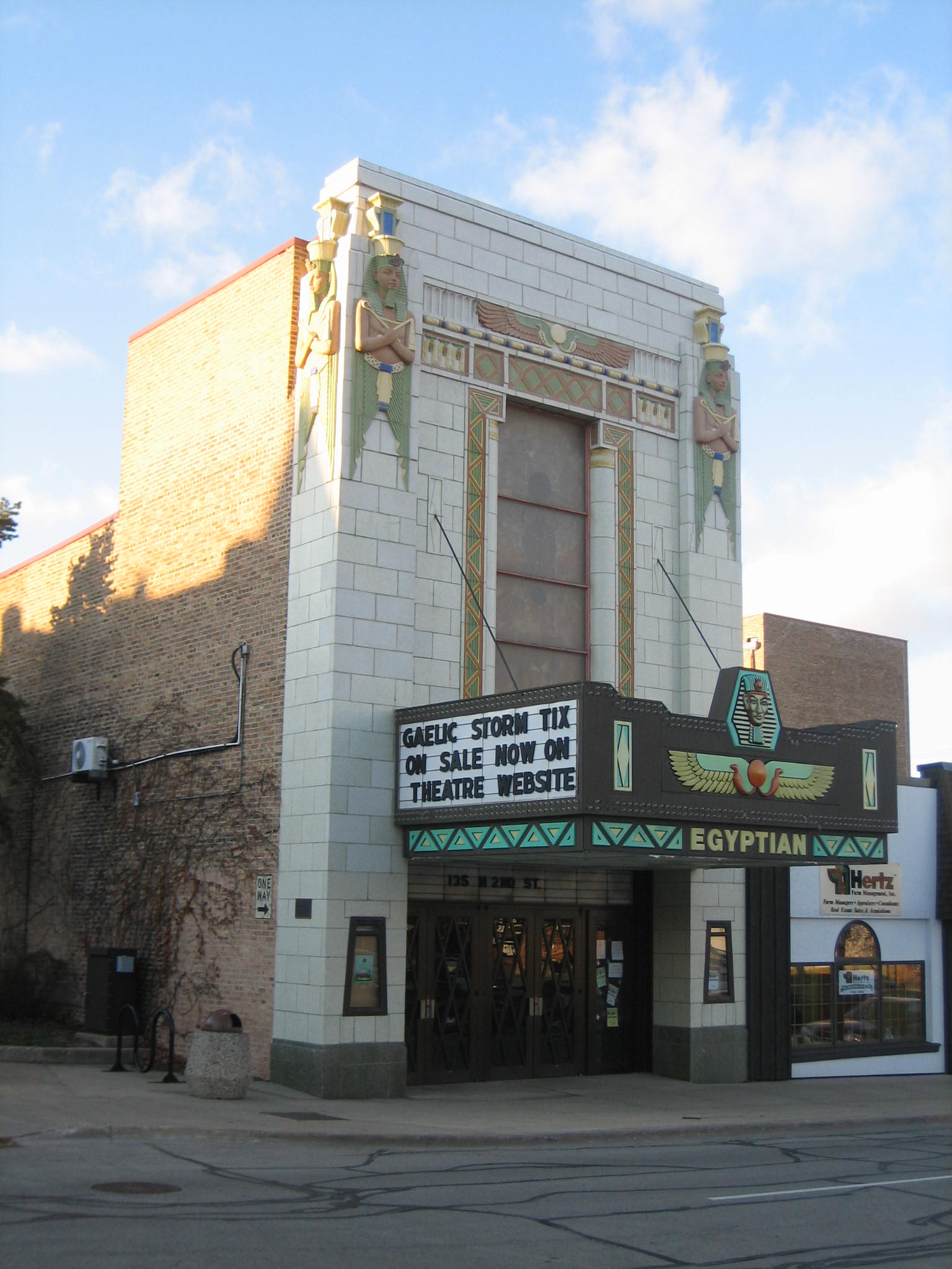
| 4 |
Egyptian Theatre |
 |
01978-12-01 December 1, 1978 |
135 N. 2nd St.
41°55′52″N 88°45′9″W / 41.93111°N 88.7525°W / 41.93111; -88.7525 (Egyptian Theatre) |
De Kalb |
|
| 5 |
Ellwood Mansion |
 |
01975-06-13 June 13, 1975 |
509 N. 1st St.
41°56′6″N 88°45′8″W / 41.935°N 88.75222°W / 41.935; -88.75222 (Ellwood Mansion) |
De Kalb |
|
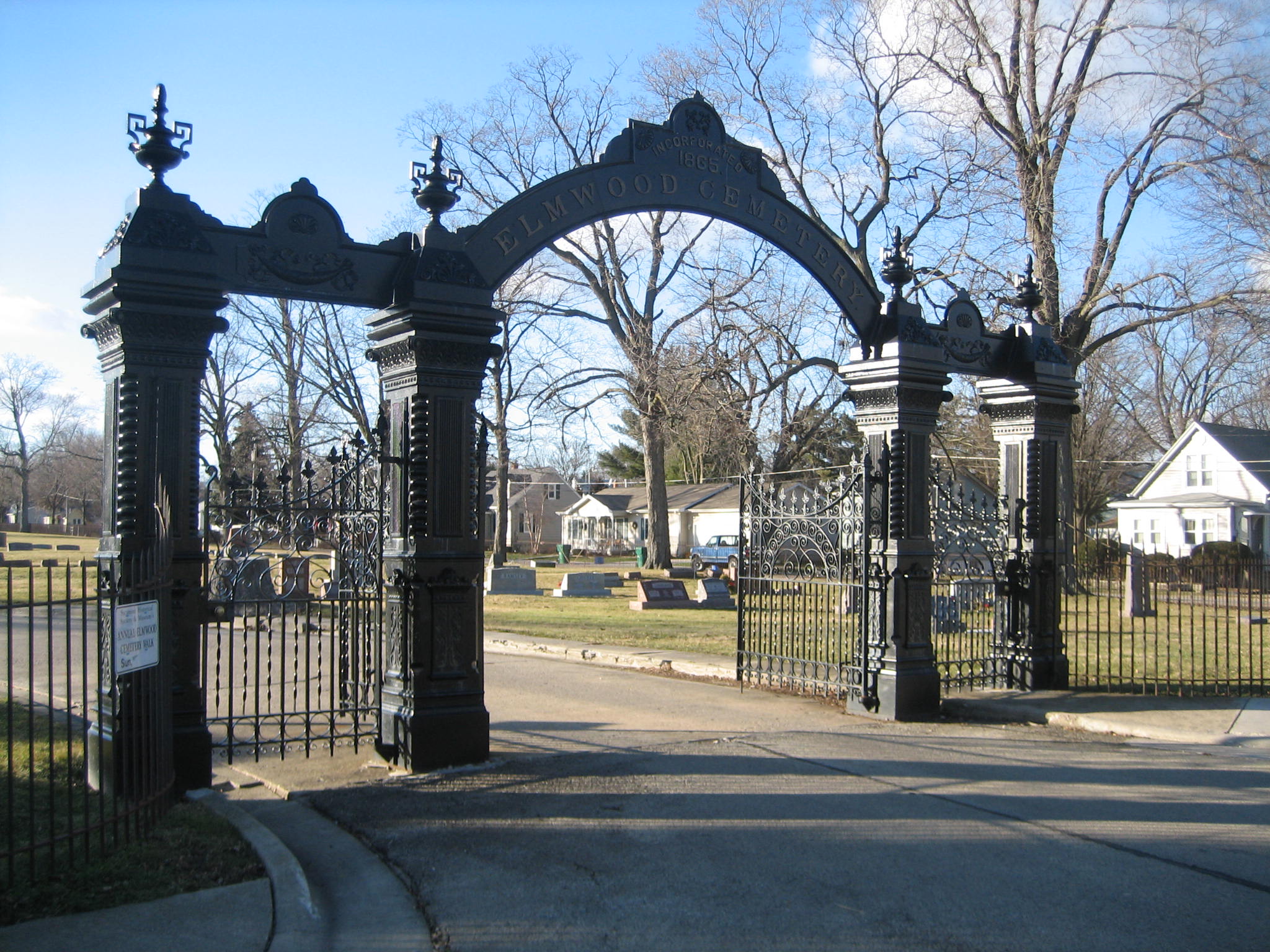
| 6 |
Elmwood Cemetery Gates |
 |
01978-11-28 November 28, 1978 |
S. Cross and Charles Sts.
41°58′57″N 88°41′52″W / 41.9825°N 88.69778°W / 41.9825; -88.69778 (Elmwood Cemetery Gates) |
Sycamore |
|
| 7 |
Joseph F. Glidden House |
 |
01973-10-25 October 25, 1973 |
917 W. Lincoln Hwy.
41°56′26″N 88°46′13″W / 41.94056°N 88.77028°W / 41.94056; -88.77028 (Glidden, Joseph F., House) |
De Kalb |
|
| 8 |
George H. Gurler House |
 |
01979-03-21 March 21, 1979 |
205 Pine St.
41°55′53″N 88°46′13″W / 41.93139°N 88.77028°W / 41.93139; -88.77028 (Gurler, George H., House) |
De Kalb |
|
| 9 |
Haish Memorial Library |
 |
01980-10-09 October 9, 1980 |
309 Oak St.
41°55′56″N 88°45′0″W / 41.93222°N 88.75°W / 41.93222; -88.75 (Haish Memorial Library) |
De Kalb |
|
| 10 |
William W. Marsh House |
 |
01978-12-22 December 22, 1978 |
740 W. State St.
41°59′23″N 88°41′48″W / 41.98972°N 88.69667°W / 41.98972; -88.69667 (Marsh, William W., House) |
Sycamore |
|
| 11 |
Nisbet Homestead Farm |
|
01984-05-31 May 31, 1984 |
Suydam Rd.
41°40′15″N 88°51′47″W / 41.67083°N 88.86306°W / 41.67083; -88.86306 (Nisbet Homestead Farm) |
Earlville |
|
| 12 |
Sandwich City Hall |
 |
01979-12-06 December 6, 1979 |
144 E. Railroad St.
41°38′41″N 88°37′12″W / 41.64472°N 88.62°W / 41.64472; -88.62 (Sandwich City Hall) |
Sandwich |
|
| 13 |
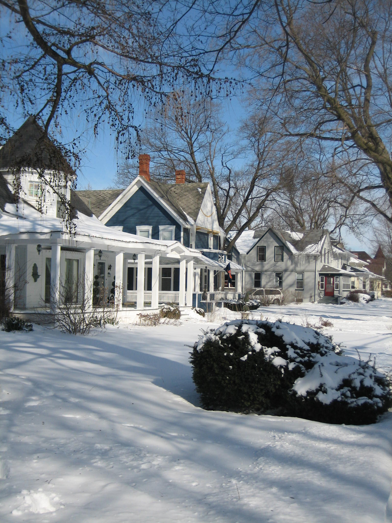
Sycamore Historic District |
 |
01978-05-02 May 2, 1978 |
Irregular pattern along Main and Somonauk Sts.
41°59′6″N 88°41′12″W / 41.985°N 88.68667°W / 41.985; -88.68667 (Sycamore Historic District) |
Sycamore |
|
| 14 |
von KleinSmid Mansion |
 |
01985-05-09 May 9, 1985 |
218 W. Center
41°38′42″N 88°37′30″W / 41.645°N 88.625°W / 41.645; -88.625 (von KleinSmid Mansion) |
Sandwich |
|
See also
References
Categories:
- DeKalb County, Illinois
- National Register of Historic Places in Illinois by county
- National Register of Historic Places in DeKalb County, Illinois
Wikimedia Foundation.
2010.
Look at other dictionaries:
National Register of Historic Places listings in Cook County, Illinois — For places listed on the National Register in Chicago, see National Register of Historic Places listings in Chicago. Map of all coordinates from Google Map of all coordinates from Bing … Wikipedia
National Register of Historic Places listings in DeKalb County, Indiana — Location of DeKalb County in Indiana This is a list of the National Register of Historic Places listings in De Kalb County, Indiana. This is intended to be a complete list of the properties and districts on National Register of Historic Places in … Wikipedia
National Register of Historic Places listings in Madison County, Tennessee — Location of Madison County in Tennessee This is a list of the National Register of Historic Places listings in Madison County, Tennessee. This is intended to be a complete list of the properties and districts on the National Register of Historic… … Wikipedia
National Register of Historic Places listings in Anderson County, Tennessee — Location of Anderson County in Tennessee This is a list of the National Register of Historic Places listings in Anderson County, Tennessee. This is intended to be a complete list of the properties and districts on the National Register of… … Wikipedia
National Register of Historic Places listings in Montgomery County, Tennessee — Location of Montgomery County in Tennessee This is a list of the National Register of Historic Places listings in Montgomery County, Tennessee. This is intended to be a complete list of the properties and districts on the National Register of… … Wikipedia
National Register of Historic Places listings in Knox County, Tennessee — Location of Knox County in Tennessee … Wikipedia
National Register of Historic Places listings in Davidson County, Tennessee — Location of Davidson County in Tennessee This is a list of the National Register of Historic Places listings in Davidson County, Tennessee. This is intended to be a complete list of the properties and districts on the National Register of… … Wikipedia
National Register of Historic Places listings in Hamilton County, Tennessee — Location of Hamilton County in Tennessee This is a list of the National Register of Historic Places listings in Hamilton County, Tennessee. This is intended to be a complete list of the properties and districts on the National Register of… … Wikipedia
National Register of Historic Places listings in Shelby County, Tennessee — Location of Shelby County in Tennessee This is a list of the National Register of Historic Places listings in Shelby County, Tennessee. This is intended to be a complete list of the properties and districts on the National Register of Historic… … Wikipedia
National Register of Historic Places listings in Williamson County, Tennessee — Location of Williamson County in Tennessee This is a list of the National Register of Historic Places listings in Williamson County, Tennessee. This is intended to be a complete list of the properties and districts on the National Register of… … Wikipedia