Nass Camp, British Columbia
- Nass Camp, British Columbia
-
Nass Camp is a settlement in British Columbia.
Climate
| Climate data for Nass Camp |
| Month |
Jan |
Feb |
Mar |
Apr |
May |
Jun |
Jul |
Aug |
Sep |
Oct |
Nov |
Dec |
Year |
| Record high °C (°F) |
10.5
(50.9) |
12
(54) |
16
(61) |
26.1
(79.0) |
33
(91) |
32
(90) |
34.5
(94.1) |
36
(97) |
32.2
(90.0) |
20
(68) |
13
(55) |
10.5
(50.9) |
36
(97) |
| Average high °C (°F) |
−3.4
(25.9) |
1.1
(34.0) |
6.3
(43.3) |
11.9
(53.4) |
16.6
(61.9) |
19.8
(67.6) |
21.6
(70.9) |
21
(70) |
16.2
(61.2) |
8.6
(47.5) |
2
(36) |
−2.1
(28.2) |
10 |
| Average low °C (°F) |
−9.8
(14.4) |
−7
(19) |
−3.4
(25.9) |
−0.3
(31.5) |
3.9
(39.0) |
7.8
(46.0) |
9.9
(49.8) |
9.6
(49.3) |
6.2
(43.2) |
1.9
(35.4) |
−3.5
(25.7) |
−7.5
(18.5) |
0.7 |
| Record low °C (°F) |
−32.5
(−26.5) |
−28.5
(−19.3) |
−22.2
(−8.0) |
−9.5
(14.9) |
−5
(23) |
−2
(28) |
1.5
(34.7) |
1.1
(34.0) |
−3
(27) |
−18.5
(−1.3) |
−31
(−24) |
−31.5
(−24.7) |
−32.5
(−26.5) |
| Precipitation mm (inches) |
136.3
(5.366) |
73.4
(2.89) |
41.5
(1.634) |
41.3
(1.626) |
50
(1.97) |
56
(2.2) |
58.2
(2.291) |
73.6
(2.898) |
107.4
(4.228) |
165.2
(6.504) |
127.6
(5.024) |
136.2
(5.362) |
1,066.9
(42.004) |
| Source: Environment Canada[1] |
References
Coordinates: 55°17′20″N 128°59′38″W / 55.289°N 128.994°W / 55.289; -128.994
Categories:
- Settlements in British Columbia
- British Columbia geography stubs
Wikimedia Foundation.
2010.
Look at other dictionaries:
Highway 37 (British Columbia) — Der British Columbia Highway 37 ist eine Straßenverbindung im Hinterland der Coast Mountains in British Columbia, die eine Verbindung zwischen dem Yellowhead Highway und dem Alaska Highway herstellt. Der nördliche Abschnitt zwischen Kitwanga und… … Deutsch Wikipedia
List of settlements in British Columbia — This is a list of communities in British Columbia, a province in Canada. For the purposes of this list, a community is defined as either an incorporated municipality (including Indian reserves), or an unincorporated settlement inside or outside… … Wikipedia
List of rivers of British Columbia — The following is a partial list of rivers in British Columbia, organized by watershed. Some large creeks are included either because of size or historical importance.( For an Alphabetical List of British Columbia rivers )East of the Continental… … Wikipedia
List of communities in British Columbia — This is a list of communities in British Columbia, a province in Canada. For the purposes of this list, a community is defined as either an incorporated municipality (including Indian reserves), or an unincorporated settlement inside or outside… … Wikipedia
Liste der Flüsse in British Columbia — Flüsse nach Provinz und Territorium BC AB SK … Deutsch Wikipedia
Nass Ranges — Range Country Canada Province British Columbia … Wikipedia
Columbia (fleuve) — Pour les articles homonymes, voir Columbia. Cet article possède un homophone, voir Colombia. Columbia (Columbia River, Wimahl, Nch’i Wàna) … Wikipédia en Français
Geschichte British Columbias — Die Geschichte British Columbias, einer Provinz Kanadas, reicht mit Blick auf die menschliche Besiedlung mindestens bis an das Ende der letzten Eiszeit zurück. Die Nachkommen der frühesten Bewohner gehören heute zu zahlreichen, als First Nations… … Deutsch Wikipedia
Nisga'a Highway — Highway 113 Nisga a Highway Route information Length: 158 km (98 mi) … Wikipedia
Cassiar Highway — Der British Columbia Highway 37 ist eine Straßenverbindung im Hinterland der Coast Mountains in British Columbia, die eine Verbindung zwischen dem Yellowhead Highway und dem Alaska Highway herstellt. Der nördliche Abschnitt zwischen Kitwanga und… … Deutsch Wikipedia
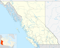
 Nass CampLocation of Nass Camp in British Columbia