- Nam Yuen District
-
Nam Yuen
น้ำยืน— Amphoe — Amphoe location in Ubon Ratchathani Province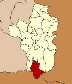
Coordinates: 14°29′21″N 105°0′3″E / 14.48917°N 105.00083°ECoordinates: 14°29′21″N 105°0′3″E / 14.48917°N 105.00083°E Country  Thailand
Province Ubon Ratchathani Seat Si Wichian Tambon Muban Amphoe established Area - Total 854.5 km2 (329.9 sq mi) Population (2005) - Total 67,641 - Density 79.2/km2 (205.1/sq mi) Time zone THA (UTC+7) Postal code 34160 Geocode 3409 Nam Yuen (Thai: น้ำยืน) is the southernmost district (Amphoe) of Ubon Ratchathani Province, northeastern Thailand.
Contents
History
A group of people from Det Udom moved to Ban Chanla Na Dom of Champassak during the reign of King Mongkut. Later in 1881 the king of Champassak proposed to King Chulalongkorn to upgraded Ban Chanla Na Dom to Mueang Dom Pradit, under the control of the Champassak Kingdom. When Champask became part of French Indochine, Mueang Dom Pradit was downgraded to be a tambon of Det Udom district. As the area of Det Udom was very large, the governor of Ubon Ratchathani proposed to the government to establish a minor district (King Amphoe). This was created on March 17 1969 by splitting off the four tambon Song, Ta Kao, Yang and Dom Pradit.[1] It was upgraded to a full district on March 29, 1974.[2]
Etymology
The name Nam Yuen has two origins: at first the district office is located in the area of the village Nam Yuen, as well as the area has three fertile rivers, Bon, Chong and Ta Em, as Nam Yuen in Thai means long-lasting water.
Geography
Neighboring districts are (from the west clockwise) Nam Khun, Det Udom, Na Chaluai of Ubon Ratchathani Province, Champasak of Laos and Preah Vihear of Cambodia.
The important water resource is the Dom Yai River.
Administration
The district is subdivided into 7 subdistricts (tambon), which are further subdivided into 92 villages (muban). Nam Yuen itself is a township (thesaban tambon) and covers parts of tambon Song and Si Wichian. There are further 7 Tambon administrative organizations (TAO).
No. Name Thai name Villages Inh. 1. Song โซง 10 7,775 3. Yang ยาง 12 7,548 4. Dom Pradit โดมประดิษฐ์ 17 15,771 6. Bu Pueai บุเปือย 15 8,939 7. Si Wichian สีวิเชียร 14 14,354 9. Yang Yai ยางใหญ่ 12 6,055 11. Kao Kham เก่าขาม 12 7,199 Missing numbers are tambon which now form the district Nam Khun
References
- ^ "ประกาศกระทรวงมหาดไทย เรื่อง แบ่งท้องที่ตั้งเป็นกิ่งอำเภอ" (in Thai). Royal Gazette 86 (24 ง): 1017. March 25 1969. http://www.ratchakitcha.soc.go.th/DATA/PDF/2512/D/024/1017.PDF.
- ^ "พระราชกฤษฎีกาตั้งอำเภอเขาวง อำเภอเชียงม่วน อำเภอดอนตาล อำเภอชาติตระการ อำเภอภูเรือ อำเภอเคียนซา อำเภอน้ำโสม อำเภอหนองวัวซอ และอำเภอน้ำยืน พ.ศ. ๒๕๑๗" (in Thai). Royal Gazette 91 (54 ก special issue): 30–33. March 28 1974. http://www.ratchakitcha.soc.go.th/DATA/PDF/2517/A/054/30.PDF.
External links
Mueang Ubon Ratchathani · Si Mueang Mai · Khong Chiam · Khueang Nai · Khemarat · Det Udom · Na Chaluai · Nam Yuen · Buntharik · Trakan Phuet Phon · Kut Khaopun · Muang Sam Sip · Warin Chamrap · Phibun Mangsahan · Tan Sum · Pho Sai · Samrong · Don Mot Daeng · Sirindhorn · Thung Si Udom · Na Yia · Na Tan · Lao Suea Kok · Sawang Wirawong · Nam Khun
Categories:- Amphoe of Ubon Ratchathani
- Isan geography stubs

Wikimedia Foundation. 2010.