- Nakaseke
-
"Nakaseke Town" redirects here. For Nakaseke District, see Nakaseke District.
Nakaseke Location in Uganda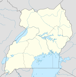
 Nakaseke
Coordinates: 00°43′48″N 32°24′54″E / 0.73°N 32.415°E Country  Uganda
Region Central Uganda District Nakaseke District Government - Mayor Elevation 3,970 ft (1,210 m) Population (2011 Estimate) - Total 2,200 Nakaseke is a town in Central Uganda. It is the main municipal, administrative and commercial center of Nakaseke District. The district is named after the town.
Contents
Location
Nakaseke is located approximately 66 kilometres (41 mi) by road, northwest of Kampala, the largest city and capital of Uganda.[1] The road from Kampala to Wobulenzi (a distance of about 50 kilometres (31 mi) is all-weather tarmac. The last 16 kilometres (9.9 mi) are on a gravel-dirt road.[2] The coordinates of the town are:00 43 48N, 32 24 54N (Latitude:0.7300; Longitude:32.4150).
Population
Most of the people in Nakaseke, are Baganda, the biggest ethnic group in Central Uganda. An estimated 59.2 percent of the Nakaseke community is literate; which is largely limited to local Ganda language. A Primary Teachers' Training College has been built in Nakaseke. Nakaseke Hospital, a 120-bed public hospital administered by the Uganda Ministry of Health is situated in Nakaseke town. The hospital is connected to other health units by a radio.
According to the 2002 national census, the population of Nakaseke District was estimated at about 138,000. In 2007, the urban population in the district was estimated at 12% of the district population with a growth rate of 3.3% annually.[3] There are four (4) urban municipalities is Nakaseke District. These are:[4]
- Nakaseke Municipality
- Butalangu Municipality
- Semuto Municipality
- Ngoma Municipality
The population of Nakaseke Town was estimated at about 3,000 in 1991.[5] In 2011, UBOS estimated the mid-year population of Nakaseke at 2,200.[6]
Landmarks
Landmarks in the town of Nakaseke or close to the town limits include:
- The headquarters of Naakaseke District Administration
- The offices of Nakaseke Town Council
- Nakaseke Central Market
- Nakaseke Hospital - A 120 bed public hospital, administered by the Uganda Ministry of Health
- Nakaseke Teacher Training College - For the training of primary (elementary) school teachers
- Nakaseke Community Multimedia Center Radio 102.9FM[7]
See also
- Nakaseke District
- Central Region, Uganda
- Nakaseke Hospital
References
External links
 Nakaseke District
Capital: Nakaseke Counties and
sub-countiesNakaseke County · Kapeeka Sub-county · Ngoma Sub-county · Kinyogoga Sub-county · Wakyaato Sub-county · Nakaseke Sub-county · Kaasangombe Sub-county · Semuto Sub-county · Kikamulo Sub-countyTowns and
villagesButalangu · Nakaseke · Kapeeka · Ngoma · Kinyogoga · Wakyaato · Kaasangombe · Semuto · Kikamulo · KiwokoNotable
landmarksEducation Oliver Tambo School of Leadership · Nakaseke Teacher Training CollegeNotable people Syda Bbumba · Salim SalehCategories:- Populated places in Uganda
- Cities in the Great Rift Valley
- Central Region, Uganda
- Nakaseke District

Wikimedia Foundation. 2010.