- Mylopotamos, Crete
-
Mylopotamos
ΜυλοπόταμοςLocation 
 Mylopotamos
Coordinates 35°22′N 24°45′E / 35.367°N 24.75°ECoordinates: 35°22′N 24°45′E / 35.367°N 24.75°E Location within the region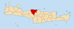
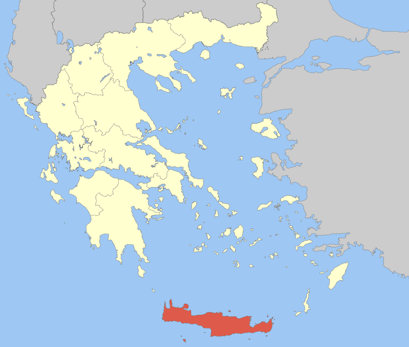
Government Country: Greece Region: Crete Regional unit: Rethymno Population statistics (as of 2001) Municipality - Population: 16,577 - Area: 337.9 km2 (130 sq mi) - Density: 49 /km2 (127 /sq mi) Other Time zone: EET/EEST (UTC+2/3) Mylopotamos (Greek: Μυλοπόταμος) is a municipality in Rethymno peripheral unit, Crete, Greece. The seat of the municipality is the village Perama.[1]
Municipality
The municipality Mylopotamos was formed at the 2011 local government reform by the merger of the following 3 former municipalities, that became municipal units:[1]
References
- ^ a b Kallikratis law Greece Ministry of Interior (Greek)
Administrative division of the Crete Region Area: 8,336km² • Population : 601,131 (2001) • Capital: Heraklion Regional unit of Chania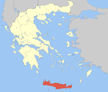 Regional unit of HeraklionArchanes–Asterousia • Faistos • Gortyna • Heraklion • Hersonissos • Malevizi • Minoa Pediada • ViannosRegional unit of LasithiRegional unit of Rethymno
Regional governor: Stavros Arnaoutakis • Website www.pkr.gov.gr Achlades · Agios Mamas · Alfa · Angeliana · Choumeri · Kalandare · Margarites · Melidoni · Melissourgaki · Orthes · Panormo · Pasalites · Perama · Roumeli · Sises · SkepastiMunicipal unit of Kouloukonas Agia · Agios Ioannis · Aimonas · Aloides · Apladiana · Axos · Chonos · Damavolos · Doxaro · Episkopi · Garazo · Kalyvos · Kryoneri · Livadia · Theodora · VeniMunicipal unit of Zoniana Categories:- Populated places in Rethymno (peripheral unit)
- Municipalities of Crete


Wikimedia Foundation. 2010.