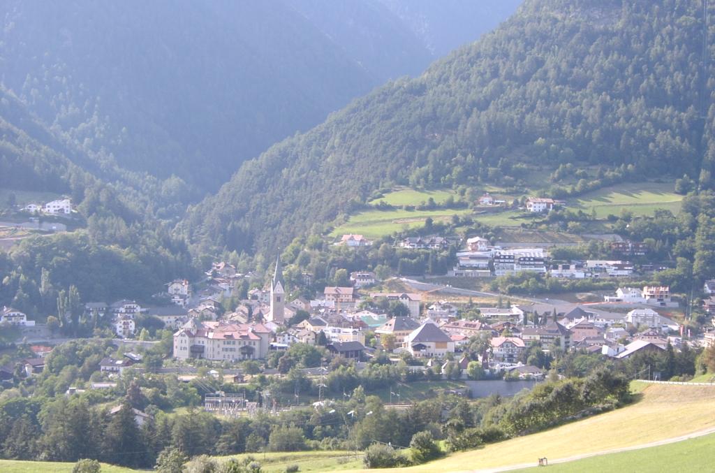
- Mühlbach, South Tyrol
-
Mühlbach — Comune — Marktgemeinde Mühlbach
Comune di Rio di Pusteria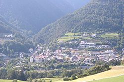 Location of Mühlbach in Italy
 Mühlbach
Coordinates: 46°48′N 11°40′E / 46.8°N 11.667°ECoordinates: 46°48′N 11°40′E / 46.8°N 11.667°E Country Italy Region Trentino-Alto Adige/Südtirol Province South Tyrol (BZ) Frazioni Maranzen (Maranza), Spinges (Spinga), Vals (Valles) Government – Mayor Christoph Prugger Area – Total 84.1 km2 (32.5 sq mi) Population (Nov. 2010) – Total 2,955 – Density 35.1/km2 (91/sq mi) Demonym German: Mühlbacher
Italian: di Rio PusteriaTime zone CET (UTC+1) – Summer (DST) CEST (UTC+2) Postal code 39037 Dialing code 0472 Website Official website Mühlbach (Italian: Rio di Pusteria) is a comune (municipality) in South Tyrol in the Italian region Trentino-Alto Adige/Südtirol, located about 90 km northeast of Trento and about 40 km northeast of Bolzano.
Contents
Geography
As of 30 November 2010, it had a population of 2,955 and an area of 84.1 km².[1]
The municipality of Mühlbach contains the frazioni (subdivisions, mainly villages and hamlets) Meransen (Maranza), Spinges (Spinga), Vals (Valles).
Mühlbach borders the following municipalities: Freienfeld, Franzensfeste, Natz-Schabs, Rodeneck, Pfitsch, and Vintl.
History
Coat-of-arms
The emblem is crossed diagonally by an argent wavy stream on vert; at the top a water wheel and an argent donkey at bottom. The water wheel symbolizes the water mill once numerous in the area for the grinding; the donkey represents the pack animals used for the transport. The emblem was adopted in 1971.[2]
Society
Linguistic distribution
According to the 2001 census, 95.31% of the population speak German, 4.03% Italian and 0.66% Ladin as first language.[3]
Demographic evolution

References
- ^ All demographics and other statistics: Italian statistical institute Istat.
- ^ Heraldry of the World: Mühlbach
- ^ Oscar Benvenuto (ed.): "South Tyrol in Figures 2008", Provincial Statistics Institute of the Autonomous Province of South Tyrol, Bozen/Bolzano 2007, p. 17, table 10
External links
- (German) (Italian) Homepage of the municipality
- Homepage of the Mühlbacher Close (Rio Pusteria Close)
Categories:


Wikimedia Foundation. 2010.