- Mueang Chanthaburi District
-
Mueang Chanthaburi
เมืองจันทบุรี— Amphoe — Amphoe location in Chanthaburi Province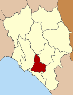
Coordinates: 12°36′38″N 102°6′15″E / 12.61056°N 102.10417°ECoordinates: 12°36′38″N 102°6′15″E / 12.61056°N 102.10417°E Country  Thailand
Province Chanthaburi Seat Wat Mai Tambon Muban Amphoe established Area – Total 253.093 km2 (97.7 sq mi) Population (2005) – Total 119,203 – Density 471.0/km2 (1,219.9/sq mi) Time zone THA (UTC+7) Postal code 22000 Geocode 2201 Mueang Chanthaburi (Thai: เมืองจันทบุรี) is the capital district (Amphoe Mueang) of Chanthaburi Province, eastern Thailand.
Geography
Neighboring districts are (from the north clockwise) Khao Khitchakut, Makham, Khlung, Laem Sing and Tha Mai of Chanthaburi Province.
Administration
The district is subdivided into 11 subdistricts (tambon), which are further subdivided into 98 villages (muban). The town (thesaban mueang) Chanthaburi covers the whole tambon Talat and Wat Mai. Three further 5 townships (thesaban tambon - Phlapphla Narai covers parts of tambon Phlapphla and Khlong Narai, Chanthanimit the whole tambon Chantha Nimit, and Tha Chang, Nong Bua and Bang Ka Cha each cover parts of the same-named tambon. There are further 8 Tambon administrative organizations (TAO).
No. Name Thai name Villages Inh. 1. Talat ตลาด - 10,872 2. Wat Mai วัดใหม่ - 16,730 3. Khlong Narai คลองนารายณ์ 14 7,838 4. Ko Khwang เกาะขวาง 9 9,678 5. Khom Bang คมบาง 10 4,421 6. Tha Chang ท่าช้าง 12 24,102 7. Chanthanimit จันทนิมิต 9 14,153 8. Bang Kacha บางกะจะ 10 9,520 9. Salaeng แสลง 10 4,621 10. Nong Bua หนองบัว 11 6,007 11. Phlapphla พลับพลา 13 11,261 External links
Mueang Chanthaburi · Khlung · Tha Mai · Pong Nam Ron · Makham · Laem Sing · Soi Dao · Kaeng Hang Maeo · Na Yai Am · Khao Khitchakut
Categories:- Chanthaburi
- Amphoe of Chanthaburi
- Eastern Thailand geography stubs

Wikimedia Foundation. 2010.