- Mt. Olive Road Covered Bridge
-
Mt. Olive Road Covered Bridge
 Southern side of the bridge, located adjacent to its replacement
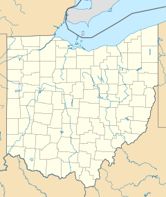

Location: 1 mile northeast of Allensville on Mt. Olive Road, Jackson Township Nearest city: Allensville, Ohio Coordinates: 39°17′10″N 82°35′21″W / 39.28611°N 82.58917°WCoordinates: 39°17′10″N 82°35′21″W / 39.28611°N 82.58917°W Area: less than one acre Built: 1875 Architect: George W. Pilcher Architectural style: Queen post truss Governing body: Local NRHP Reference#: 76001538[1] Added to NRHP: October 8, 1976 The Mt. Olive Road Covered Bridge is a historic covered bridge in Vinton County, Ohio, United States. Located northeast of Allensville,[1] the bridge carries Mt. Olive Road through a valley in northwestern Vinton County. In the earliest days of white settlement of southern Ohio, the Mt. Olive Road was a major transportation artery; until about 1825, it was heavily used by travellers between Marietta and Chillicothe.[2]
Built on stone piers and covered with a metal roof,[3] the Mt. Olive Road Bridge is supported by a simple queen post truss design. Its builder was local engineer George Washington Pilcher; a leading engineer in southeastern Ohio, Pilcher helped to built many other Vinton County covered bridges and contributed toward the construction of Manasseh Cutler Hall on the campus of Ohio University.[2]
When the bridge was built, it lay amid land owned by a family named "Grandstaff"; because this family owned wide lands surrounding the bridge, it has also frequently been known as the "Grandstaff Bridge."[2] Nevertheless, the name "Mt. Olive Road Bridge" persists; when it was named a historic site in 1973, the designation was made under that name. This designation was that of placement on the National Register of Historic Places, an honor shared by two other Vinton County covered bridges.[1] It qualified for this distinction both because of its well-preserved historic engineering and because of its contribution to statewide history.[3]
References
- ^ a b c "National Register Information System". National Register of Historic Places. National Park Service. 2009-03-13. http://nrhp.focus.nps.gov/natreg/docs/All_Data.html.
- ^ a b c Owen, Lorrie K., ed. Dictionary of Ohio Historic Places. Vol. 2. St. Clair Shores: Somerset, 1999, 1368-1369.
- ^ a b Mt. Olive Road Covered Bridge, Ohio Historical Society, 2007. Accessed 2010-08-08.
U.S. National Register of Historic Places Topics Lists by states Alabama • Alaska • Arizona • Arkansas • California • Colorado • Connecticut • Delaware • Florida • Georgia • Hawaii • Idaho • Illinois • Indiana • Iowa • Kansas • Kentucky • Louisiana • Maine • Maryland • Massachusetts • Michigan • Minnesota • Mississippi • Missouri • Montana • Nebraska • Nevada • New Hampshire • New Jersey • New Mexico • New York • North Carolina • North Dakota • Ohio • Oklahoma • Oregon • Pennsylvania • Rhode Island • South Carolina • South Dakota • Tennessee • Texas • Utah • Vermont • Virginia • Washington • West Virginia • Wisconsin • WyomingLists by territories Lists by associated states Other National Register of Historic Places in Vinton County, Ohio Properties Eakin Mill Covered Bridge | Hope Furnace | Markham Mound | Masonic Lodge No. 472 | Mt. Olive Road Covered Bridge | Ponn Humpback Covered Bridge | Ranger Station Mound | Ratcliffe Mound | Trinity Episcopal Church | Zaleski Methodist Church Mound
 Categories:
- Covered bridges in Ohio
- Bridges on the National Register of Historic Places in Ohio
- Buildings and structures in Vinton County, Ohio
- Bridges completed in 1875
- Transportation in Vinton County, Ohio
- Visitor attractions in Vinton County, Ohio
- Road bridges in Ohio


Wikimedia Foundation. 2010.