- Msinga Local Municipality
-
Msinga Local Municipality — Local municipality — Location in KwaZulu-Natal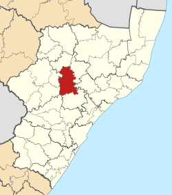
Country South Africa Province KwaZulu-Natal District Umzinyathi District Seat Tugela Ferry Area - Total 2,501.2 km2 (965.7 sq mi) Population (2007)[1] - Total 161,894 - Density 64.7/km2 (167.6/sq mi) - Households 32,592 Racial makeup[2] (2007) - Black African 99.87% - White 0.07% - Coloured 0.01% - Indian or Asian 0.04% Time zone SAST (UTC+2) Municipal code KZN244 Msinga Local Municipality is an administrative area in the Umzinyathi District of KwaZulu-Natal in South Africa. The name means a current in the sea where air movement causes ripples on top of the water surface and ends up influencing the nearby climatic conditions through its breeze.[3]
Msinga is largely located in deep gorges of the Tugela and Buffalo Rivers, isolated from the immediate surrounding municipal areas.[4] The population dynamics result in a growing rural area and a declining urban area in Msinga, contrary to most other areas in the country.[4] This can be attributed to the fact that the urban areas of Msinga are very small and are unable to provide the normal range of goods and services provided in urban areas.[4]
Msinga is a poverty stricken area with few economic resources and little economic activity. Social services and private households generate 29% of the income for the area.[4]
References
- ^ "Community Survey, 2007: Basic Results Municipalities" (PDF). Statistics South Africa. http://www.statssa.gov.za/Publications/P03011/P030112007.pdf. Retrieved 2009-10-20.
- ^ "Community Survey 2007 interactive data". Statistics South Africa. http://www.statssa.gov.za/community_new/content.asp?link=interactivedata.asp. Retrieved 19 October 2009.
- ^ South African Languages - Place names
- ^ a b c d KwaZulu-Natal Top Business - Msinga Municipality
Province of KwaZulu-Natal, South Africa Provincial Capital: PietermaritzburgMetropolitan
MunicipalitiesDistrict
and Local
MunicipalitiesVulamehlo · uMdoni · Umzumbe · uMuziwabantu · Ezingoleni · Hibiscus CoastEmnambithi-Ladysmith · Indaka · Umtshezi · Okhahlamba · ImbabazaneEndumeni · Nquthu · Msinga · UmvotiNewcastle · eMadlangeni · DannhauseruMhlabuyalingana · Jozini · The Big Five False Bay · Hlabisa · MtubatubaIngwe · Kwa Sani · Greater Kokstad · Ubuhlebezwe · UmzimkhuluCategories:- Local Municipalities of Umzinyathi

Wikimedia Foundation. 2010.