- Mount Jefferson (Bitterroot Range)
-
For other mountains named Mount Jefferson, see Mount Jefferson.
Mount Jefferson 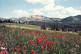
Mount Jefferson and Flowers (Indian Paintbrush)Elevation 10,216 ft (3,114 m) [1] Prominence 3,400 ft (1,036 m) [2] Location Location Fremont County, Idaho and Beaverhead County, Montana. USA Range Centennial Mountains, Bitterroot Range Coordinates 44°33′43″N 111°30′18″W / 44.561983°N 111.504899°WCoordinates: 44°33′43″N 111°30′18″W / 44.561983°N 111.504899°W[1] Topo map USGS Mount Jefferson Climbing Easiest route scramble from Sawtelle Peak Mount Jefferson is a mountain located on the Continental Divide between Fremont County of northeastern Idaho and Beaverhead County of southwestern Montana. Mount Jefferson is the highest point of the Centennial Mountains, whose crest runs along the Continental Divide and can be climbed using a class 2 route (scramble) from the access road to neighboring Sawtelle Peak.
The south and west slopes of Mount Jefferson drain into Hell Roaring Creek, thence into Red Rock Creek, the Red Rock River, the Beaverhead River, the Jefferson River, the Missouri River, the Mississippi River, and into the Gulf of Mexico. Brower's Spring, the source of Hell Roaring Creek, on the mountain's east flank in Montana, is considered the absolute headwaters of the Missouri River.[3] The northeast slope of Mt. Jefferson drains into the South Fork of Duck Creek, thence into Henrys Lake, the Henrys Fork of the Snake River, the Columbia River, and into the Pacific Ocean.
References
- ^ a b "NGS Data Sheet for SAWTELLE". U.S. National Geodetic Survey. http://www.ngs.noaa.gov/cgi-bin/ds_mark.prl?PidBox=PY1196. Retrieved 2008-04-08. This benchmark is located on the summit of Mount Jefferson.
- ^ Key col elevation between 6800 and 6840 feet. "Mount Jefferson, Idaho/Montana". Peakbagger.com. http://www.peakbagger.com/peak.aspx?pid=5002. Retrieved 2008-04-08.
- ^ Nell, Donald F.; Anthony Demetriades (2005). "The True Utmost Reaches of the Missouri". Montana Outdoors (Montana Fish, Wildlife and Parks) (July–August, 2205). http://fwp.mt.gov/mtoutdoors/HTML/articles/2005/MissouriSource.htm. Retrieved 2008-04-08.
External links
Categories:- Landforms of Beaverhead County, Montana
- Landforms of Fremont County, Idaho
- Mountains of Idaho
- Mountains of Montana
- Missouri River
- Montana geography stubs
- Idaho geography stubs

Wikimedia Foundation. 2010.