Mosteiros, Cape Verde

Mosteiros, Cape Verde
Mosteiros
Musteru
View over Mosteiros
Mosteiros is located in Cape Verde
Mosteiros
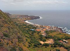
Location in Cape Verde
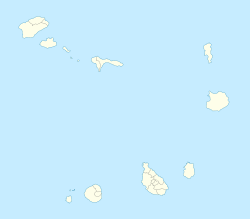
Coordinates: 15°02′00″N 24°19′30″W / 15.0333333°N 24.325°W / 15.0333333; -24.325Coordinates: 15°02′00″N 24°19′30″W / 15.0333333°N 24.325°W / 15.0333333; -24.325
Country  Cape Verde
Municipality Mosteiros (seat)

Mosteiros (Portuguese for “monasteries”) is a town that constitutes the seat of the Mosteiros Municipality, in Cape Verde. The town is a small centre between the mountain and the sea and has homes that are constructed from lava rocks. The recent closure of the local airport in favor of São Filipe, brought a decline to the town. There are several coffee plantations near the town.

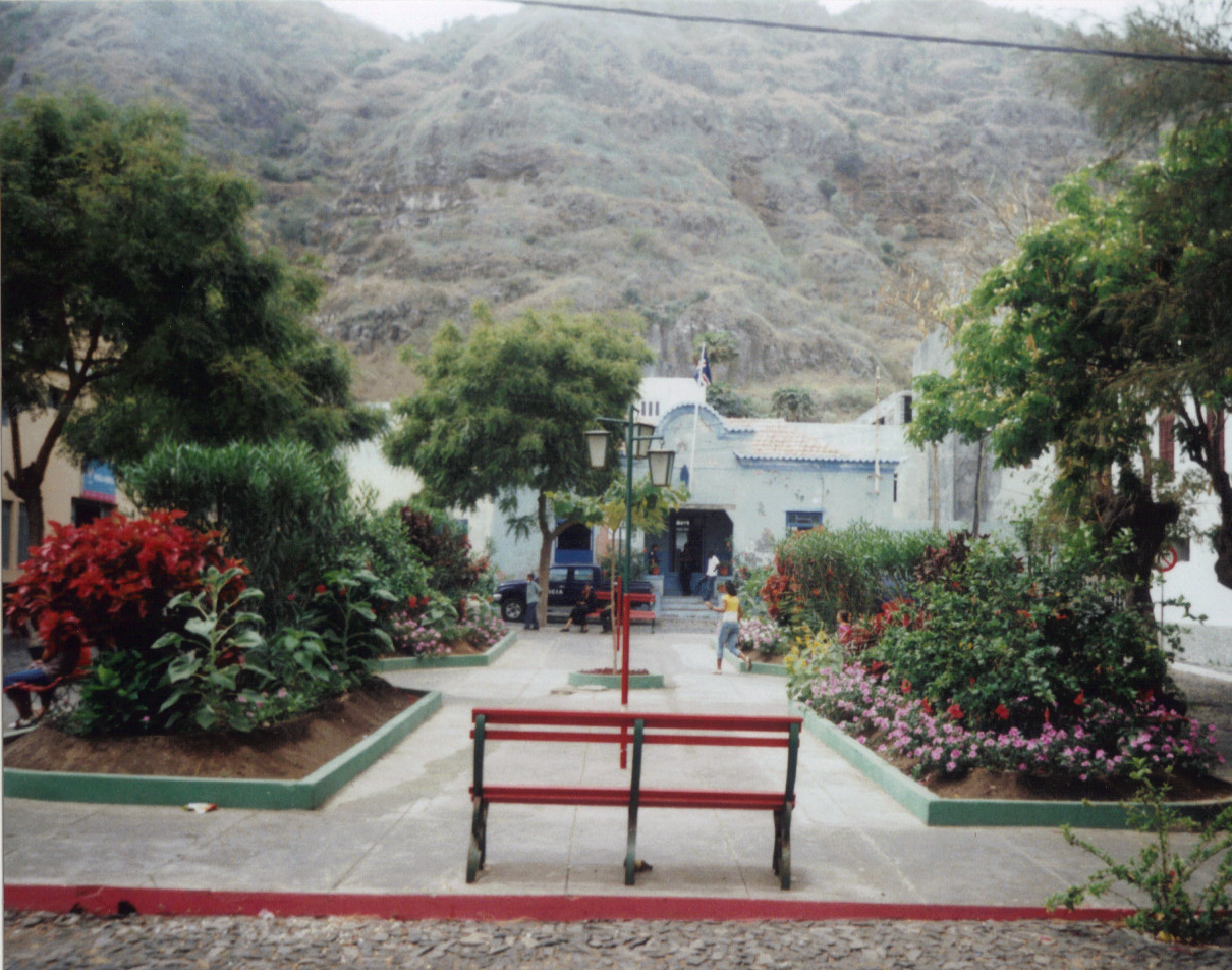
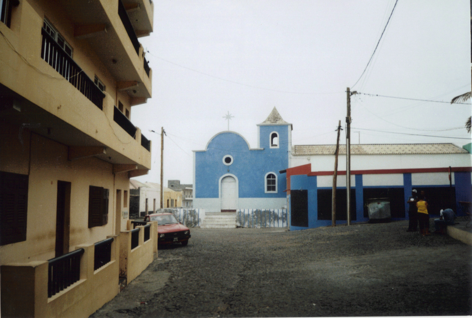
Mosteiros contains several kindergartens and primary schools, and one high school ("liceu"). Prior to the 20th century, Mosteiros did not have any schools. Mosteiros has a beach, a bank, a guesthouse, a post office and a town square ("Praça do Entroncamento"), which has free wireless internet service. The church Igreja Nossa Senhora da Ajuda is worth a visit.

From São Filipe, Mosteiros can be reached on a good road by "aluguer" busses several times a day.

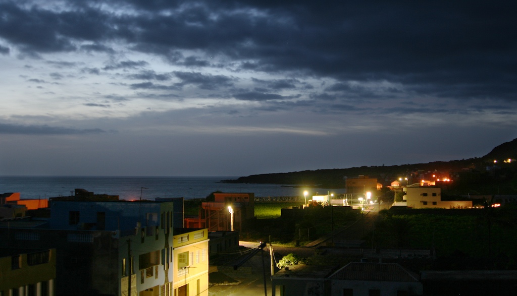
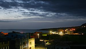
Morning in Mosteiros.
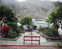
Praça do Entroncamento.
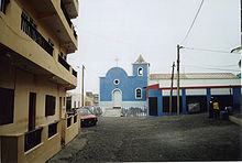
Church.

Wikimedia Foundation. 2010.

Игры ⚽ Нужно решить контрольную?

Look at other dictionaries:

  • Mosteiros, Cape Verde (municipality) — Mosteiros Municipality Country Cape Verde Island Fogo …   Wikipedia

  • Cape Verde — Cape Verdean /verr dee euhn/. /verrd/ a republic consisting of a group of islands (Cape Verde Islands) in the Atlantic, W of Senegal in W Africa: formerly an overseas territory of Portugal; gained independence in 1975. 393,843; 1557 sq. mi. (4033 …   Universalium

  • Cape Verde — This article is about the country. For the surface feature on Mars, see Cape Verde (Mars). For weather pattern, see Cape Verde type hurricane. Republic of Cape Verde República de Cabo Verde   (Portuguese) …   Wikipedia

  • Fogo, Cape Verde — Fogo (Portuguese for fire ) is an island in the Sotavento group of Cape Verde. It is the most prominent of the group, rising to nearly 3,000 m (10,000 ft) above sea level at Mount Fogo.GeographyThe island is located between the islands of… …   Wikipedia

  • Atalaia, Cape Verde — For the Brazilian city in the state of São Paulo, see Atalaia Atalaia (also in Cape Verdean Creole), is a village located approximately 20 km northeast of the island capital of Sao Filipe and southwest of Mosteiros on the island of Fogo, Cape… …   Wikipedia

  • Salto, Cape Verde — Salto (Capeverdean Crioulo, ALUPEC or ALUPEK: Saltu ), is a village located approximately 15 km northeast of the island capital of Sao Filipe and southwest of Mosteiros in the northern part of the island of Fogo, Cape Verde. Salto are is linked… …   Wikipedia

  • Fajãzinha, Cape Verde — Fajãzinha (also in Capeverdean Crioulo, ALUPEC or ALUPEK and Fogo Crioulo (Djarfogo)), is a village located approximately 30 km northeast of the island capital of Sao Filipe, east of Mosteiros and north of Cova Figueira in the island of Fogo,… …   Wikipedia

  • Relva, Cape Verde — Relva (also in Capeverdean Crioulo, ALUPEC or ALUPEK and Fogo Crioulo (Djarfogo)), is a village located approximately 40 km east of the island capital of Sao Filipe, southeast of Mosteiros and north of Cova Figueira in the island of Fogo, Cape… …   Wikipedia

  • Administrative divisions of Cape Verde — Cape Verde This article is part of the series: Politics and government of Cape Verde President Jorge Carlos Fonseca …   Wikipedia

  • Monte Grande, Cape Verde — For other uses, see Monte Grande. Monte Grande Monti Grandi Statistics Island: Fogo Municipality: São Filipe Distance from the island capital: about 6 …   Wikipedia

Share the article and excerpts

Direct link
Do a right-click on the link above
and select “Copy Link”