- Moose Brook State Park
-
Moose Brook State Park New Hampshire State Park 
named for: Moose Brook Country United States State New Hampshire County Coos County Elevation 1,070 ft (326 m) [1] Coordinates 44°24′28″N 71°13′50″W / 44.40778°N 71.23056°W Area 774 acres (313 ha) Established 1936 [2] Management New Hampshire Parks and Recreation 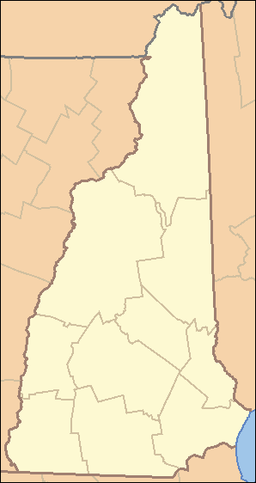
 Location of Moose Brook State Park in New Hampshire
Website: Moose Brook State Park Moose Brook State Park is a New Hampshire state park in Coos County, New Hampshire in the United States. The park occupies 774 acres (313 ha)[2] and sits at an elevation of 1,070 feet (330 m).[1] The park, which was built by the Civilian Conservation Corps during the Great Depression, was opened to the public in 1936.[2]
Contents
History
Moose Brook State Park was constructed during the Great Depression by a workers from the Civilian Conservation Corps. The Civilian Conservation Corps (CCC) was a work relief program for young men from unemployed families, established in 1933. As part of President Franklin D. Roosevelt's New Deal legislation, it was designed to combat unemployment during the Great Depression. The CCC operated in every U.S. state.[3] Young men from all over the country were assigned to the many CCC camps that were constructed in rural areas throughout the United States.[3]
Moose Brook State Park is considered to be an excellent example of CCC design.[4] The corps built park facilities and trails using the natural resources that were at hand. Cabins and other facilities were built with rocks and logs that were taken from the land surrounding their construction sites. The original park offices, built by the CCC, are still in use today.[4] Other park facilities that were built by the CCC and are still in use include the bathhouse, campground and swimming area.[4]
Geology
Moose Brook State Park is within the White Mountains. The White Mountains are part of the larger Appalachian Mountains. The magma intrusions forming the White Mountains today were created 124 to 100 million years ago as the North American Plate moved westward over the New England hotspot.[5]
The park is named for Moose Brook. The brook is a tributary of the Androscoggin River, which flows south and east into Maine, joining the Kennebec River near the Atlantic Ocean. Moose Brook rises in the town of Randolph, New Hampshire, in Ice Gulch, a notch in the Crescent Mountain Range north of the White Mountains. Moose Brook exits the gulch by dropping over Peboamauk Fall, then continues east through the park to reach the Androscoggin River in the town of Gorham.[6]
Recreation
Moose Brook State Park is open May through October. Recreation activities include camping, picnicking, mountain biking, swimming, hiking and fishing.[2] There are 59 campsites at the park in a variety of areas. Some are wooded and shaded and others are in open, sunny areas. The campground opens on Memorial Day weekend and closes Columbus Day weekend. Moose Brook State Park is used as a base for visitors to the White Mountains and the Presidential Range.[7]
References
- ^ a b "Moose Brook State Park". Geographic Names Information System. United States Geological Survey. February 1, 1991. http://geonames.usgs.gov/pls/gnispublic/f?p=gnispq:3:::NO::P3_FID:873058. Retrieved 2010-07-11.
- ^ a b c d "Moose Brook State Park and Campground". New Hampshire State Parks. http://www.nhstateparks.com/moose.html. Retrieved 2010-07-11.
- ^ a b Paige, John C. (1985). "Chapter One: A Brief History of the Civilian Conservation Corps". The Civilian Conservation Corps and the National Park Service, 1933-1942: An Administrative History. Washington, D.C.: U.S. National Park Service, Department of the Interior. OCLC 12072830. http://www.nps.gov/history/history/online_books/ccc/ccc1.htm. Retrieved 2010-07-11.
- ^ a b c "Moose Brook State Park: History" (pdf). The New Hampshire Division of Parks and Recreation. http://www.nhstateparks.org/uploads/MooseBrookStatePark_History_2010.pdf. Retrieved 2010-07-11.
- ^ "Physiographic divisions of the conterminous U. S.". U.S. Geological Survey. http://water.usgs.gov/GIS/metadata/usgswrd/XML/physio.xml. Retrieved 2010-07-11.
- ^ "Moose Brook". Geographic Names Information System. United States Geological Survey. August 27, 1980. http://geonames.usgs.gov/pls/gnispublic/f?p=gnispq:3:::NO::P3_FID:868543. Retrieved 2010-07-11.
- ^ "Moose Brook State Park". The New Hampshire Division of Parks and Recreation. http://www.nhstateparks.org/explore/state-parks/moose-brook-state-park.aspx. Retrieved 2010-07-11.
Federal National Historic SiteNational Wildlife RefugesGreat Bay • John Hay • Silvio O. Conte • Umbagog • Wapack
Other Protected AreasGreat Bay National Estuarine Research ReserveState Ahern • Androscoggin • Annett • Bear Brook • Bear's Den • Beaver Brook Falls • Bedell Bridge • Binney Pond • Bradford Pines • Cardigan • Cathedral Ledge • Chesterfield Gorge • Clough • Coleman • Crawford Notch • Crosby Mountain • Curtiss Dogwood • Daniel Webster Birthplace • Deer Mountain Campground • Dixville Notch • Dublin Lake • Echo Lake • Eisenhower Memorial • Ellacoya • Endicott Rock • Forest Lake • Fort Constitution • Fort Stark • Franconia Notch • Franklin Pierce Homestead • Gardner Memorial Wayside • Governor Wentworth Historical Site • Greenfield • Hampton Beach • Hannah Duston • Heath Pond Bog • Humphrey's Ledge • Jenness • Jeremy Hill • Jericho Mountain • Kingston • Lake Francis • Lake Tarleton • Madison Boulder • Mascot Mine • Milan Hill • Miller • Mollidgewock • Monadnock • Moose Brook • Mt. Sunapee • Mt. Washington • Nansen Wayside • North Hampton • Northwood Meadows • Odiorne Point • Otter Brook • Pawtuckaway • Pillsbury • Pisgah • Plummer's Ledge • Rhododendron • Robert Frost • Rollins • Rye Harbor • Sculptured Rocks • Silver Lake • Smith's Ferry • Taylor Mill • Umbagog Lake • Wadleigh • Wallis Sands • Wantastiquet Mountain • Weeks • Wellington • Wentworth • Wentworth-Coolidge Mansion • White Island • White Lake • Winslow
Abbott • Agnew • Allen • Alton Bay • Ames • Ammonoosuc • Annett • Annie Duncan • Ashenden • Ayers • Ballard • Bear Mountain • Belknap Mountain • Benton • Big Island • Black Mountain • Blair • Blue Job Mountain • Bowditch-Runnels • Cape Horn • Cardigan Mountain • Carroll • Casalis • Chemung • Cilley • Connecticut Lakes • Connecticut River • Contoocook • Conway Common Lands • Cowden • Craney Hill • Cushman • Davisville • Davis-White • Devils Slide • District #5 • Dodge Brook • Eaton • Fall Mountain • Fay • Feuer • Foster & Colburn • Fox • Gay • George Duncan • Gile • Gilmore • Goodwin-Chandler • Grant • Green Mountain • Hamel • Harriman-Chandler • Haven • Hemenway • Hodgman • Honey Brook • Hubbard Hill • Huston-Morgan • Hyland Hill • Kearsarge Mountain • Lang Station • Lead Mine • Leighton • Litchfield • Little Pine River • Livermore Falls • Lord Pines • Lovewell Mountain • Low • Marshall • Mascoma • Mast Yard • Max Israel • Meadow Pond • Merrimack River • Merriman • Mt. Major • Nash Stream • Nottingham • Nursery • Opechee Bay • Page • Page's Corner • Paugus Bay • Percy • Pine River • Piscataquog • Powwow River • Prescott • Province Road • Ragged Mountain • Reed's Ferry • Rock Rimmon • Russell • Russell-Abbott • Russell-Shea • Saltmarsh Pond • Sanborn • Scribner-Fellows • Second Presidential • Sentinel Mountain • Shadow Hill • Shaker • Shieling • Sky Pond • Soucook River • Southeast • Stevens Pines • Strawberry Hill • Sugar Hill • Swain • Taylor • Totten Trails • Upton Morgan • Urban Forestry Center • Vienna Smith • Vincent • Wade • Walker • Welton Falls • West Iron Works Road • White Farm • William Thomas • Woodman
Other OtherLost River Reservation • Proctor Wildlife Sanctuary • Sheldrick Forest Preserve
New Hampshire Department of Resources and Economic Development (web) Categories:- Civilian Conservation Corps in New Hampshire
- Protected areas established in 1936
- New Hampshire state parks
- Parks in Coos County, New Hampshire


Wikimedia Foundation. 2010.