- Monroeville, California
-
For the community in Mendocino County formerly with this name, see Hales Grove, California.
Coordinates: 39°40′40″N 121°58′39″W / 39.67778°N 121.9775°W
Monroeville — Former settlement — Location in California
 Monroeville
Coordinates: 39°40′40″N 121°58′39″W / 39.67778°N 121.9775°W Country United States State California County Glenn County Elevation[1] 128 ft (39 m) Monroeville (also, Munroeville)[2], named for its founder U. P. Monroe, was the county seat of Colusa County from 1851 to 1853. [2] It was located 15 miles (24 km) north of Butte City,[2] near the mouth of Stony Creek in northeastern Glenn County, at an elevation of 128 feet (39 m).[1] The people of the community of Colusa fought for and eventually won the right to become the County Seat in 1853. A post office operated at Monroeville from 1853 to 1862.[2] The area containing Monroeville was eventually absorbed into Glenn County when that county was formed in 1891.[1]
References
Municipalities and communities of Glenn County, California County seat: Willows Cities 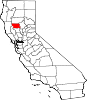
CDPs Unincorporated
communitiesAfton | Alder Springs | Bayliss | Bluegum | Butte City | Capay | Chrome | Codora | Copper City | Cory | Dogtown | Fiddlers Green | Fruto | Glenn | Grapit | Greenwood | Jacinto | Jenks Place | Keller Place | Kirkwood | Logandale | Lone Star | Meyers Place | Mills Orchard | Newville | Norman | Ordbend | Rotavele | Wilson Place | Wyo
Indian
reservationsGrindstone Indian Rancheria of Wintun-Wailaki Indians
Ghost towns Categories:- Former settlements in Glenn County, California
- Former populated places in California
- Former county seats in California
- Sacramento Valley geography stubs


Wikimedia Foundation. 2010.