- Mobile mapping
-
Mobile mapping is the process of collecting geospatial data from a mobile vehicle,[1] typically fitted with a range of photographic, radar, laser, LiDAR or any number of remote sensing systems. Such systems are composed of an integrated array of time synchronised navigation sensors and imaging sensors mounted on a mobile platform.[2] The primary output from such systems include GIS data, digital maps, and georeferenced images and video.
Contents
History
The development of direct reading georeferencing technologies opened the way for mobile mapping systems. GPS and Inertial Navigation Systems, have allowed rapid and accurate determination of position and attitude of remote sensing equipment,[3] effectively leading to direct mapping of features of interest without the need for complex post-processing of observed data.
Applications
Aerial mobile mapping
Traditional techniques of geo-referencing aerial photography, ground profiling radar, or Lidar are prohibitively expensive, particularly in inaccessible areas, or where the type of data collected makes interpretation of individual features difficult. Image direct georeferencing, simplifies the mapping control for large scale mapping tasks.[4]
Emergency response planning
Mobile mapping systems allow rapid collection of data to allow accurate assessment of conditions on the ground.[5]
Internet applications
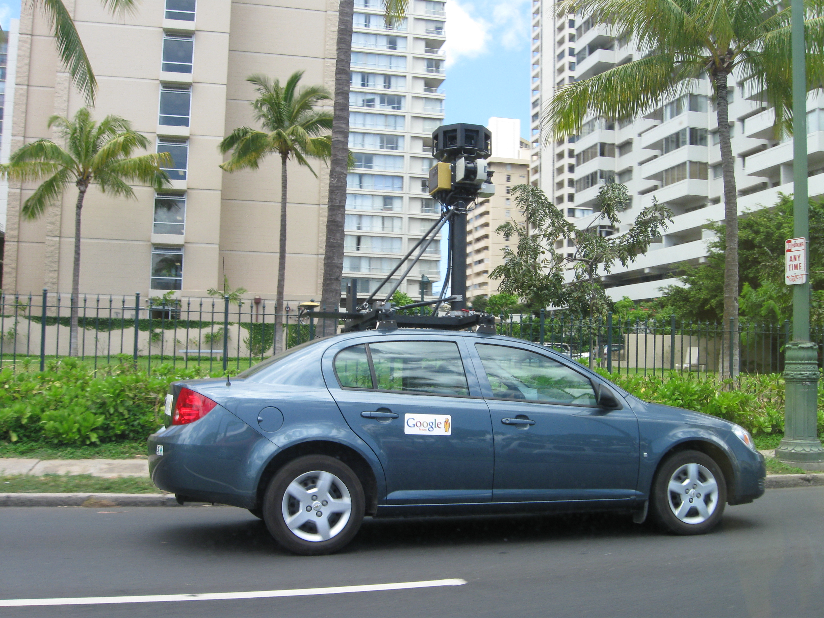
Internet, and mobile device users, are increasingly utilising geo-spatial information, either in the form of mapping, or geo-referenced imaging. Google, Microsoft, and Yahoo have adapted both aerial photographs and satellite images to develop online mapping systems. Street View type images are also an increasing market.[6]
Location aware PDA systems rely on geo-referenced features collated from mobile mapping sources.[7]
Road mapping and highway facility management
GPS combined with digital camera systems allow rapid update of road maps.[8] The same system can be utilised to carry out efficient road condition surveys,[9] and facilities management.[10] Laser scanning technologies, applied in the mobile mapping sense, allow full 3D data collection of slope, bankings, etc.[11]
Footnotes
- ^ Vitrià, et.al. (2004) p.69 Retrieved June 2011.
- ^ Hofmann-Wellenhof, B., et.al. (2003) p.379-380. Retrieved June 2011.
- ^ Tao, C. V. (2007) p.5. Retrieved June 2011
- ^ Gao, J. (2009) p.196. Retrieved June 2011.
- ^ Zlatanova, et.al. (2008) p.103. Retrieved June 2011.
- ^ Tao, C.V. (2007) p.xiii. Retrieved June 2011.
- ^ Weng, Q. (2009) p.70. Retrieved June 2011.
- ^ Tao, C.V. (2009) p.614. Retrieved June 2011.
- ^ Zlatanova, et.al. (2008) p.113. Retrieved June 2011.
- ^ Gavrilova, M.L. (2006) p.996-1001. Retrieved June 2011.
- ^ van Oosterom, P. (2008) p.8. Retrieved June 2011
References
- Tao, C. V. (2007) Advances in mobile mapping technology: Volume 4 of International Society for Photogrammetry and Remote Sensing book series. (ISSN 1572-) Taylor & Francis. ISBN 0415427231
- Gao, J. (2009) Digital Analysis of Remotely Sensed Imagery. McGraw Hill Professional. ISBN 0071604650.
- Zlatanova, S. & Li, J. (2008) Geospatial Information Technology for Emergency Response: Volume 6 of International Society for Photogrammetry and Remote Sensing book series. Routledge. ISBN 0415422477.
- van Oosterom, Peter (2008) Advances in 3D geoinformation systems: Lecture notes in geoinformation and cartography. Springer. ISBN 3540721347.
- Hofmann-Wellenhof, B., Legat, K., Wieser, M. (2003) Navigation: principles of positioning and guidance Springer. ISBN 3211008284.
- Vitrià, J., Radeva, P., Aguiló, I. (2004) Recent advances in artificial intelligence research and development: Volume 113 of Frontiers in artificial intelligence and applications. IOS Press. ISBN 1586034669.
- Gavrilova, M.L. (2006) Computational science and its applications: ICCSA 2006 : international conference, Glasgow, UK, May 8-11, 2006 : proceedings. Springer. ISBN 3540340726.
- Weng, Q. (2009) Remote Sensing and GIS Integration: Theories, Methods, and Applications McGraw Hill Professional. ISBN 007160653X.
Categories:- Surveying
- Applications of computer vision
- Earth sciences
- Cartography
- Satellite meteorology and remote sensing
- Geographical technology
- Remote sensing
Wikimedia Foundation. 2010.