- Mkpat-Enin
-
Mkpat-Enin — LGA and town — 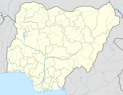
 Mkpat-Enin
Coordinates: 4°44′1″N 7°44′55″E / 4.73361°N 7.74861°E Country  Nigeria
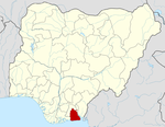
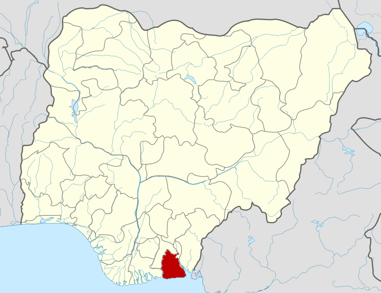
State Akwa Ibom State Time zone WAT (UTC+1) Mkpat-Enin is located in the south east of Nigeria and is a town and a Local Government Area of Akwa Ibom State. It is at an altitude of about 185 m.[1]
The LGA has an area of 322.352 km2 and is located within the industrial belt extending from Ibiono, Eket to Ikot Abasi. The people are traditionally Ibibio speakers. The population was 178,036 based on the 2006 census. The area is rich in oil and natural gas. Oil was discovered in Ikot Akpa/Ekop as early as 1953. Forest reserves include timber and wood, palm produce.[2]
One of the campuses of the Akwa Ibom State University of Technology is located in this community.[3] It is part of the Ikot Abasi / Mkpat Enin / Eastern Obolo Constituency of the Nigerian House of Representatives.[4] It is within the Catholic Diocese of Uyo.[5]
References
- ^ "Nkpat-Enin". Geonames. http://www.geonames.org/2328814/nkpat-enin.html. Retrieved 2009-12-08.
- ^ "Mkpat Enin". Akwa Ibom State Government. http://www.aksgonline.com/lga.aspx?qrID=mkpatenin. Retrieved 2009-12-08.
- ^ "Brief Introduction". Akwa Ibom State University of Technology. http://www.akutech.edu.ng/introduction.html. Retrieved 2009-12-08.
- ^ "Ikot Abasi / Mkpat Enin / Eastern Obolo Constituency". AfDevInfo. http://www.afdevinfo.com/htmlreports/org/org_18330.html. Retrieved 2009-12-08.
- ^ "Diocese of Uyo". Catholic Church in Nigeria. http://www.thecatholicchurchinnigeria.org/uyo.htm. Retrieved 2009-12-08.
Coordinates: 4°44′1″N 7°44′55″E / 4.73361°N 7.74861°E
 Akwa Ibom StateState capital: Uyo
LGAs Abak · Eastern Obolo · Eket · Esit Eket · Essien Udim · Etim Ekpo · Etinan · Ibeno · Ibesikpo Asutan · Ibiono-Ibom · Ika · Ikono · Ikot-Abasi · Ikot Ekpene · Ini · Itu · Mbo · Mkpat-Enin · Nsit-Atai · Nsit-Ibom · Nsit-Ubium · Obot-Akara · Okobo · Onna · Oron · Oruk-Anam · Udung-Uko · Ukanafun · Uruan · Urue-Offong/Oruko · Uyo
 Categories:
- Local Government Areas in Akwa Ibom State
- Populated places in Akwa Ibom State
- Nigeria geography stubs

Wikimedia Foundation. 2010.