- Middle Fork Eel River
-
Middle Fork Eel River (Ba-ka-wha[1]) River 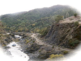 Middle Fork Eel River near Round Valley, low water, 2008
Country United States State California Regions Trinity County, Mendocino County Part of Eel River Tributaries - left Black Butte River Source Near Wrights Ridge - location Yolla Bolly Mountains, Trinity County - elevation 6,398 ft (1,950 m) - coordinates 40°04′52″N 122°58′57″W / 40.08111°N 122.9825°W [1] Mouth Eel River - location Dos Rios, Mendocino County - elevation 863 ft (263 m) [1] - coordinates 39°42′50″N 123°21′10″W / 39.71389°N 123.35278°W [1] Length 69.8 mi (112 km), Northeast-southwest Basin 745 sq mi (1,930 km2) [2] Discharge for Dos Rios - average 1,472 cu ft/s (42 m3/s) [3] - max 135,000 cu ft/s (3,823 m3/s) - min 0.39 cu ft/s (0 m3/s) 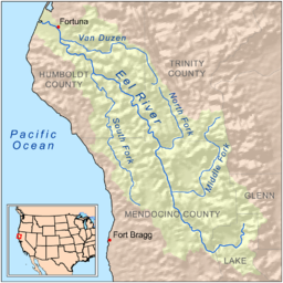 Map of the Eel River drainage basin, including the Middle Fork Eel River
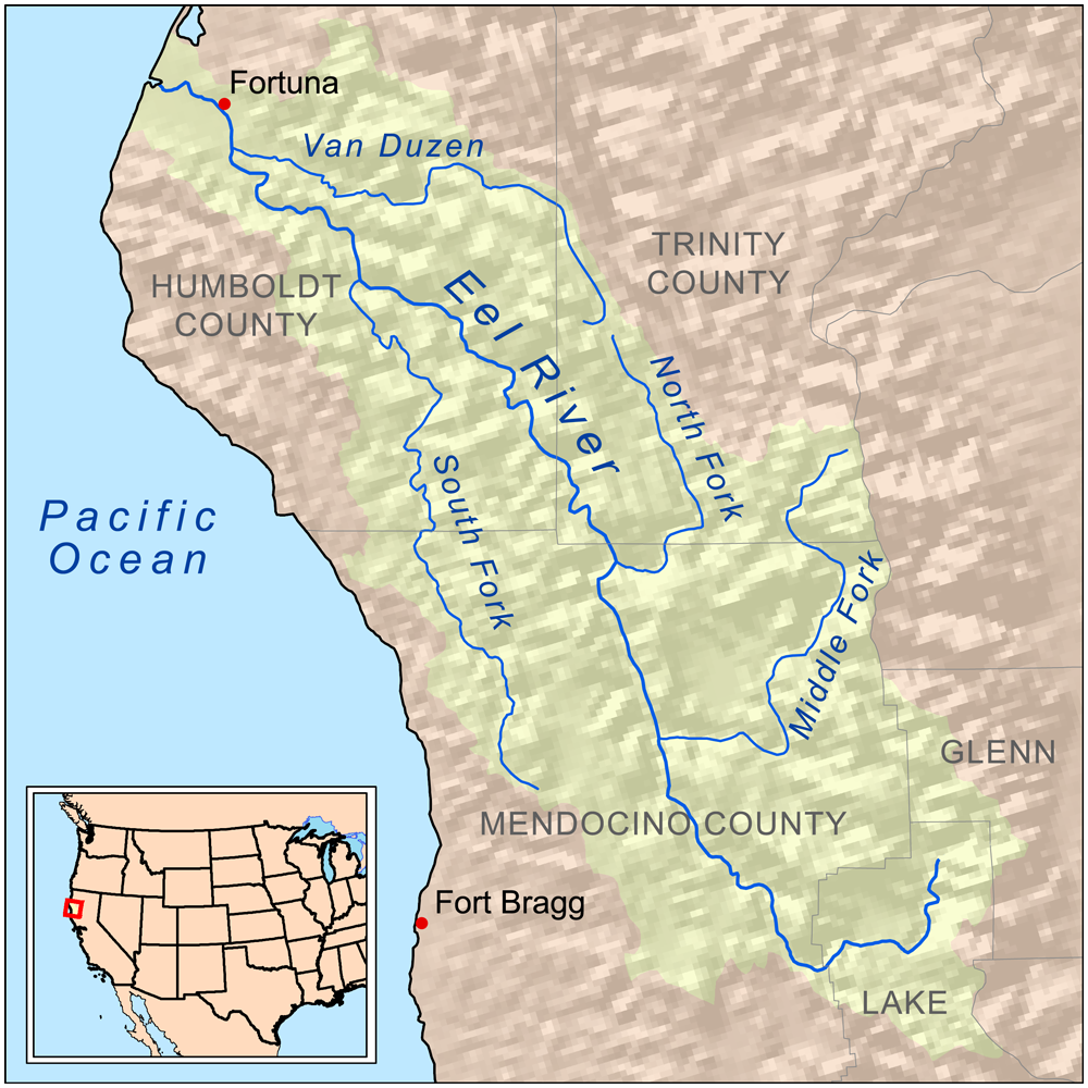
The Middle Fork Eel River is a major tributary of the Eel River of northwestern California in the United States.[1] It drains a rugged and sparsely populated region of the Yolla Bolly Mountains, part of the California Coast Range, in Trinity and Mendocino Counties. Its watershed comprises roughly 745 square miles (1,930 km2) of land, or 20% of the entire Eel River basin.
Contents
Course
The Middle Fork Eel River flows almost 70 stream miles.[4] It rises in the Yolla Bolly-Middle Eel Wilderness at the crest of the Coast Range about a mile or so north of Wrights Ridge and west of The Knob, at the confluence of several small unnamed streams. It makes a large bend to the south, then southeast past the confluence with Rattlesnake Creek (on the left) and the boundary between Trinity and Mendocino Counties. Turning south around Taliaferro Ridge at the Beaver Creek[5] confluence, it then runs southwest to where the Black Butte River enters from the left. Williams Creek enters on the right, then the Middle Fork flows south through Round Valley Indian Reservation, passing within a few miles of Covelo before receiving Mill Creek from the right. Hayshed and Elk Creeks both enter from the left as the river rounds a bend to the north. Afterwards, the river's final miles are spent flowing westwards through a gorge to the confluence with the main stem near Dos Rios.[6]
History
In 1967, the U.S. Army Corps of Engineers proposed to build an enormous dam on the Middle Fork Eel River shortly above the confluence with the Eel River. The Dos Rios Dam would have been 730 feet (220 m) tall, creating a reservoir that covered 110,000 acres (450 km2) of land (including Round Valley, the Middle Fork Eel River watershed's primary agricultural area and also the location of the town of Covelo, plus the Round Valley Indian Reservation).[7] If built, this dam would have diverted most of the flow of the river into the Central Valley for irrigation purposes.[8] The project was eventually defeated by public outcry from local residents and the intervening of then-California governor Ronald Reagan.[9] It is believed that he said that "enough treaties had already been broken with the Indians".[10]
Ecology
In a 1965 California Fish and Wildlife Plan, the Middle Fork Eel River watershed supported an annual run of 23,000 Steelhead trout (Oncorhynchus mykiss) in 178 miles of stream habitat. Steelhead surveys were conducted by DFG and USFS from 1966 to 1999. In 1999 they described the Middle Fork summer steelhead run as “The largest remaining wild run of these magnificent fish”. It was noted to be “...probably the only population that has not been touched by a hatchery program, and as such, is most likely the State’s most important summer steelhead population”. Counts from the annual surveys indicated that the Middle Fork summer steelhead population has declined since 1987, to 471 fish were counted in 1999.[4]
See also
- North Fork Eel River
- South Fork Eel River
- List of rivers of California
- Yolla Bolly-Middle Eel Wilderness
References
- ^ a b c d e "Middle Fork Eel River". Geographic Names Information System, U.S. Geological Survey. 1981-01-19. http://geonames.usgs.gov/pls/gnispublic/f?p=gnispq:3:::NO::P3_FID:263526. Retrieved 2010-06-17.
- ^ "USGS Gage #11478900 on the Middle Fork Eel River near Dos Rios". National Water Information System. U.S. Geological Survey. 1966-present. http://waterdata.usgs.gov/nwis/annual/?referred_module=sw&site_no=11473900&por_11473900_3=2210156,00060,3,1966,2010&year_type=W&format=html_table&date_format=YYYY-MM-DD&rdb_compression=file&submitted_form=parameter_selection_list. Retrieved 2010-06-17.
- ^ "Water-Data Report 2009 for USGS Gage #11473900 on the Middle Fork Eel River near Dos Rios". Water Resources of the United States. U.S. Geological Survey. 2009. http://wdr.water.usgs.gov/wy2009/pdfs/11473900.2009.pdf. Retrieved 2010-06-17.
- ^ a b Steelhead/rainbow trout resources of the Middle Fork Eel River (Report). http://www.cemar.org/eel/06_MiddleForkEel_final.pdf. Retrieved 2010-12-07.
- ^ U.S. Geological Survey Geographic Names Information System: Beaver Creek
- ^ ACME Mapper. USGS Topo Maps for United States (Map). Cartography by United States Geological Survey. http://mapper.acme.com/. Retrieved 2010-06-17.
- ^ Wilson, Richard (1969). "The Dos Rios Project". Round Valley Conservation League. Western Section of the Wildlife Society. http://www.tws-west.org/transactions/Wilson.pdf. Retrieved 2010-06-17.
- ^ Reisner, p. 199-200
- ^ "Undoing of the Dos Rios dam". Humboldt Herald. http://humboldtherald.wordpress.com/2009/05/23/undoing-of-the-dos-rios-dam/. Retrieved 2010-06-17.
- ^ "Watershed Review". University of Washington Water Center. http://water.washington.edu/Outreach/Publications/WatershedReview/watershedreviewv3n2.pdf. Retrieved 2010-06-17.
Works cited
- Reisner, Marc. Cadillac Desert, revised edition, Penguin USA, (1993), ISBN 0-14-017824-4
Categories:- Rivers of Trinity County, California
- Rivers of Mendocino County, California

Wikimedia Foundation. 2010.