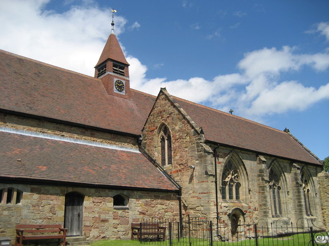
- St. Mary The Church of Our Lady, Merevale
-
St. Mary The Church of Our Lady 
St. Mary The Church of Our Lady, MerevaleDenomination Church of England Churchmanship Anglican Website Kingsbury And Baxterley Churches Administration Diocese Diocese of Birmingham Province Province of Canterbury Clergy Vicar(s) Revd. Janet Gasper MD Laity Churchwarden(s) Mr. Gerald Overton and Mrs. Ruth Taylor St. Mary The Church of Our Lady Merevale is an historic parish church in Merevale, Warwickshire it is known for its Jesse window, it was originally part of Merevale Abbey but is now a Church of England parish church.
History
The Church was originally the gate house to the much larger Merevale Abbey which was founded in 1148 and was a Cistercestan Abbey the abbey was destroyed in the Dissolution of the Monasteries by Henry VIII some traces of it remain today, The Gatehouse survived and became a Church of England parish church.
Today
It is part of the Kingsbury and Baxterley group of churches along with Baxterley, Kingsbury, Hurley and Wood End, All five share the same vicar who is currently Revd. Janet Gasper.
It is the only church in the parish of Merevale with Bentley which has 4 exclaves (2 near Twycross, 1 near Sheepy Parva Both in Leicestershire and one in Hams Hall in Warwickshire).
It is part of the Deanery of Polesworth, Which is Part of the Arch Deanery of Aston.
It is the only Cistercian Gate Chapel to be open for regular weekly services throughout the year in the United Kingdom.
External links
Categories:- Church of England churches in Warwickshire
Wikimedia Foundation. 2010.