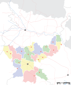
- Meghahatuburu
-
Meghahatuburu — city — Coordinates 22°04′N 85°16′E / 22.07°N 85.26°ECoordinates: 22°04′N 85°16′E / 22.07°N 85.26°E Country India State Jharkhand District(s) Pashchimi Singhbhum Population 6,879 (2001[update]) Time zone IST (UTC+05:30) Area
• 785 metres (2,575 ft)
Meghahatuburu (mentioned in census records as Meghahatuburu Forest village) is a census town in Pashchimi Singhbhum district in the Indian state of Jharkhand.
Contents
Overview
The places Meghatuburu and Kiriburu are very close to each other; in fact, it is better to say they are the same place, differentiated by MIOM and KIOM, the two iron ore mines. It is a very good place to visit, if you want to visit a very dense forest (Saranda) and fond of streams and mountain ranges. Megahatuburu is very rich in iron ore and many companies are excavating iron ore. This place had an annual rain fall of 128 cc which has decreased because of cutting of trees. This place is situated on the border of the states of Jharkhand (Pashchimi Singhbhum district) and Orissa (Keonjhar). Hilltop comes under Orissa and Meghahatuburu and Kiriburu come under Jharkhand.
Demographics
As of 2001[update] India census[1], Meghahatuburu Forest village had a population of 6,879. Males constitute 53% of the population and females 47%. Meghahatuburu Forest village has an average literacy rate of 74%, higher than the national average of 59.5%: male literacy is 82%, and female literacy is 66%. In Meghahatuburu Forest village, 13% of the population is under 6 years of age.
Education
Schools:Kendriya Vidyalaya, Jharkhand (English-medium) School, Project Central School (Kiriburu), Oriya Medium school(Hilltop, Orissa)
References
- ^ "Census of India 2001: Data from the 2001 Census, including cities, villages and towns (Provisional)". Census Commission of India. Archived from the original on 2004-06-16. http://web.archive.org/web/20040616075334/http://www.censusindia.net/results/town.php?stad=A&state5=999. Retrieved 2008-11-01.
Cities and towns in Kolhan division East Singhbhum district Bagbera • Baharagora • Chakulia • Chhota Gobindpur • Gadhra • Ghatshila • Ghorabandha • Haludbani • Jadugora • Jamshedpur • Jugsalai • Kokpara • Mahulia • Mango • Musabani • SarjamdaSeraikela Kharsawan district West Singhbhum district Related topics Kolhan Division topicsCities and towns
in other DivisionsCategories:- Iron ore mining in India
- Cities and towns in West Singhbhum district
- Jharkhand geography stubs
Wikimedia Foundation. 2010.


