- Media City Footbridge
-
Media City Footbridge 
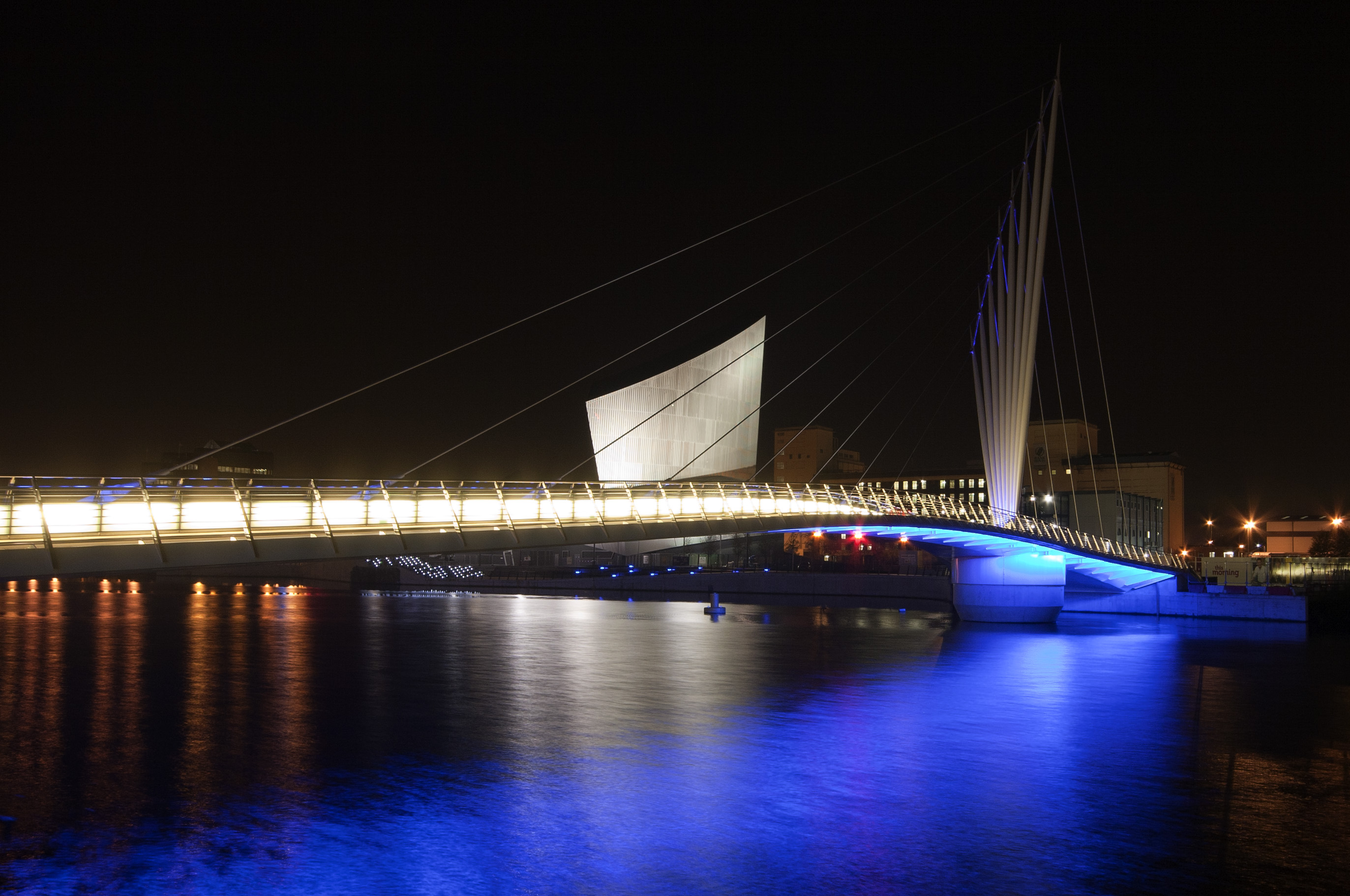
Media City Footbridge at nightOther name(s) Salford Quays Swing Bridge Carries Pedestrians Crosses Manchester Ship Canal Locale Salford Quays Owner Peel Group Architect Wilkinson Eyre Designer Gifford (structure), Pinniger (lighting) Engineering design Bennett Associates (Atkins) Design Cable-stay swing bridge Material Steel Total length 83 metres Width 6 - 19 metres Height 31 metres Longest span 65 metres Number of spans 2 Piers in water 1 Vertical clearance 48 metres Clearance below 4.77 metres Constructed by Balfour Beatty Civil Engineering Ltd Fabrication by Rowecord Engineering Construction begin September 2009 Construction end 2011 Construction cost £11 million Opened 2011 Coordinates 53°28′17″N 2°18′00″W / 53.4713°N 2.3001°WCoordinates: 53°28′17″N 2°18′00″W / 53.4713°N 2.3001°W The Media City Footbridge is a swing-mechanism footbridge over the Manchester Ship Canal near MediaCityUK. It is an assymetric cable-stayed swing bridge.
Contents
History
It was built to serve the new development of MediaCity UK.
Design
It was designed by Wilkinson Eyre. It is similar in position to the Gateshead Millennium Bridge's proximity to Gateshead's The Sage Gateshead, the main arts venue for North East England. Both were designed by Wilkinson Eyre, and Gifford, and both have eye-catching unusual features. The Gateshead bridge is a more daring design.
The bridge links MediaCityUK with Trafford Wharf. It weighs 450 tonnes, and has two spans of 65 metres and 18 metres. It swings through 71 degrees to give a 48 metre navigation channel. The deck of the bridge is an orthotropic steel box.[1] The bridge is supported by eight tapered steel fanned masts.
Construction
It was built by Balfour Beatty, with the steel fabrication by Rowecord Engineering of Newport, south Wales.
The swing mechanism is built on a reinforced concrete caisson foundation of 13 metres diameter. Above the water it is 7.3 metres in diameter.
See also
References
External links
Categories:- Buildings and structures in Salford
- Bridges in Greater Manchester
- Bridges completed in 2011
- Balfour Beatty
- Pedestrian bridges in England
- Cable-stayed bridges in the United Kingdom
- Swing bridges in the United Kingdom
Wikimedia Foundation. 2010.