- McDowell, West Virginia
-
McDowell — Unincorporated community — Location within West Virginia
 McDowell
Coordinates: 37°24′10″N 81°22′49″W / 37.40278°N 81.38028°WCoordinates: 37°24′10″N 81°22′49″W / 37.40278°N 81.38028°W Country United States State West Virginia County McDowell Elevation 1,965 ft (599 m) Time zone Eastern (EST) (UTC-5) – Summer (DST) EDT (UTC-4) Area code(s) 304 & 681 GNIS feature ID 1555083[1] McDowell is an unincorporated community in McDowell County, West Virginia, United States. McDowell is 3.5 miles (5.6 km) east-southeast of Northfork.
References
Municipalities and communities of McDowell County, West Virginia Cities 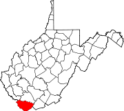
Towns CDPs Unincorporated
communitiesAlgoma | Antler | Apple Grove | Asco | Ashland | Atwell | Avondale | Beartown | Big Four | Bishop | Black Wolf | Bottom Creek | Canebrake | Capels | Caretta | Carlos | Carswell | Coalwood | Eckman | Elkhorn | English | Ennis | Erin | Faraday | Garland | Gilliam | Havaco | Hemphill | Hensley | Hull | Isaban‡ | Jacobs Fork | Jed | Jenkinjones | Johnnycake | Jolo | Krollitz | Kyle | Landgraff | Leckie | Lex | Lila | Litwar | Longpole | Maitland | McDowell | Mohawk | Mohegan | Monson | Newhall | Panther | Paynesville | Powhatan | Premier | Rift | Rockridge | Rolfe | Sandy Huff | Six | Skygusty | Squire | Superior | Switchback | Twin Branch | Union City | Upland | Vallscreek | Worth | Wyoming City | Yerba | Yukon
Footnotes ‡This populated place also has portions in an adjacent county or counties
Categories:- Populated places in McDowell County, West Virginia
- Unincorporated communities in West Virginia
- McDowell County, West Virginia geography stubs


Wikimedia Foundation. 2010.