- McCuddin Mountains
-
The McCuddin Mountains is a small cluster of mountains in Antarctica consisting mainly of two large mountains, Mount Flint and Mount Petras, along with several scattered peaks and nunataks. Located in Marie Byrd Land, 64 km (40 mi) east of the Ames Range. The mountains were discovered and photographed from the air in a flight from West Base of the U.S. Antarctic Service on Dec. 14, 1940. They were mapped by U.S. Geological Survey (USGS) from surveys and U.S. Navy air photos, 1959-65. Named by Advisory Committee on Antarctic Names (US-ACAN) for Rear Admiral Leo B. McCuddin, U.S. Navy (USN), Commander of the U.S. Naval Support Force, Antarctica, 1972.[1] Coordinates: 75°47′S 128°42′W / 75.783°S 128.7°W
Mount Flint
Mount Flint (75°44′S 129°06′W / 75.733°S 129.1°W)is a prominent rounded and mainly snow-covered mountain, 2,695 m, standing 16 km (10 mi) NW of Mount Petras. The feature was observed from aircraft of the U.S. Antarctic Service (USAS) in Flight G, Dec. 15, 1940, and was briefly referred to as "Mount Gray." It was mapped in detail by U.S. Geological Survey (USGS), 1959-65. Named by US-ACAN for Robert B. Flint, Jr., U.S. Antarctic Research Program (USARP) scientist on high latitude geophysical and geomagnetic phenomena. Flint wintered over at Byrd Station, 1964, Plateau Station where he was scientific leader, 1966, and Vostok Station where he was U.S. Exchange Scientist, 1974.[2]
Gillick Rock
Gillick Rock (75°36′S 129°12′W / 75.6°S 129.2°W) is an isolated rock nunatak lying at the northwest end of the McCuddin Mountains, 8 nautical miles (15 km) north of the summit of Mount Flint. Mapped by United States Geological Survey (USGS) from ground surveys and U.S. Navy tricamera aerial photographs, 1959-66. Named by US-ACAN for Lieutenant Thomas L. Gillick, U.S. Navy Reserve, helicopter pilot who flew close support for United States Antarctic Research Program (USARP) scientists during Operation Deep Freeze 1970 and 1971. [3]
Mount Josephine Petras
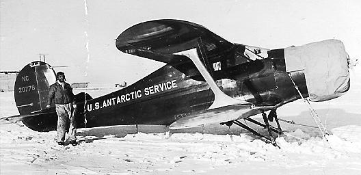
Mount Josephine Petras (75°52′S 128°39′W / 75.867°S 128.65°W) is a high, prominent, ridge-shaped mountain, 2,865 m, standing 16 km (10 mi) southeast of Mount Flint. It was discovered by the US Antarctic Service (USAS) on a flight from West Base on December 15, 1940, and named for Josephine Petras, wife of Theodore A. Petras, master technical sergeant, USMC, pilot of the airplane, a Beechcraft 5PCLB, Model D-17-A, SN357 REG NC20778 on this flight with Dr. Siple.
Schwob Peak
Schwob Peak (75°53′S 128°39′W / 75.883°S 128.65°W) is a peak (2,715 m) 2.4 km (1.5 mi) south of Mount Josephine Petras. Mapped by United States Geological Survey (USGS) from surveys and U.S. Navy air photos, 1959-65. Named by US-ACAN for Captain William S. Schwob, USCG, Commanding Officer of USCGC Southwind during Operation Deep Freeze 1972.[4]
References
- ^ "McCuddin Mountains". Geographic Names Information System, U.S. Geological Survey. http://geonames.usgs.gov/pls/gnispublic/f?p=gnispq:5:::NO::P5_ANTAR_ID:9665. Retrieved 2010-05-16.
- ^ "Mount Flint". Geographic Names Information System, U.S. Geological Survey. http://geonames.usgs.gov/pls/gnispublic/f?p=gnispq:5:::NO::P5_ANTAR_ID:5044. Retrieved 2010-05-16.
- ^ "Gillick Rock". Geographic Names Information System, U.S. Geological Survey. http://geonames.usgs.gov/pls/gnispublic/f?p=gnispq:5:::NO::P5_ANTAR_ID:5686. Retrieved 2009-02-19.
- ^ "Schwob Peak". Geographic Names Information System, U.S. Geological Survey. http://geonames.usgs.gov/pls/gnispublic/f?p=gnispq:5:::NO::P5_ANTAR_ID:13432. Retrieved 2008-03-23.
Categories:- Mountain ranges of Marie Byrd Land
-

Wikimedia Foundation. 2010.