- Maze (electoral ward)
-
Coordinates: 54°29′17″N 6°07′23″W / 54.488°N 6.123°W
Maze 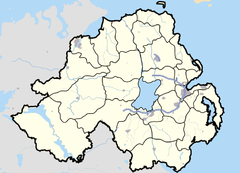
 Maze
Maze
Maze shown within Northern IrelandPopulation 3,393 (2001 Census) District Lisburn County County Down
County AntrimCountry Northern Ireland Sovereign state United Kingdom Post town LISBURN Postcode district BT27, BT28 Dialling code 028 EU Parliament Northern Ireland UK Parliament Lagan Valley NI Assembly Lagan Valley List of places: UK • Northern Ireland • Maze is an electoral ward in the Lisburn City Council area of Northern Ireland. It predominantly lies in County Down although its northwestern corner lies in County Antrim, the division being the River Lagan. The Maze electoral ward consists of the settlements of Mazetown, Long Kesh, Culcavy, Aghnatrisk, Halftown and Ravernet. In 2001, there were 3393 residents in the electoral ward.[1]
Contents
Mazetown and Long Kesh
Main article: MazetownMazetown is small settlement just off the main A3 Belfast-Armagh road, some 3 miles west of Lisburn.
Long Kesh is most famous for the Maze Prison (closed in 2000), which was sited on an aircraft field known as 'Long Kesh'. The actual prison entrance is on the Culcavy Road in Halftown. Long Kesh is also known for Down Royal Racecourse, which is the main attraction in the area, as well as the adjoining nine-hole and eighteen-hole Down Royal Golf Course. The area had 351 residents in the 2001 Census.[1]
Transport and Communications
The main A1 Belfast-Dublin dual-carriageway splits the ward as it ascends from the Sprucefield Roundabout (M1 junctions 7/8) to the Hillsborough roundabout, on a section commonly known as Carnbane Hill, named after the townland which it passes through.
As with the rest of the province, the dialling code in 028. However, the electoral ward covers no less than three local exchange areas (all of which lie within the Lisburn telephone area). The western side is covered by the 'Maze' exchange (9262xxxx), the centre-north area by the Lisburn central exchange (926xxxxx) and the eastern and southern areas by the 'Hillsborough' exchange (9268xxxx).
Demographics
This data covers the whole electoral ward, not just the traditional Maze settlement. On Census day (29 April 2001) there were 3353 people living in the Maze electoral ward. Of these:
- 22.9% were aged under 16 years and 15.6% were aged 60 and over
- 50.8% were female and 49.2% were male
- 89.1% were from a Protestant background and 6.2% were from a Catholic background
- 1.9% of people aged 16-74 were unemployed.[1]
References
External links
Categories:- Wards of Northern Ireland
Wikimedia Foundation. 2010.