- Masindi Port
-
Masindi Port Map of Uganda showing the location of Masindi Port.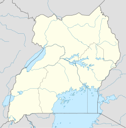
 Masindi Port
Coordinates: 01°42′00″N 32°04′20″E / 1.7°N 32.07222°E Country  Uganda
District Masindi District Elevation 1,040 m (3,412 ft) Population (2010) - Total 8,800 Time zone EAT (UTC+3) Masindi Port is a town in Uganda.
Contents
Location
Masindi Port is located in Masindi District in western Uganda. The town is located on the western banks of the Victoria Nile, approximately 200 kilometres (120 mi), by road, northwest of Kampala, Uganda's capital and largest city.[1] This location is approximately 50 kilometres (31 mi), by road, east of Masindi, the district capital.[2] The coordinates of the town are:00 42 00N, 32 04 20E (Latitude:1.7000; Longitude:32.0722).
Overview
Masindi Port was a busy river boat docking station during the late 19th an early 20th centuries. Back then, steamboats were a major mode of transport on the Nile River. Due to the Karuma Falls and Murchison Falls on the Victoria Nile between Lake Kyoga and Lake Albert, steamboats could not navigate that part of the Nile. Passengers would travel by boat from Lake Victoria, up the Victoria Nile into Lake Kyoga. They would then disembark at Masindi Port and travel by land to Butiaba, a port on Lake Albert, where they would resume their water journey upstream the Nile. With the decline of this mode of river transportation, Masindi Port and Butiaba have been reduced to mainly market towns.[3]
Population
In 2006, the population of Masindi Port was estimated at about 7,800.[4] It is estimated that the population of the town in 2010 is approximately 8,800.
External links
See also
- Masindi District
- Masindi
- Victoria Nile
References
 Masindi District
Capital: Masindi Towns and villages Economy Barclays Bank · Centenary Bank · Stanbic Bank · Kinyara Sugar Works · Kinyara Power StationNotable landmarks Masindi Airport · Murchison Falls National Park · Budongo Forest Reserve · Bugungu Wildlife Reserve · Butiaba Port · Omukama's Masindi Palace · Masindi Hotel · Masindi HospitalEducation Kigumba Institute of Petroleum StudiesNotable people Kabakumba MasikoCategories:- Populated places in Uganda
- Cities in the Great Rift Valley
- Communities on the Nile River
- Masindi District

Wikimedia Foundation. 2010.