- Markham, Caerphilly
-
Markham is a small village in the South Wales Valleys in Caerphilly County Borough, close to Blackwood.
The village has a primary school, Markham Primary School, which is a feeder school of Pontllanfraith Comprehensive School, although some pupils move on to Blackwood Comprehensive School.
Markham RFC currently are in WRU Swalec League Six East and have won the Cyrus Davies Cup three times in the last four years. They have also been semi-finalists of the Worthington District's Cup three times losing to Trefil, Caerleon and Bryncethin on those occasions.
The old name for Markham Primary was Markham Infants, Markham Jnr and Markham Senior Mixed. This was an all age school serving the village, where pupils started school at 5 years of age and continued until 15. Pupils took the old 11 plus exam for entry to grammar school or the entry exam for 'Technical School' at 12/13 years of age. It changed in the early sixties and became a feeder for the comprehensive schools at Blackwood and Pontllanfraith.
Caerphilly County Borough Caerphilly County Borough Council Principal settlements Aberbargoed · Abercarn · Bargoed · Bedwas · Blackwood · Caerphilly · Crumlin · Gelligaer · Newbridge · Rhymney · Risca · Senghenydd · Ystrad Mynach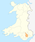
Towns and villages Abertridwr, Caerphilly · Abertysswg · Argoed · Blaen-carno · Bont Pren · Britannia · Brithdir · Bryn · Bryncenydd · Bute Town · Caledfryn · Castle Park · Cefn Fforest · Cefn Hengoed · Cefn Mably · Chapel of Ease · Churchill Park · Croespenmaen · Crosskeys · Cwmbargoed · Cwmcarn · Cwmgelli · Cwmfelinfach · Cwmsyfiog · Cwmnantygwynt · Darran Valley · Deri · Draethen · Eglwysilan · Elliotstown · Energleyn · Fernlea · Fleur de Lys · Fochriw · Gellihaf · Gelligroes · Gilfach · Gilfach Estate · Glan-y-nant · Graig-y-Rhacca · Groesfaen · Hafodyrynys · Hendredenny · Hengoed · Hollybush · Lansbury Park · Llanbradach · Llanfabon · Llanfach · Llechryd · Llwyn Gwyn · Machen · Maesycwmmer · Manmoel · Markham · Mornington Meadows · Mynyddislwyn · Nelson · New Tredegar · Oakdale · Ochrwyth · Pantside · Pantyresk · Penallta · Pengam · Penllwyn · Penmaen · Penpedairheol · Pentwyn (near Fochriw) · Pentwyn (near Penyrheol) · Pentwyn (near Trinant) · Pentwynmawr · Penybryn · Penyfan · Penyrheol · Phillipstown · Pontllanfraith · Pontlottyn · Pontymister · Pontywaun · Princetown · Pwllypant · Rhymney Bridge · Rudry · Ruperra · Springfield · Tirphil · Tir-y-berth · Trecenydd · Tredomen · Treowen · Trethomas · Trinant · Troedrhiwfwch · Ty Sign · Van · Waterloo · Watford · Wattsville · West End · Wernddu · Woodfieldside · Wyllie · YnysdduCoordinates: 53°15′N 0°53′W / 53.25°N 0.883°W
Categories:- Villages in Caerphilly county borough
- Gwent geography stubs

Wikimedia Foundation. 2010.