- Ojinaga Municipality
-
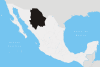
Ojinaga — Municipality — Nickname(s): La perla del desierto Municipality of Ojinaga in Chihuahua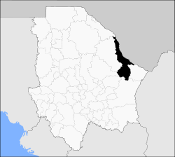 Location in Mexico
 Ojinaga
Coordinates: 29°34′N 104°25′W / 29.567°N 104.417°W Country  Mexico
State Chihuahua Municipal seat Ojinaga Area – Total 9,500.5 km2 (3,668.2 sq mi) Population (2010) – Total 26,304 Ojinaga Municipality (formally: Manuel Ojinaga ) is one of the 67 municipalities of Chihuahua, in northern Mexico. The municipal seat lies at Ojinaga, a rural bordertown on the U.S.-Mexico border. The municipality has an area of 9,500.50 km² (3,668.16 sq mi).
Contents
Geography
Ojinaga, named after Juarista governor Manuel Ojinaga, reported a 2010 census population of 22,744 people in the town, which serves as municipal seat of the municipality of 26,304 inhabitants. The municipality includes numerous very small outlying communities, the largest of which are El Oasis and Nueva Holanda.
Towns and villages
The municipality has 108 localities. The largest are:
Name 2010 Census Population Ojinaga 22,744 El Oasis 475 Nueva Holanda 426 La Esmeralda 187 Maijoma 160 Valverde 143 El Divisadero 135 Potrero del Llano 129 Total Municipality 26,304 Adjacent municipalities and counties
- Manuel Benavides Municipality - southeast
- Camargo Municipality - south
- Julimes Municipality - southwest
- Aldama Municipality - southwest
- Coyame del Sotol Municipality - west
- Guadalupe Municipality - northwest
- Presidio County, Texas - north and northeast
References
- 2010 census tables: INEGI: Instituto Nacional de Estadística, Geografía e Informática
- Chihuahua Enciclopedia de los Municipios de México
External links
- Ojinaga Hoy
- La Perla del Desierto, local website
- Camino Minerals, Maijoma mine, Ojinaga Municipality
Coordinates: 29°34′N 104°25′W / 29.567°N 104.417°W
 State of Chihuahua
Cities Ciudad Chihuahua • Ciudad Cuauhtémoc • Ciudad Juárez • Delicias • Parral
Municipalities Sights Categories:- Chihuahua geography stubs
- Municipalities of Chihuahua
- Mexico–United States border crossings


Wikimedia Foundation. 2010.