- Magor Township, Hancock County, Iowa
-
Magor Township — Township — Location in Hancock County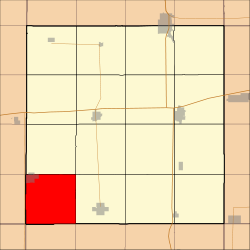
Coordinates: 42°56′59″N 93°55′10″W / 42.94972°N 93.91944°WCoordinates: 42°56′59″N 93°55′10″W / 42.94972°N 93.91944°W Country  United States
State  Iowa
IowaCounty Hancock Area - Total 36.12 sq mi (93.54 km2) - Land 36.12 sq mi (93.54 km2) - Water 0 sq mi (0 km2) 0% Elevation 1,161 ft (354 m) Population (2000) - Total 450 - Density 12.5/sq mi (4.8/km2) Time zone CST (UTC-6) - Summer (DST) CDT (UTC-5) ZIP codes 50430, 50447 GNIS feature ID 0468331 Magor Township is one of sixteen townships in Hancock County, Iowa, USA. As of the 2000 census, its population was 450[1].
Contents
Geography
According to the United States Census Bureau, Magor Township covers an area of 36.12 square miles (93.54 square kilometers).
Cities, towns, villages
- Corwith (south three-quarters)
Unincorporated towns
(This list is based on USGS data and may include former settlements.)
Adjacent townships
- Boone Township (north)
- Erin Township (northeast)
- Amsterdam Township (east)
- Norway Township, Wright County (southeast)
- Boone Township, Wright County (south)
- Vernon Township, Humboldt County (southwest)
- Lu Verne Township, Kossuth County (west)
- Prairie Township, Kossuth County (northwest)
Cemeteries
The township contains these three cemeteries: Corwith, Magor Township and Saint Marys.
School districts
- Corwith-Wesley Community School District
- West Hancock Community School District
Political districts
- Iowa's 4th congressional district
- State House District 11
- State Senate District 6
References
- United States Census Bureau 2008 TIGER/Line Shapefiles
- United States Board on Geographic Names (GNIS)
- United States National Atlas
External links

Prairie Township, Kossuth County Boone Township Erin Township Lu Verne Township, Kossuth County 
Amsterdam Township  Magor Township

Vernon Township, Humboldt County Boone Township, Wright County Norway Township, Wright County Municipalities and communities of Hancock County, Iowa County seat: Garner Cities Britt | Corwith | Crystal Lake | Forest City‡ | Garner | Goodell | Kanawha | Klemme | Woden

Townships Footnotes ‡This populated place also has portions in an adjacent county or counties
Categories:- Townships in Hancock County, Iowa

Wikimedia Foundation. 2010.