- Mafikeng Airport
-
Mafikeng Airport
Mmabatho AirportIATA: MBD – ICAO: FAMM Summary Airport type Public Operator Government Serves Mafikeng, South Africa Location Mmabatho Elevation AMSL 4,181 ft / 1,274 m Coordinates 25°48′27″S 025°32′40″E / 25.8075°S 25.54444°ECoordinates: 25°48′27″S 025°32′40″E / 25.8075°S 25.54444°E Map Location in North West province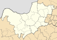
 MBD
MBDRunways Direction Length Surface m ft 04/22 4,500 14,764 Asphalt Sources: South African AIP[1], DAFIF[2][3] Mafikeng Airport or Mmabatho Airport (IATA: MBD, ICAO: FAMM) is an airport serving Mafikeng and Mmabatho, the current and former capital cities of the North West province in South Africa.
Contents
Facilities
The airport resides at an elevation of 4,181 feet (1,274 m) above mean sea level. It has one runway designated 04/22 with an asphalt surface measuring 4,500 by 45 metres (14,764 × 148 ft).[1]
Airlines and destinations
Airlines Destinations South African Airways operated by Airlink Johannesburg See also
References
- ^ a b "Aerodrome chart for MAFIKENG - FAMM" (PDF). South African Civil Aviation Authority. Effective 14 Jan 2010. http://www.caa.co.za/resource%20center/Charts/AERONAUTICAL%20CHARTS/M/FAMM_MAFIKENG/AD_01/FAMM_AD_01.pdf.
- ^ Airport information for FAMM from DAFIF (effective October 2006)
- ^ Airport information for MBD at Great Circle Mapper. Source: DAFIF (effective Oct. 2006).
External links
- Current weather for Mafikeng Intl. Ad, South Africa (FAMM) at NOAA/NWS
- Accident history for Mmabatho Mafikeng International Airport (MBD / FAMM) at Aviation Safety Network
 Passenger airports of South Africa
Bloemfontein Airport · Cape Town International Airport · East London Airport · George Airport · K. D. Matanzima Airport (Mthatha) · Kimberley Airport · King Shaka International Airport (Durban) · Kruger Mpumalanga International Airport (Nelspruit) · Lanseria International Airport (Johannesburg) · Mafikeng Airport · Mala Mala Airport · OR Tambo International Airport (Johannesburg) · Pietermaritzburg Airport · Pilanesberg International Airport · Polokwane International Airport · Port Elizabeth Airport · Richards Bay Airport · Upington Airport · Wonderboom Airport (Pretoria)
Categories:- Airports in South Africa
- North West (South African province)
- Transport in North West (South African province)
- Southern African airport stubs

Wikimedia Foundation. 2010.