- The Palisades (Hudson River)
-
For other uses, see Palisades (disambiguation).
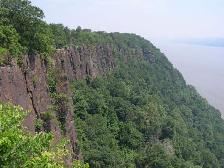
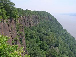 The cliffs of the Palisades as seen from a scenic view on the Palisades Interstate Parkway. The Hudson River is the background.
The Palisades, also called the New Jersey Palisades or the Hudson Palisades are a line of steep cliffs along the west side of the lower Hudson River in northeastern New Jersey and southern New York in the United States. The cliffs stretch north from Jersey City approximately 20 mi (32 km) to near Nyack, New York. They rise nearly vertically from near the edge of the river, approximately 300 feet at Weehawken and increasing gradually in height to 540 feet near their northern terminus.[1] From Fort Lee north the Palisades are part of Palisades Interstate Park and are a National Natural Landmark.
The Palisades and are among the most dramatic geologic features in the vicinity of New York City, forming a canyon of the Hudson north of George Washington Bridge, as well as providing a vista of the skyline.
Palisade is derived from the same root as word pale, ultimately from the Latin word palus, meaning stake. The Lenape called the cliffs "rocks that look like rows of trees" in a phrase that has become Weehawken, and is the name of the town which sits at the top of the cliffs across from Manhattan.
Contents
Geology
Main article: Palisades SillThe cliffs are the margin of a diabase sill, formed about 200 million years ago[2] at the close of the Triassic Period by the intrusion of molten magma upward into sandstone. The molten material cooled and solidified before reaching the surface. Water erosion of the softer sandstone left behind the columnar structure of harder rock that exists today. The cliffs are about 300 ft (100 m) thick in sections and originally may have reached to 1,000 ft (300 m).
History
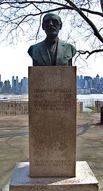 A monument on Boulevard East of Thomas M. Donnelly, whose contributions helped save the Palisades.
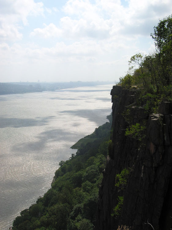
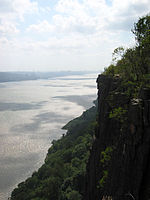 Looking south down the Hudson from the Palisades
The Palisades appear on the first European map of the New World, made by Gerardus Mercator in 1541 based on the description given him by Giovanni da Verrazano,[3] who suggested they look like a "fence of stakes".[4]
In the 19th century, the cliffs were widely quarried for railroad ballast, leading to local efforts to preserve them. Beginning in the 1890s, several unsuccessful efforts were made to turn much of the Highlands into a forest preserve. Fearing that they would soon be put out of business, quarry operators responded by working faster: in March 1898 alone, more than three tons of dynamite was used to bring down Washington Head and Indian Head in Fort Lee, New Jersey producing several million cubic yards of traprock. The following year,[3] work by the New Jersey Federation of Women's Clubs led to the creation of Palisades Interstate Park Commission, headed by George W. Perkins, which was authorized to acquire land between Fort Lee and Piermont, New York; its jurisdiction was extended to Stony Point, New York in 1906.
In 1908, the State of New York announced plans to move Sing Sing Prison to Bear Mountain. Work was begun on the area near Highland Lake (renamed Hessian Lake) and in January 1909, the state purchased the 740-acre (3.0 km2) Bear Mountain tract. Conservationists, inspired by the work of the Palisades Interstate Park Commission lobbied successfully for the creation of the Highlands of the Hudson Forest Preserve. However, the prison project was continued.
Mary Averell Harriman, whose husband, Union Pacific Railroad president E. H. Harriman died in September of that year, offered the state another 10,000 acres (40 km2) and one million dollars toward the creation of a state park. George W. Perkins, with whom she had been working, raised another $1.5 million from a dozen wealthy contributors including John D. Rockefeller and J. Pierpont Morgan. New York state appropriated a matching $2.5 million and the state of New Jersey appropriated $500,000 to build the Henry Hudson Drive (which would be succeeded by the Palisades Interstate Parkway in 1947). Ultimately the Sing Sing relocation was discontinued.
In June 1983, the Palisades were designated a National Natural Landmark by the National Parks Service.[5]
The land is now a part of Palisades Interstate Park, a popular destination for hiking and other outdoor recreational activities, that also includes Harriman-Bear Mountain State Park, Minnewaska State Park Preserve and several other parks and historic sites in the region.
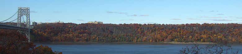 The Palisades, with fall foliage. On the left is the George Washington Bridge.
See also
- Hudson River Waterfront Walkway
- Palisades Interstate Parkway
- List of National Natural Landmarks
- Long Path
- New York-New Jersey Highlands
- New York-New Jersey Line War
Notes
- ^ https://sites.google.com/site/bergencogenweb/home/history/township-borough-histories/township-of-palisade
- ^ Tirella, Tricia. "Spotlight on North Bergen". Palisade magazine; Summer 2010; Page 16.
- ^ a b Cheslow, Jerry (December 14, 1997). "Alpine, N.J.; Lavish Homes in a Millionaire's Borough". If You're Thinking of Living In/. New York Times. http://www.nytimes.com/1997/12/14/realestate/if-you-re-thinking-living-alpine-nj-lavish-homes-millionaire-s-borough.html?scp=1&sq=Alpine,%20N.J.;%20Lavish%20Homes%20in%20a%20Millionaire's%20Borough&st=cse. Retrieved 2011-02-28.
- ^ http://www.northbergenreporter.com/view/full_story/2416155/article-Preserving-Palisades-from-development-Commissioners-also-tackle-road-repairs--hybrid-car?
- ^ NPS NNL Summary
External links
- Palisades Interstate Park
- Saving the Palisades Documentary, shown at Weehawken Public Library, portrays women's role in preserving cliffs, by Jim Hague, Hudson Reporter
Coordinates: 40°57′52″N 73°54′31″W / 40.964507°N 73.908591°W
Categories:- Cliffs of the United States
- Geography of Hudson County, New Jersey
- Geography of Bergen County, New Jersey
- Geography of Rockland County, New York
- Hudson River
- Landforms of New Jersey
- Palisades Interstate Park system
- National Natural Landmarks in New Jersey
- National Natural Landmarks in New York
- Regions of New Jersey


Wikimedia Foundation. 2010.