- Gornozavodsky District
-
Gornozavodsky District (English)
Горнозаводский район (Russian)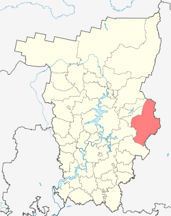
Location of Gornozavodsky District on the map of Perm KraiAdministrative status (as of 2010) Country Russia Federal subject Perm Krai[1] Administrative center town of Gornozavodsk[1] Statistics Area (municipal district) 7,057 km2 (2,725 sq mi)[2] Population (2010 Census,
preliminary)26,059 inhabitants[3] Population (2002 Census) 30,172 inhabitants[4] - Urban population 93.1% - Rural population 6.9% Density 4 /km2 (10 /sq mi)[5] Time zone YEKST (UTC+06:00)[6] Established November 4, 1965[2] Gornozavodsky District (Russian: Горнозаво́дский райо́н) is an administrative district (raion) of Perm Krai, Russia; one of the thirty-three in the krai. Municipally, it is incorporated as Gornozavodsky Municipal District. The area of the district is 7,057 square kilometers (2,725 sq mi).[2] Its administrative center is the town of Gornozavodsk.[1] District's population: 26,059 (2010 Census preliminary results);[3] 30,172 (2002 Census);[4] 38,004 (1989 Census).[7] Population of Gornozavodsk accounts for 46.3% of the district's population.[3]
Contents
Geography
The district is located on the western slopes of the Ural Mountains. The relief is hilly in the west and mountainous in the east. Climate changes from southwest to northeast, where it becomes more cold and humid. Main rivers include the Vilva, the Vizhay, the Koyva, and the Usva River.
A part of the Basegi Nature Reserve occupies the north of the district.
History
Human settlement of this territory started in the early 17th century, when iron ore was found. Several metallurgical plants were later constructed. In the end of the 19th century, the Perm–Yekaterinburg was constructed, contributing to the development of the region. The district in its modern borders was established on November 4, 1965.[2]
Demographics
Most of the inhabited localities in the district are concentrated along the Perm-Nizhny Tagil railroad and along the Koyva River.
Ethnically, Russians account for 88.4% of the population, Tatars are distant second at 4.9%, followed by Ukrainians at 1.7%.[2]
Economy
Manufacture of building materials, and timber and metallurgical industries form the basis of the district's economy.[citation needed]
References
- ^ a b c Law #416-67, Appendix, Section 4
- ^ a b c d e Encyclopedia of Perm Krai. Entry on Gornozavodsky District (Russian)
- ^ a b c Федеральная служба государственной статистики (Federal State Statistics Service) (2011). "Предварительные итоги Всероссийской переписи населения 2010 года (Preliminary results of the 2010 All-Russian Population Census)" (in Russian). Всероссийская перепись населения 2010 года (All-Russia Population Census of 2010). Federal State Statistics Service. http://www.perepis-2010.ru/results_of_the_census/results-inform.php. Retrieved 2011-04-25.
- ^ a b Федеральная служба государственной статистики (Federal State Statistics Service) (2004-05-21). "Численность населения России, субъектов Российской Федерации в составе федеральных округов, районов, городских поселений, сельских населённых пунктов – районных центров и сельских населённых пунктов с населением 3 тысячи и более человек (Population of Russia, its federal districts, federal subjects, districts, urban localities, rural localities—administrative centers, and rural localities with population of over 3,000)" (in Russian). Всероссийская перепись населения 2002 года (All-Russia Population Census of 2002). Federal State Statistics Service. http://www.perepis2002.ru/ct/doc/1_TOM_01_04.xls. Retrieved 2010-03-23.
- ^ The value of density was calculated automatically by dividing the 2010 Census population by the area specified in the infobox. Please note that this value may not be accurate as the area specified in the infobox does not necessarily correspond to the area of the entity proper or is reported for the same year as the population.
- ^ Правительство Российской Федерации. Постановление №725 от 31 августа 2011 г. «О составе территорий, образующих каждую часовую зону, и порядке исчисления времени в часовых зонах, а также о признании утратившими силу отдельных Постановлений Правительства Российской Федерации». Вступил в силу по истечении 7 дней после дня официального опубликования. Опубликован: "Российская Газета", №197, 6 сентября 2011 г. (Government of the Russian Federation. Resolution #725 of August 31, 2011 On the Composition of the Territories Included into Each Time Zone and on the Procedures of Timekeeping in the Time Zones, as Well as on Abrogation of Several Resolutions of the Government of the Russian Federation. Effective as of after 7 days following the day of the official publication).
- ^ "Всесоюзная перепись населения 1989 г. Численность наличного населения союзных и автономных республик, автономных областей и округов, краёв, областей, районов, городских поселений и сёл-райцентров. (All Union Population Census of 1989. Present population of union and autonomous republics, autonomous oblasts and okrugs, krais, oblasts, districts, urban settlements, and villages serving as district administrative centers.)" (in Russian). Всесоюзная перепись населения 1989 года (All-Union Population Census of 1989). Demoscope Weekly (website of the Institute of Demographics of the State University—Higher School of Economics. 1989. http://demoscope.ru/weekly/ssp/rus89_reg.php. Retrieved 2010-03-23.
Sources
- Законодательное собрание Пермской области. Закон №416-67 от 28 февраля 1996 г. «Об административно-территориальном устройстве Пермского края», в ред. Закона №652-ПК от 29 июня 2010 г «О распространении действия Закона Пермской области "Об административно-территориальном устройстве Пермской области" на территорию Пермского края и внесении в него изменений». Вступил в силу с момента опубликования. Опубликован: "Звезда", №38, 12 марта 1996 г. (Legislative Assembly of Perm Oblast. Law #416-67 of February 28, 1996 On the Administrative-Territorial Structure of Perm Krai, as amended by the Law #652-PK of June 29, 2010 On Expanding the Scope of the Law of Perm Oblast "On the Administrative-Territorial Structure of Perm Oblast" to Cover the Territory of Perm Krai and on Amending the Law. Effective as of the moment of publication).
Administrative divisions of Perm Krai 
Cities and towns Alexandrovsk · Berezniki · Chaykovsky · Cherdyn · Chernushka · Chusovoy · Chyormoz · Dobryanka · Gornozavodsk · Gremyachinsk · Gubakha · Kizel · Krasnokamsk · Krasnovishersk · Kudymkar · Kungur · Lysva · Nytva · Ochyor · Okhansk · Osa · Solikamsk · Usolye · Vereshchagino
Administrative districts Bardymsky · Beryozovsky · Bolshesosnovsky · Chastinsky · Cherdynsky · Chernushinsky · Gornozavodsky · Ilyinsky · Karagaysky · Kishertsky · Krasnovishersky · Kungursky · Kuyedinsky · Nytvensky · Ochyorsky · Okhansky · Oktyabrsky · Ordinsky · Osinsky · Permsky · Sivinsky · Solikamsky · Suksunsky · Uinsky · Usolsky · Vereshchaginsky · YelovskyDistricts of Komi-Permyak Okrug Gaynsky · Kochyovsky · Kosinsky · Kudymkarsky · Yurlinsky · YusvinskyCategories:- Districts of Perm Krai
- States and territories established in 1965

Wikimedia Foundation. 2010.