- Dwale, Kentucky
-
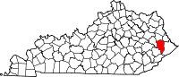
Dwale — Census Designated Place — Dwale's position in Kentucky.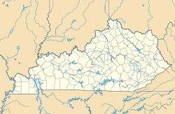
 Dwale
DwaleCoordinates: 37°37′15″N 82°43′38″W / 37.62083°N 82.72722°WCoordinates: 37°37′15″N 82°43′38″W / 37.62083°N 82.72722°W Country  United States
State  Kentucky
County Floyd Elevation 244 m (801 ft) Time zone Eastern (EST) (UTC-5) - Summer (DST) EDT (UTC-4) ZIP Code GNIS feature ID 2629606 U.S. Geological Survey Geographic Names Information System: Dwale, Kentucky Dwale is a census-designated place in Floyd County, Kentucky, United States.[1] The 2010 United States Census reported that Dwale’s population is 329, of which 312 persons are white and 9 persons are Asian.[2]
References
- ^ "Feature Detail Report for: Dwale, Kentucky." USGS. U.S. Geological Survey Geographic Names Information System: Dwale, Kentucky Retrieved May 12, 2011.
- ^ http://factfinder2.census.gov/faces/tableservices/jsf/pages/productview.xhtml?pid=DEC_10_PL_GCTPL1.ST10&prodType=table 2010 US Census report for Kentucky
Municipalities and communities of Floyd County, Kentucky County seat: Prestonsburg Cities Allen | Martin | Prestonsburg | Wayland | Wheelwright
CDPs Unincorporated
communitiesCategories:- Populated places in Floyd County, Kentucky
- Census-designated places in Kentucky
- Kentucky geography stubs


Wikimedia Foundation. 2010.