Dupont, Pointe Coupee Parish, Louisiana
- Dupont, Pointe Coupee Parish, Louisiana
-
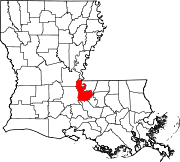
Dupont is an unincorporated community in southeastern Pointe Coupee Parish, Louisiana, United States. The community is located along Louisiana Highway 413, north of the community of Jarreau. The area falls under the service of the nearby Jarreau Post Office.
History
In 1902, a group of men gathered on the island side of False River to come up with a new name for the post office what was designated to be opened in their area. After the community could not agree on a new name, Pierre Guidroz suggested that the new community be named Dupont. A box of Dupont shotgun shells was in full view and the committee decided on that name. After World War II, the post office was closed[1].
References
Wikimedia Foundation.
2010.
Look at other dictionaries:
National Register of Historic Places listings in Pointe Coupee Parish, Louisiana — Location of Pointe Coupee Parish in Louisiana This is a list of the National Register of Historic Places listings in Pointe Coupee Parish, Louisiana. This is intended to be a complete list of the properties on the National Register of Historic… … Wikipedia
Dupont — Dupont, DuPont, Du Pont, or du Pont may refer to: Contents 1 Companies 2 Places in the United States 3 People 4 Other Comp … Wikipedia
Dupont, Louisiana — may refer to the following places: Dupont, Avoyelles Parish, Louisiana Dupont, Pointe Coupee Parish, Louisiana See also Dupont (disambiguation) This disambiguation page lists articles about distinct geographical locations with the same name. If… … Wikipedia
Louisiana Highway 413 — Infobox LA Highway type=State route=413 map custom=yes length mi=23.6 length round=1 formed=1955 renumbering dir1=North dir2=South from=New Roads, LA in Pointe Coupee Parish junction= to= in West Baton Rouge Parish previous type=State previous… … Wikipedia
New Roads, Louisiana — Coordinates: 30°41′47″N 91°26′20″W / 30.69639°N 91.43889°W / 30.69639; 91.43889 … Wikipedia
Morganza, Louisiana — Coordinates: 30°44′08″N 91°36′36″W / 30.73556°N 91.61°W / 30.73556; 91.61 … Wikipedia
McCrea, Louisiana — McCrea is a small, unincorporated community on the east bank of the Atchafalaya River in the northwestern portion of Pointe Coupee Parish, Louisiana (USA). it is located along Louisiana Highway 417, some distance north of East Krotz Springs,… … Wikipedia
Oscar, Louisiana — Coordinates: 30°37′15″N 91°27′03″W / 30.62083°N 91.45083°W / 30.62083; 91.45083 … Wikipedia
Mix, Louisiana — Mix is an unincorporated community in Pointe Coupee Parish, Louisiana, United States. It is the home of the Parlange Plantation House, a National Historic Landmark. It is located along Louisiana Highway 1, south of New Roads, Louisiana. Mix is… … Wikipedia
Chenal, Louisiana — Coordinates: 30°36′45″N 91°22′47″W / 30.6125°N 91.37972°W / 30.6125; 91.37972 … Wikipedia