- Duncorn Hill
-
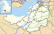

Duncorn Hill is a rounded hill with a flat top by the Fosse Way, on the limestone plateau south of Bath in Somerset, England. It is 585 feet above sea level and is a landmark.[1] Its name is from the Celtic din for fort and corn meaning horn-shaped.[2]
Contents
Geology
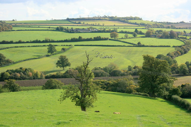
 The northern slopes of Duncorn Hill, as seen from SE of Wilmington
The bedrock is sedimentary limestone of the Great Oolite layer.[3] This is typically covered with a soil layer of 5-6 inches. The soil is mostly brown or greyish brown but there are some yellow patches. The drainage on the hill is good.[4]
The hill contains deposits of fuller's earth[5] and these have been analysed for their content of fossil shellfish.[6]
History
There may have been a Bronze or Iron Age hill fort there.[7][8] Field investigations on the fort were made in 1966,[9] but no evidence was found. The scarps which had been seen from the road and were thought to provide evidence of a man made structure were found to be natural geological formations. There was also no sign of the cairn or pile of stones which had been described in the 18th century,[10] but in 1975, Ralph Whitlock wrote of hilltop earthworks that were occupied in Iron Age times.[11]
References
- ^ "Appendix 8 Rural Landscapes of Bath and North East Somerset", World Heritage Site Setting Study, 2003, https://bathnes.gov.uk/SiteCollectionDocuments/Environment%20and%20Planning/World%20Heritage%20Site%20Setting%20Study%20rev4%20current%2022-10-09%20WEB%20VERSION%20PART%205.pdf, "...and Duncorn Hill. These are important landmarks within the area."
- ^ David Higgins (2006), The Bristol region in the sub-Roman and early Anglo-Saxon periods, Historical Association
- ^ Geological Survey of Great Britain, Charles Fox-Strangways, Horace Bolingbroke Woodward (1894). The Jurassic rocks of Britain. Printed for H.M. Stationery off., by Eyre and Spottiswoode. pp. 97. http://books.google.com/books?id=YW0RAAAAIAAJ&pg=PA97&dq=%22Duncorn+Hill%22&hl=en&ei=QQh6TaGAIY2isAPn6oH_Ag&sa=X&oi=book_result&ct=result&resnum=4&ved=0CEEQ6AEwAw#v=onepage&q=%22Duncorn%20Hill%22&f=false.
- ^ The Journal of the South Eastern Agricultural College (University of London) (41-44): 191–195, 1938
- ^ Geological Survey of Great Britain, Museum of Economic Geology in London (1876). Memoirs of the Geological Survey of Great Britain and the Museum of Economic Geology in London. H.M.S.O.. pp. 126, 131.
- ^ William Stuart Mckerrow (February 1953), "Variation in the Terebratulacea of the Fuller's Earth Rock", Quarterly Journal of the Geological Society 109: 97–124, doi:10.1144/GSL.JGS.1953.109.01-04.06
- ^ Field investigations
- ^ Geology of East Somerset and the Bristol coal-fields. Horace Bolingbroke Woodward, Frank Rutley, Robert Etheridge. 1876. pp. 126, 131, 261. http://books.google.co.uk/books?id=kfe7AAAAIAAJ&q=duncorn+hill&dq=duncorn+hill&hl=en&ei=pes9Tbu3BMHKhAeV16CQCg&sa=X&oi=book_result&ct=result&resnum=2&ved=0CCwQ6AEwAQ.
- ^ "Duncorn Hill". Fortified England. http://www.fortifiedengland.com/Home/Categories/ViewItem/tabid/61/Default.aspx?IID=1415. Retrieved 16 January 2011.
- ^ "Monument No. 204516". Pastscape. English Heritage. http://www.heritagegateway.org.uk/Gateway/Results_Single.aspx?uid=204516&resourceID=2. Retrieved 24 January 2011.
- ^ Somerset. Batsford. 1975. pp. 55.
External links
Categories:- Somerset geography stubs
- History of Somerset
- Hill forts in Somerset
- Iron Age Britain

Wikimedia Foundation. 2010.