- Drslavice (Uherské Hradiště District)
-
Drslavice — Municipality — 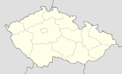
 Drslavice
Coordinates: 49°2′51″N 17°36′4″E / 49.0475°N 17.60111°ECoordinates: 49°2′51″N 17°36′4″E / 49.0475°N 17.60111°E Country  Czech Republic
Region Zlín District Uherské Hradiště Area – Total 7.9 km2 (3.1 sq mi) Elevation 204 m (669 ft) Population (2006) – Total 514 – Density 65.1/km2 (168.5/sq mi) Postal code 687 33 Website http://www.drslavice.cz Drslavice is a village and municipality (obec) in Uherské Hradiště District in the Zlín Region of the Czech Republic.
The municipality covers an area of 7.9 square kilometres (3.1 sq mi), and has a population of 514 (as at 28 August 2006).
Drslavice lies approximately 11 kilometres (7 mi) east of Uherské Hradiště, 22 km (14 mi) south of Zlín, and 257 km (160 mi) south-east of Prague.
References
People
- Adolf Jellinek, rabbi
Towns, městyse and villages of Uherské Hradiště District Babice • Bánov • Bílovice • Bojkovice • Boršice • Boršice u Blatnice • Břestek • Březolupy • Březová • Buchlovice • Bystřice pod Lopeníkem • Částkov • Dolní Němčí • Drslavice • Hluk • Horní Němčí • Hostějov • Hostětín • Hradčovice • Huštěnovice • Jalubí • Jankovice • Kněžpole • Komňa • Korytná • Košíky • Kostelany nad Moravou • Kudlovice • Kunovice • Lopeník • Medlovice • Mistřice • Modrá • Nedachlebice • Nedakonice • Nezdenice • Nivnice • Ořechov • Ostrožská Lhota • Ostrožská Nová Ves • Osvětimany • Pašovice • Pitín • Podolí • Polešovice • Popovice • Prakšice • Rudice • Salaš • Slavkov • Staré Hutě • Staré Město • Starý Hrozenkov • Strání • Stříbrnice • Stupava • Suchá Loz • Šumice • Sušice • Svárov • Topolná • Traplice • Tučapy • Tupesy • Uherské Hradiště • Uherský Brod • Uherský Ostroh • Újezdec • Vápenice • Vážany • Velehrad • Veletiny • Vlčnov • Vyškovec • Záhorovice • Žítková • Zlámanec • ZlechovCategories:- Populated places in Uherské Hradiště District
- Uherské Hradiště District
- Villages in the Czech Republic
- Shtetls
- Zlín Region geography stubs
- Jewish history stubs

Wikimedia Foundation. 2010.