- Don Phut District
-
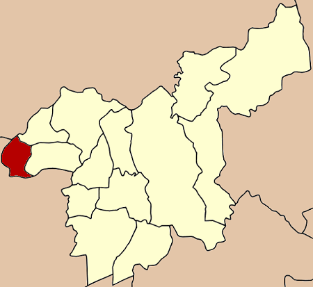
Don Phut
ดอนพุด— Amphoe — Amphoe location in Saraburi Province
Coordinates: 14°35′32″N 100°37′42″E / 14.59222°N 100.62833°ECoordinates: 14°35′32″N 100°37′42″E / 14.59222°N 100.62833°E Country  Thailand
Province Saraburi Seat Don Phut Tambon Muban Amphoe established Area – Total 58.714 km2 (22.7 sq mi) Population (2000) – Total 6,957 – Density 118.5/km2 (306.9/sq mi) Time zone THA (UTC+7) Postal code 18210 Geocode 1907 Don Phut (Thai: ดอนพุด) is a district (Amphoe) in the western part of Saraburi Province, Thailand.
Contents
History
Tambon Don Phut, Dong Ta Ngao, Ban Luang and Phai Lio were separated from Ban Mo district to create the minor district (King Amphoe) Don Phut on May 31, 1971.[1] It was official upgraded to a full district on November 4, 1993.[2]
Most of people in this district are Phuan who migrated from Chiang Khong, Luang Phrabang and Vientiane in the reign of King Rama II.
Geography
Neighboring district are (from the north clockwise) Mueang Lopburi of Lopburi Province, Nong Don and Ban Mo of Saraburi Province, Tha Ruea, Nakhon Luang, Maha Rat and Ban Phraek of Ayutthaya Province.
Administration
The district is subdivided into 4 subdistricts (tambon), which are further subdivided into 28 villages (muban). Don Phut has township (thesaban tambon) status and covers all the tambon except Dong Ta Ngau. Dong Ta Ngau is administrated by a Tambon Administrative Organization (TAO), the only one in the district.
No. Name Thai name Villages Inh. 1. Don Phut ดอนพุด 5 1,615 2. Phai Lio ไผ่หลิ่ว 7 1,352 3. Ban Luang บ้านหลวง 7 1,701 4. Dong Ta Ngao ดงตะงาว 9 2,034 References
- ^ "ประกาศกระทรวงมหาดไทย เรื่อง แบ่งท้องที่ตั้งเป็นกิ่งอำเภอ" (in Thai). Royal Gazette 88 (59 ง special): 12. June 4 1971. http://www.ratchakitcha.soc.go.th/DATA/PDF/2514/D/059/12.PDF.
- ^ "พระราชกฤษฎีกาตั้งอำเภอลำทับ อำเภอร่องคำ อำเภอเวียงแหง อำเภอนาโยง อำเภอแก้งสนามนาง อำเภอโนนแดง อำเภอบ้านหลวง อำเภอกะพ้อ อำเภอศรีบรรพต อำเภอแก่งกระจาน อำเภอหนองสูง อำเภอสบเมย อำเภอเมยวดี อำเภอโคกเจริญ อำเภอทุ่งหัวช้าง อำเภอผาขาว อำเภอวังหิน อำเภอดอนพุด อำเภอบึงโขงหลง และอำเภอห้วยคต พ.ศ. ๒๕๓๖" (in Thai). Royal Gazette 110 (179 ก special): 1–3. November 3 1993. http://www.ratchakitcha.soc.go.th/DATA/PDF/2536/A/179/1.PDF.
External links
Mueang Saraburi · Kaeng Khoi · Nong Khae · Wihan Daeng · Nong Saeng · Ban Mo · Don Phut · Nong Don · Phra Phutthabat · Sao Hai · Muak Lek · Wang Muang · Chaloem Phra Kiat
Categories:- Amphoe of Saraburi
- Central Thailand geography stubs
Wikimedia Foundation. 2010.