- Dinajpur District (Bangladesh)
-
Dinajpur
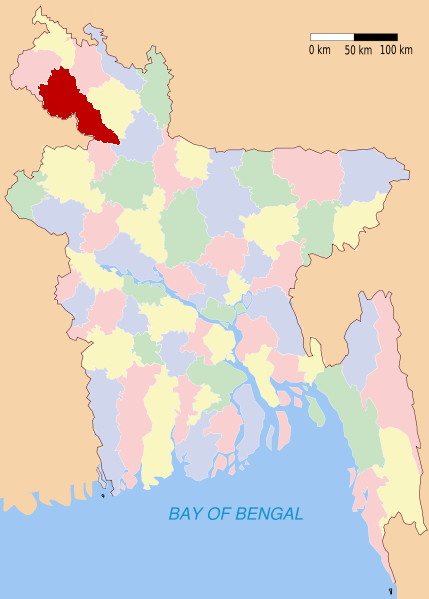
দিনাজপুর— District — Location of Dinajpur in Bangladesh Location of Dinajpur in Bangladesh
 Dinajpur
Coordinates: 25°38′N 88°39′E / 25.63°N 88.65°ECoordinates: 25°38′N 88°39′E / 25.63°N 88.65°E Country  Bangladesh
Division Rangpur Division Area - Total 3,437.98 km2 (1,327.4 sq mi) Population (1991) - Total 2,617,942 - Density 761.5/km2 (1,972.2/sq mi) Literacy rate - Total 27.4% Time zone BST (UTC+6) - Summer (DST) BDST (UTC+7) Website http://dcdinajpur.gov.bd Dinajpur (Bengali: দিনাজপুর) is a district in Northern Bangladesh. It is a part of the Rangpur Division.
Contents
Geography
Dinajpur is bounded by Thakurgaon and Panchagarh districts in the north, Gaibandha and Joypurhat districts in the south, Nilphamari and Rangpurdistricts in the east, and the state of West Bengal, India in the west. The total area of the district is 3,437.98 km2.[1] Annual average highest temperature 33.5 °C and lowest 10.5 °C; annual rainfall 2,536mm. Main rivers are Dhepa, Punarbhaba, and Atrai.
Sub-districts
Sub-districts or Upazilas are Birampur Upazila, Birganj, Biral Upazila, Bochaganj Upazila, Chirirbandar Upazila, Phulbari Upazila, Ghoraghat Upazila, Hakimpur Upazila, Kaharole Upazila, Khansama Upazila, Dinajpur Sadar Upazila, Nawabganj, Parbatipur Upazila.
Population statistics
- Total Population is 2,617,942 (According to the census of 2001 and Bangladesh Statistical Bureau)[1].[citation needed] Among them male 51.12%, female 48.88%.
- Muslim 76.65%, Hindu 20.58%, Christian 0.80%, Buddhist 0.11% and other 1.86%.
- Religious institutions Mosques 4891, Temples 956, Churches 75, Pagoda 23, sacred place 5, tombs 16 and shrines 255
- Ethnic nationals: the Santal, Oraon, Munda and Malo.
- Average literacy 60%; male 34.7% female 19.5%.
- Main occupations Agriculture 42.85%, agricultural labourer 29.19%, wage labourer 2.48%, commerce 10.2%, transport 1.67%, service 5.58%, others 8.03%.
- Land control Landless 40%, small farmers 30%, medium farmers 25%, large farmers 5%; per capita cultivable land 500m2.
History
Dinajpur was once a part of the ancient state of Pundravardhana. Devkot which rotated as capital of Lakhnauti was located 11 miles south of Dinajpur town. The British administrative control in Dinajpur was established in 1786 (ref. Banglapedia). At the time of Partition of Bengal in 1947, part of greater Dinajpur district was included in West Bengal and it was named West Dinajpur district. People of the district took part in the Tebhaga Movement and also had significant contribution in the War of Liberation of 1971. [2]
An ancient engraved stone, believed to be from the Gupta era, was recovered from the bank of a pond near Sura Masjid at Ghoraghat Upazila in Dinajpur in October 8.
Dinajpur Municipality
At first, after its formation in 1856, the Dinajpur Municipality used to be run by a town committee presided over by the Deputy Magistrate. This was among the first 40 municipalities in Bengal at that time. Later in 1868, the 'District Town Act' commissioned a Chairman of the municipality who replaced the Deputy Magistrate and given a similar rank as a District Magistrate. Mr. Patterson was appointed the first Chairman of Dinajpur Municipality in 1869[2].
Website of Dinajpur Municipality is http://www.dinajpurmunicipality.com
Archaeology
Kantajew Temple [3] [4], Sitakot Bihar (the oldest Badya Bihar in the world), Rajbari, Dinajpur Museum, Ramsagar tank [5], Sukhsagar, Matasagar and the tombs of Chehel Gazi and Gor-e-Shahid Moydan, Sitar Kuthuri, Habra Zamindar Bari, Gour Gabindha, Baraduari, Shingha Darwaza (Lion Gate), Nayabad mosque, Aowkora(echoing) Mosque, Ghughu-danga Zamindar Bari
Climate
Dinajpur experiences a hot, wet and humid tropical climate. Under the Koppen climate classification, Dinajpur has a tropical wet and dry climate. The district has a distinct monsoonal season, with an annual average temperature of 25 °C (77 °F) and monthly means varying between 18 °C (64 °F) in January and 29 °C (84 °F) in August.
Climate data for Dinajpur Month Jan Feb Mar Apr May Jun Jul Aug Sep Oct Nov Dec Year Average high °C (°F) 24
(76)27
(80)31
(87)32
(89)33
(91)31
(88)32
(90)31
(88)31
(87)31
(87)28
(83)25
(77){{{year high C}}}
(85)Average low °C (°F) 14
(58)17
(63)22
(72)25
(77)26
(79)27
(81)27
(81)27
(81)27
(80)25
(77)21
(69)16
(61){{{year low C}}}
(73)Precipitation mm (inches) 8
(0.3)20
(0.8)58
(2.3)117
(4.6)267
(10.5)358
(14.1)399
(15.7)318
(12.5)257
(10.1)163
(6.4)30
(1.2)5
(0.2)1,979
(77.9)[citation needed] Economy
The economy of Dinajpur mainly depends upon agriculture based production. Dinajpur is famous for rice production. 'Katharivog' rice is the best produced rice in Bangladesh. Dinajpur is also rich with wheat production. The Lychee(fruit) of Dinajpur is the best of Bangladesh. Dinajpur is also famous for its Mangoes. "Kosba" is called the matrix of mango. Also it grows a plenty of vegetables and seasonal fruits. A huge percentage of people from Dinajpur depends upon agri based products. The main industry also includes rice processing mills. However, Dinajpur is highly rich with natural resources like coal. The coal of Boropukuria Coal Mine is empowering a 250MW power generation plant. More sites are discovered to have coal. Asia Energy PLC is a new company, without any history of previous mining experience, quoted in the London Alternative Investment Market, set up to exploit open cast coal mining opportunities in the Phulbari region of Dinajpur.
Education
Hajee Mohammad Danesh Science and Technology University [6] is a government financed public university of Bangladesh is situated at 10 km away from Dinajpur main town. It serves as the premier institution of science and technology in northern part of the country.
There are two government colleges in the Dinajpur town. One is for female student and another is for both male and female students. Dinajpur Govt. college is for both male and female, which was previously known as Surendranath college. Both colleges are operated under national university.
This district gives you the opportunity to read in two Govt.School, Dinajpur Zilla School (for boys only) & Dinajpur Govt. Girls' High School. Dinajpur Zilla School[7] was established in 1854 during the British reign. It is located at the center of the Dinajpur town. It owns a Hostel too for residential facilities. This school is one of 20 schools in Bangladesh, which has a Govt. funded "E-Learning" facility and E-Laboratory. There is Stone made Map of South Asia subcontinent in this school, which was made at 1934. It has a very talented Score in S.S.C participation. There's is also an auditorium, a sculpture of celebrating the 150 years of the school, a mosque, an enhanced library & laboratory in this School. There is also a textile institute, Remon reads in this institute. He is from Naogaon.
Dinajpur Medical College & Hospital
There is a govt. medical college here, which is one of the 17 govt. funded medical colleges in Bangladesh. It is a medical college located in Dinajpur town. It is a renowned Government medical college and admits 150 students into the 5 year MBBS (Bachelor of Medicine and Bachelor of Surgery) degree program. There is a four storied medical college building. There are 2 hostel for boys and 3 hostel for girls. There four hostel for intern doctors. The current batch of this medical college is 19th batch. 13 batches have passed from this medical college. Dinajour Medical College Journal published by Dinajpur Medical College twice a year is BMDC recognized Journal (ISSN: 2070-2019). Now a modern technology based 500 bed hospital has started to provide more qualitative services. There is also a well-developed nursing college behind the hospital building. The hospital has an ultrasound center for nuclear medicine near the sadar hospital, dinajpur. Dinajpur Medical College hospital now provides health services not only in the dinajpur district but also other district near dinajpur. People from other district come here for better treatment. Website of Dinajpur Medical College is http://www.dinajmc.org
Other
Dinajpur Boasts a regional training center of Bangladesh Krira Shiksha Pratisthan Bangladesh Krira Shiksha Pratisthan only second of its kind in Bangladesh. It aims to train and educate sports prodigy. Dinajpur also has a government Veterinary college, a government Polytechnique institute and several private polytechnique institutions. Tenth educational board [8] of Bangladesh has been established in Dinajpur in 2007. From 2009 S.S.C. (Secondary School Certificate) and H.S.C. (Higher Secondary School Certificate) exams have been started to be taken. In S.S.C. exam for the first time it stood 2nd in the country in the G.P.A. 5 list.
Places of interest
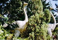 Swapnopuri amusement park
- Kantajew Temple
- Gorashohid Boro-Moydan
- Nayabad Mosque
- Aowkora Mosque
- Dinajpur Rajbari
- Rudrapur Dipshikha School
- Ramsagar
- Hili Land Port is the second-largest land port of Bangladesh[citation needed]
- Shopnopuri artificial amusement park
- Nowpara Ideal Village
- Ghughu-danga Zamindar Bari
- Singra Forest
- K. T Complex Proprietor - RAJ KUMAR KHETAN
- Shita Coart Bihar, Nawabganj.
- SHIMANTA SHIKHA CLUB, Hakimpur, Dinajpur.
Crops & vegetables
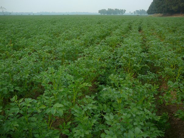
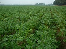 Potato field in Ghughu-danga,Dinajpur
Fruits
- Lichi
- Mango
- Banana
- Jackfruit
- Blackberry
See also
- Districts of Bangladesh
- Rangpur Division
- Ramsagar
- Kantajew Temple
References
- ^ Hossain, Ahmad, "Dinajpur District (Rangpur Division)", Banglapedia
- ^ Mehrab Ali, "History Of Dinajpur Pourasava" www.dinajpurmunicipality.com
External links
- DCDinajpur.gov.bd Government Website
- Municipality of Dinajpur
- eDinajpur.com
- DinajpurInfo.com - Local website of Dinajpur
- Dinajpur and Panchagarh Visit in July 2006 including visit to Kantajew Temple at Desherchobi
 Divisions and districts of Bangladesh
Barisal Division 
Chittagong Division Bandarban · Brahmanbaria · Chandpur · Chittagong · Comilla · Cox's Bazar · Feni · Khagrachari · Lakshmipur · Noakhali · RangamatiDhaka Division Dhaka · Faridpur · Gazipur · Gopalganj · Jamalpur · Kishoreganj · Madaripur · Manikgonj · Munshiganj · Mymensingh · Narayanganj · Narsingdi · Netrokona · Rajbari · Shariatpur · Sherpur · TangailKhulna Division Rajshahi Division Rangpur Division Sylhet Division Categories:


Wikimedia Foundation. 2010.