- Dhoki Dam
-
Dhoki Dam Official name Dhoki Dam Location Dhoki, Parner
IndiaCoordinates 19°10′21″N 74°25′5″E / 19.1725°N 74.41806°ECoordinates: 19°10′21″N 74°25′5″E / 19.1725°N 74.41806°E Opening date 1981 Demolition date N/A Owner(s) Government of Maharashtra, India Dam and spillways Type of dam Earth-fill (Earthen) Height 17.33 m (56.9 ft) Length 397 m (1,302 ft) Impounds Kalu River Reservoir Creates Dhoki lake Capacity 1,240 km3 (300 cu mi) Surface area 290 km2 (110 sq mi) Dhoki Dam (Marathi: ढोकी धरण ), is a earth-fill dam on Kalu river in Dhoki village in Parner taluka of Ahmednagar district of State of Maharashtra in India.
Contents
Specifications
The height of the dam above lowest foundation is 17.33 m (56.9 ft) while the length is 397 m (1,302 ft). The gross storage capacity is 1,270 km3 (300 cu mi).[1]
Purpose
- Irrigation
- Drinking water for neatest villages
See Also
- Dams in Parner taluka
- Parner taluka
- Ahmednagar district
References
Villages Akkalwadi · Alkuti · Apadhup · Astagaon · Babhulwade · Baburdi · Bhalwani · Bhandgaon · Bhondre · Bhoyre Gangarda · Chincholi · Chombhut · Daithane Gunjal · Darodi · Desawade · Devibhoaire · Dhawalpuri · Dhoki · Dhotre Bk · Diksal · Ganji Bhoyare · Gargundi · Garkhindi · Gatewadi · Ghanegaon · Goregaon · Gunaore · Hanga · Hattalkhindi · Hiware Korda · Jadhvawadi · Jamgaon · Jategaon · Jawala · Kadus · Kakane Wadi · Kalas · Kalkup · Kanhur Pathar · Karandi · Karegaon · Karjule Harya · Kasare · Katalwedha · Khadakwadi · Kinhi · Kohkadi · Kurund · Loni Haveli · Lonimawala · Mahskewadi · Map · Mandave Kd · Mawale Wadi · Mhasane · Mungashi · Nandur Pathar · Narayan Gawhan · Nighoj · Pabal · Padali Aale · Padali Darya · Padali Kanhur · Padali Ranjangaon · Palashi · Palspur · Palwe Bk · Palwe Kd · Panoli · Parner · Patharwadi · Pimpalgaon Rotha · Pimpalgaon Turk · Pimpalner · Pimpri Gawali · Pimpri Jalsen · Pimpri Pathar · Pokhari · Punewadi · Raitale · Ralegan Siddhi · Ralegan Therpal · Randhe · Ranjangaon Mashid · Renwadi · Rui Chatrapati · Sangvi Surya · Sarola Adwai · Sawargaon · Shanjapur · Sherikasare · Shirapur · Sidheshwar Wadi · Supa · Takali Dhokeshwar · Tikhol · Vesdare · Viroli · Wadegawhan Wadgaon Amali · Wadgaon Darya · Wadgaon Savtal · Wadner Bk · Wadner Haveli · Wadule · Wadzire · Waghunde Bk · Waghunde Kd · Walwane · Wankute · Wasunde · Yadavwadi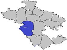
Large Dams Dhoki Dam · Hanga Dam · Lonimavla Dam · Mandohol Dam · Palashi Dam · Rui Chatrapati Dam · Tikhol DamEducation Societies Shree Hareshwar Education SocietySchools Shree Hareshwar VidyalayaColleges New Arts, Science and Commerce College, Parner · Shri Dhokeshwar MahavidyalayaProminent Personalities Categories:- Dams in Ahmednagar district
- Dams in Maharashtra
- Earth-filled dams

Wikimedia Foundation. 2010.