- Deoria Tal
-
Coordinates: 30°31′19.9″N 79°7′39.7″E / 30.522194°N 79.127694°E
Deoriatal 
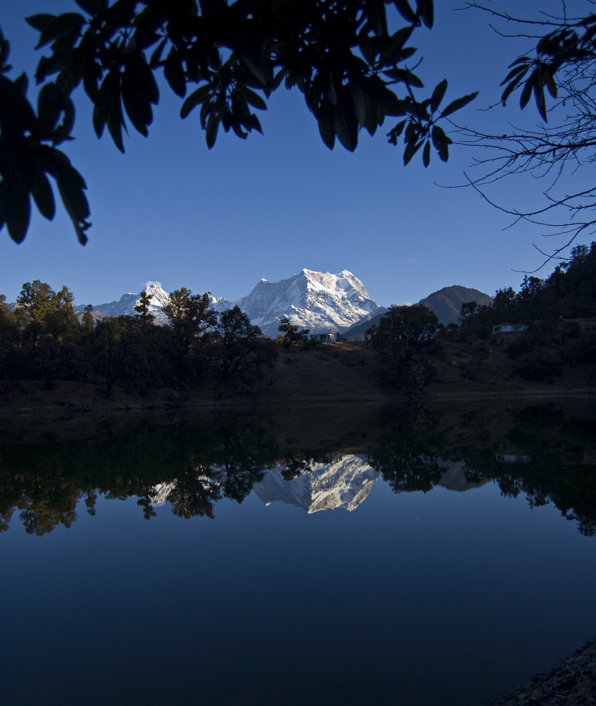
Reflection of Chaukhamba Peak in Deoria TalElevation 2,438 m (7,999 ft) Location Location Uttarakhand, India Range Garhwal Himalaya Deoria Tal (Also spelled as Devaria' or 'Deoriya) is a lake located about 3 km on an uphill trek from the villages of Mastura and Sari, on the Ukhimath-Chopta road in Uttarakhand. At an altitude of about 2387 meters, it has heavily wooded, lush green surroundings with snow covered mountains (Chaukhamba is one of them) in the backdrop. There are options of overnight camping, jungle trek etc. There are a couple of shops which sell tea and snacks, but these close at sundown. Trekkers usually combine this trek with the nearby trek to Tungnath (highest Hindu shrine devoted to Lord Shiva) and Chandrashila which are approached from Chopta.[1]
Contents
Access
Jeeps are available from Ukhimath to reach Sari, via Mastura. However in the time of returning one has to wait for ages for a jeep, or go down trekking to Mastura to search for share jeeps.[2]
Reasons for being a famous spot
The lake is mostly famous for its wide 300° panorama. Mountains like Chaukhamba, Nilkantha, Bandarpunch, Yellow Tooth, Kedar Range, Kalanag, etc. can be seen from here. There exists another route from Deoria Tal to Tungnath, which is mainly chosen as Night Camping, Jungle Trekking, etc.
In the Indian mythology
The legend is that the Devas bathed in this lake hence the name, the lake is also sometimes believed to be the "Indra Sarovar" referred to in the Puranas by wandering, Hindu mendicants Sadhus.[3] It is also believed that it was the place from where the mighty Pandavas were asked queries by Yaksha.[4]
References
External links
Categories:- Geography of Uttarakhand
Wikimedia Foundation. 2010.