- Lake Darling Dam
-
Lake Darling Dam 
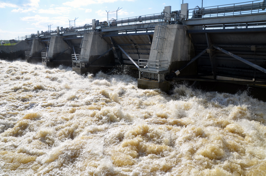
Lake Darling Dam releases 22,000 cubic feet per second (620 m3/s) on June 27 during 2011 Souris River flood.Location of Lake Darling Dam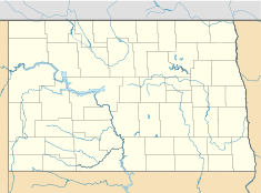

Country United States Location Minot Coordinates 48°27′27″N 101°35′00″W / 48.4575°N 101.5833333°WCoordinates: 48°27′27″N 101°35′00″W / 48.4575°N 101.5833333°W Status Operational Opening date 1936 Owner(s) United States Fish and Wildlife Service Dam and spillways Type of dam Embankment, earthen Height 39 ft (12 m) Length 3,300 ft (1,006 m) Impounds Souris River Reservoir Creates Lake Darling Capacity 110,000 acre·ft (135,683,002 m3) Catchment area 9,450 sq mi (24,500 km2) Surface area 15.6 sq mi (40 km2) Max. water depth 26 ft (8 m)[1] Lake Darling Dam is an earthen embankment dam on the Souris River located 20 mi (32 km) northwest of Minot, Ward County, North Dakota. The dam began impounding water in April 1936 and was completed July of that year. It was created for the purposes of water storage and conservation.[2] It is part of the Upper Souris National Wildlife Refuge and is owned by the United States Fish and Wildlife Service. The dam and lake are named after Jay N. "Ding" Darling, the first director of the Bureau of Biological Survey.[3]
Although the Fish and Wildlife Service owns the dam, its operation is controlled by the U.S. Army Corps of Engineers according to a 1989 memorandum of understanding.[4] During the 2011 Souris River flood, the dam's reservoir reached maximum levels and releases of 7,500 cu ft/s (210 m3/s) in early June, contributing to flooding downstream.[5][6] By June 26, releases had reached 24,000 cu ft/s (680 m3/s) and were being incrementally reduced thereafter.[7]
References
- ^ "Lake Water Quality Assessment for Lake Darling Renville and Ward Counties, North Dakota". North Dakota Department of Health Division of Water Qualit. March 2006. pp. 4. http://www.ndhealth.gov/wq/sw/Z7_Publications/LakeReports/DARLING_FINAL.pdf. Retrieved 26 June 2011.
- ^ "Red River of The North Basin". U.S. Geological Service. http://nd.water.usgs.gov/pubs/wdr/wdrnd001/htdocs/d.05115500sw00.html. Retrieved 26 June 2011.
- ^ "Upper Souris National Wildlife Refuge". Renville County, North Dakota. http://www.renvillecountynd.org/wildlife_refuge.htm. Retrieved 26 June 2011.
- ^ "Western Flood Control Sites – North Dakota: Lake Ashtabula, Homme Lake, Souris River". U.S. Army Corps of Engineers. http://www.mvp.usace.army.mil/fl_damage_reduct/default.asp?pageid=1468. Retrieved 26 June 2011.
- ^ Boughton, Kevin. "Souris to Rise Over the Weekend". KFYR-TV. doi:10 June 2011. http://www.kfyrtv.com/News_Stories.asp?news=49888. Retrieved 26 June 2011.
- ^ "Corps increases outflow from Lake Darling Dam". U.S. Army Corps of Engineers. 8 June 2011. http://www.mvp.usace.army.mil/pressroom/default.asp?pageid=1929. Retrieved 26 June 2011.
- ^ Fundingsland, Kim. "1,561.72: Souris crest sets record four feet higher". Minot Daily News. http://www.minotdailynews.com/page/content.detail/id/556174/1-561-72--Souris-crest-sets-record-four-feet-higher.html?nav=5010. Retrieved 28 June 2011.
Categories:- Dams in North Dakota
- Earth-filled dams
- Buildings and structures completed in 1936
- Buildings and structures in Ward County, North Dakota

Wikimedia Foundation. 2010.