- Cono Este
-
Cono Este — Sector — Location of Cono Este in the Lima province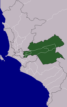
Country  Peru
PeruRegion Lima Province Lima Founded Districts Ate, Cieneguilla, Chaclacayo, El Agustino, Lurigancho, San Luis, Santa Anita Area - Total 620.74 km2 (239.7 sq mi) Elevation 861 m (2,825 ft) Population (2005 census) - Total 938,187 - Density 1,511.4/km2 (3,914.5/sq mi) Time zone PET (UTC-5) UBIGEO The Cono Este is one of the six areas that make up the Lima Metropolitan Area. It is located in the eastern part of the metropolis hence its name. The socioeconomic levels of its residents are varied. They mainly belong however to the middle class. Wealthier residents can be found in a few districts in this area as many Limeans move to this area to escape the cloudy winters of Lima. During the winter, this is the only area of Lima that is not permanently covered by fog. The most developed areas of this section are the urbanizations of Chosica and Chaclacayo. These areas are home to picturesque winter housing developments owned by Limeans seeking to escape the winter fog. The least developed are that of El Agustino which is populated by slum housing, and Cienguilla, which is mostly unurbanized. The district of Ate has to some extent undergone industrialization with several factories having been built there.
Districts
The following districts are part of the Cono Este:[1]
References
- ^ (Spanish) INEI, Characteristics per Cono and District, Retrieved October 31, 2007.
Lima and Callao Metropolitan Area Culture · History · Landmarks · Notable people · Mayors · Other elected officials · Transportation Districts Central Lima Breña · La Victoria · Lima · Rimac South Central Lima Barranco · Jesús María · La Molina · Lince · Magdalena · Miraflores · Pueblo Libre ·San Borja · San Isidro · San Miguel · Santiago de Surco · Surquillo Cono Este Ate · Cieneguilla · Chaclacayo · El Agustino · Lurigancho (Chosica) · San Juan de Lurigancho · San Luis · Santa Anita Cono Norte Ancón · Carabayllo · Comas · Independencia · Los Olivos · Puente Piedra · San Martin de Porres · Santa Rosa Cono Sur Chorrillos · Lurín · Pachacamac · Pucusana · Punta Hermosa · Punta Negra · San Bartolo · San Juan de Miraflores · Santa María del Mar · Villa el Salvador · Villa María del Triunfo Callao Bellavista · Callao District · Carmen de la Legua Reynoso· La Perla · La Punta · Ventanilla Categories:

Wikimedia Foundation. 2010.