- Guna Yala
-
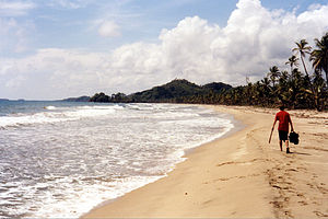 Main Land Beaches.
Guna Yala is an autonomous territory or comarca in Panama, inhabited by the Kuna indigenous people. The name means "Guna-land" or "Guna mountain" in the Kuna language. The area was formerly known as San Blas and afterwards as Kuna Yala, but it changed in October 2011 when the Panamanian Government recognized the Guna people's claim that in their native language there was no equivalent to the letter "K" and that the official name should be "Guna Yala" [citation needed]. The capital of Guna Yala is El Porvenir.
Contents
History
 The Flag of Kuna Yala was adopted in 1925.
The Guna revolution began on February 25, 1925 when an armed group attacked the Panamaniajn police stationed on the islands of Tupile and Ukupseni. The police had been involved in the violent suppression of Kuna cultural practices and had been abusing the populations of various communities. The revolution was led by Nele Kantule of Ustupu and Simral Colman of Aligandi. It took place after many meetings with the Panamanian government and even a delegation to the United States.
The flag of Guna Yala was adopted in 1925, and is based on a swastika design, an ancient symbol in Guna culture. A number of variations on the flag have existed over the years; red top and bottom bands instead of orange were previously used, and in 1942 a ring was added to the centre of the flag to differentiate it from the symbol of the Nazi party (this version subsequently fell into disuse).[1] To this day, different versions of the flag are used on different islands. The flag is most often seen on the islands which were directly involved with the revolution, such as Ustupu, Aligandi, and Ukupseni.
 An Island in San Blas and a Dugout.
The autonomous status of the Guna was officially recognized in 1930 in response to political pressure by Guna leaders. The Comarca of Guna Yala was established in 1938, under the name of Comarca de San Blas. The comarca was formed from the provinces of Colón and Panamá. The governmental structure of Kuna Yala is defined in the Carta Orgánica, of Law 16 of 1953. The Guna General Congress is the highest political authority of Guna Yala. It consists of representatives from all of the communities in Guna Yala and meets twice yearly. Each community has one vote regardless of population size. The Guna General Congress has a permanent office in Howard, in the former canal zone.
In April 2003, a meeting of representatives of the 68 Guna communities in the three comarcas of Guna Yala, Guna de Madugandí, and Guna de Wargandí, declared their desire to unite the three comarcas and were reprimanded by the Moscoso administration. The comarca is divided into three corrigimientos; Mulatupu, Aligandi, and Carti. Each corrigimiento is represented by one diputado in the national assembly of Panama. The governor of the comarca has an office in Porvenir. The comarca has no districts.
Geography
 Location of Kuna Yala in Panama
Guna Yala has an area of 924 square miles (2393 km²) and a population of 36,487 people (2004). The comarca consists of a strip of land stretching 232 miles (373 km) along the Caribbean coast of Panama, bordering Colombia and the province of Darién. The San Blas Islands, an archipelago of 365 islands, runs along the coast. About 36 of the islands are inhabited by Guna communities. An additional 13 communities are located on the mainland coast, for a total of 49 communities.
Biosphere reserve
Guna Yala also houses a biosphere reserve called the PEMASKY Nature Park. PEMASKY stands for Proyecto de Estudio para el Manejo de Areas Silvestres de Guna Yala (Study Project of Management of the Wilderness Areas of Guna Yala). It was a project started in 1983 and dissolved in the next century. The Pemasky Nature Park is still there and is located near Nusagandi.[2] This region is made to preserve both Guna-heritage, as well as the marine and land-ecosystems. The project aimed to do so by allowing the Guna-Indians to better handle their environment.[3][4]
Chief of state
Like other comarcas, the Guna Yala is directed by a governor. The acting governor in 2006 was Avelino Brenes.
Communities
Corregimiento de Carti
- Wichupwala
- Nalunega
- Gorbiski
- Carti Mamidup
- Uargandup
- Ailidup
- Orosdup
- Mandi Ubgigandup
- Arridup
- Narasgandup Dummad or Naranja Grande
- Narasgandup Bipi or Naranja Chica
- Akwadup
- Carti Sugdupu
- Carti Mulatupu
- Carti Yandup
- Carti Tupile
- Mirya Ubgigandup or Soledad Miria
- Dupir or San Ignacio de Tupile
- Mormakedup or Isla Maquina
- Mamardup
- Urgandi
- Nusadup
- Uargandup
- Yandup or Narganá
- Akwanusadup or Corazon de Jesus
- Digir or Tigre
- Tikantiki or Niadup
Corregimiento de Ailigandi
- Magebgandi
- Nabagandi
- Aidirgandi
- Ukupa
- Irgandi
Corregimiento de Mulatupu
- Isla Cuba
- Sukunya
- Yansipdiwar
- Anachukuna
- Armila
- Puerto Obaldia
Humanitarian work
In many cases the people lack adequate healthcare facilities and other basic needs. The Peace Corps has a substantial presence in the region, as does the Church of Jesus Christ of Latter-day Saints, both groups contributing to social, medical, agricultural and public-works projects. The Red Cross likewise contributes medical aid and services in some of the more densely populated regions, and other religious groups - including the Catholic Church and various Evangelical organizations - have presences there, though with more limited scope.
Tourism
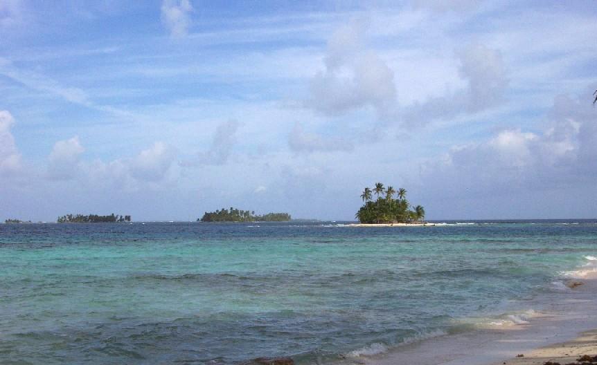
 Islands of the archipelago of San Blas.
Tourism is a force in the Guna economy. There are several Guna-run hotels in the archipelago offering ecotours, fishing, snorkeling, and touring of nearby villages. Most tourism in Guna Yala is centered in the region of Carti, where there is a greater number of uninhabited islands and beautiful beaches. Other popular areas for tourism include Ukupseni and Isla Pino.
With an estimated 365 islands in the Guna Yala territories, many tourists arrive from Panama City by plane and stay in small lodges run by locals where they have an opportunity to sleep in active fishing villages and during the day are shuttled over to vacant islands in motorized canoes for a day of swimming and lounging in hammocks. Many islands can be rented for as little as $2/USD per day.
The islands of the archipelago are also a world-famous destination for cruising sailors, some of whom spend months, or even years, anchored in the islands.[5][6]
See also
References
- ^ Panama - Native Peoples, from Flags of the World. Retrieved February 20, 2006.
- ^ Pemasky Parc location
- ^ PEMASKY
- ^ PEMASKY History
- ^ San Blas, by Jimmy Cornell. From Noonsite. Retrieved May 17, 2006.
- ^ Sitting Around the Pool, By Bernadette Bernon. From Cruising World. Retrieved May 17, 2006.
External links
Provinces Bocas del Toro · Chiriquí · Coclé · Colón · Darién · Herrera · Los Santos · Panamá · Veraguas

Comarcas indígenas
("Indigenous regions")Categories:- Comarcas of Panama
- States and territories established in 1938


Wikimedia Foundation. 2010.