- Col de Joux Plane
-
Col de Joux Plane 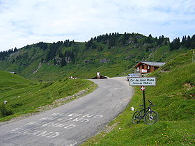
Col de Joux PlaneElevation 1700 m Traversed by D354 road Location Haute-Savoie,
 Col de Joux Plane
 France
Range Alps Coordinates 46°7′58″N 6°42′41″E / 46.13278°N 6.71139°ECoordinates: 46°7′58″N 6°42′41″E / 46.13278°N 6.71139°E Col de Joux Plane (el. 1700 m.) is a high mountain pass in the Alps in Haute-Savoie, France, linking Morzine with Samoëns. The climb has been featured several times in the Tour de France cycling race
Contents
Climb details
- Starting from Samoëns, the Col de Joux Plane is 11.7 km long with an average percentage of 8.5% and a maximum gradient of 10%.
- Starting from Morzine, the Col de Joux Plane is 10.9 km long with an average percentage of 6.5% and a maximum gradient of 11%.
Tour de France
Col de Joux Plane has been used a total of eleven times by the Tour de France since its debut in 1978.[1]
Year Stage Category Start Finish Leader at the summit 1978 17 1 Grenoble Morzine Christian Seznec (FRA)1981 17 1 Serre-Chevalier Morzine Mariano Martínez (FRA)1981 18 HC Thonon-les-Bains Morzine Robert Alban (FRA)1982 17 1 Bourg-d'Oisans Morzine  Peter Winnen (NLD)
1983 18 1 L'Alpe d'Huez Morzine Jacques Michaud (FRA)1984 19 1 La Plagne Morzine  Ángel Arroyo (ESP)
1987 22 HC La Plagne Morzine Eduardo Chozas (ESP)1991 18 HC Bourg-d'Oisans Morzine Thierry Claveyrolat (FRA)1997 15 HC Courchevel Morzine  Marco Pantani (ITA)
2000 16 HC Courchevel Morzine Richard Virenque (FRA)2006 17 HC Saint-Jean-de-Maurienne Morzine  Floyd Landis (USA)
See also
- List of highest paved roads in Europe
- List of mountain passes
External links
- Col de Joux Plane profile from Samoens at climbbybike.com
- Col de Joux Plane profile from Morzine at climbbybike.com
References
Categories:- Climbs in cycle racing
- Mountain passes of the Alps
- Mountain passes of France
- Haute-Savoie
- Haute-Savoie geography stubs
- Cycling stubs


Wikimedia Foundation. 2010.