- Cluny Power Station
-
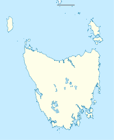
Cluny Power Station Location of Cluny Power Station in Tasmania Country Australia Location Lower Derwent River, Tasmania Coordinates 42°30′23″S 146°40′52″E / 42.50639°S 146.68111°ECoordinates: 42°30′23″S 146°40′52″E / 42.50639°S 146.68111°E Commission date 1968 Owner(s) Hydro Tasmania Power station information Primary fuel Hydroelectric Generation units 1 Power generation information Maximum capacity 17 MW Cluny Power Station is a hydroelectric power station on the Lower Derwent River in Tasmania. It has one Kaplan-type turbine, with a generating capacity of 17 MW of electricity. Cluny was commissioned in 1968.
External links
- Hydro Tasmania page on the Lower Derwent
Energy in Tasmania Hydro Bastyan • Butlers Gorge • Catagunya • Cethana • Cluny • Devils Gate • Fisher • Gordon • John Butters • Lake Echo • Lemonthyme • Liapootah • Mackintosh • Meadowbank • Paloona • Poatina • Reece • Repulse • Rowallan • Tarraleah • Trevallyn • Tungatinah • Wayatinah • WilmotWind Farms Huxley Hill • Musselroe • WoolnorthGas Tamar Valley • Bell BayMisc Companies Regulators Office of the Tasmanian Energy RegulatorHistorical Duck Reach • Lake Margaret • Moorina • WaddamanaCategories:- Hydroelectric power stations in Tasmania
- Power stations in Tasmania
- Hydroelectric power plant stubs
- Australian power station stubs
Wikimedia Foundation. 2010.

