- Clogh, County Kilkenny
-
Clogh
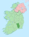
An Chloch— Town — Location in Ireland
 Clogh
CloghCoordinates: 52°51′37″N 7°09′46″W / 52.86035°N 7.16281°WCoordinates: 52°51′37″N 7°09′46″W / 52.86035°N 7.16281°W Country Ireland Province Leinster County County Kilkenny Time zone WET (UTC+0) - Summer (DST) IST (WEST) (UTC-1) Irish Grid Reference S5627678602 Website kilkenny.ie Clogh (Irish: An Chloch) is a village,[1] a townland,[2] and electoral district[3] in County Kilkenny, Ireland.
Clogh on the R426 road near Castlecomer.
Contents
History
In 1837 it lay along the road from Castlecomer on the road to Athy.[1] It containing 116 houses and 582 inhabitants. Most people were employed in the neighbouring collieries.[1] It had a constabulary police station.[1] In 1837, the district of Clough comprised parts of the parishes of Castlecomer and Rathaspeck.[1] The Roman Catholic chapel for the district was in Clough.[1]
Clogh townland is in the parish of Castlecomer and the barony of Fassadining.[1]
Village
As of the 2006 census, by the Central Statistics Office, the town's population, including Chatsworth, was 351. This was a 9.7% change since 2002.[4]
See also
References
Further reading
- Census (2006), 2006 Census of Ireland, Central Statistics Office (Ireland), http://www.cso.ie/releasespublications/pr_pop.htm
- Agriculture (2002), 2002 Agriculture Census - Kilkenny, Central Statistics Office (Ireland), http://www.cso.ie/px/pxcoa2000/Database/Census%20of%20Agriculture%202000/Kilkenny/Kilkenny.asp
- Lewis, Samuel (1837), "Clough, a village", A Topgrahical Dictionary of Ireland, Volume 1, London: Samuel Lewis & Co. 87, Aldergate Street., http://www.libraryireland.com/topog/C/Clough-Fassadining-Kilkenny.php
- logainm (2010), "Irish placenames database" (in English and Irish), logainm.ie (Department of Community, Rural and Gaeltacht Affairs), http://www.logainm.ie/?uiLang=en, retrieved 30 September 2010
Places in County Kilkenny County town: Kilkenny Towns Ballyragget · Callan · Castlecomer · Graiguenamanagh · Kilkenny · Mooncoin · Thomastown
Villages Aughamucky · Ballyhale · Bennettsbridge · Carigeen · Castlewarren · Freshford · Galmoy · Goresbridge · Gowran · Hugginstown · Inistioge · Jenkinstown · Johnstown · Johnswell · Kells · Killamery · Killinaspick · Kilmacow · Kilmoganny · Knocktopher · Mullinavat · Paulstown · Piltown · Redhouse · The Rower · Slieverue · Stoneyford · Tullaroan · Urlingford · Windgap
Townlands Ballyda · Cantwell's Court · Flagmount · Hoodsgrove · Jeanville · Loughcullen
List of townlands in County Kilkenny · Category:Mountains and hills of County Kilkenny · Category:Rivers of County Kilkenny · Category:Geography of County Kilkenny Categories:- Towns and villages in County Kilkenny
- Census towns in County Kilkenny


Wikimedia Foundation. 2010.